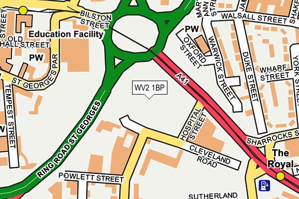
WV2 1BP lies on Cleveland Road in Wolverhampton. WV2 1BP is located in the St Peters electoral ward, within the metropolitan district of Wolverhampton and the English Parliamentary constituency of Wolverhampton South East. The Sub Integrated Care Board (ICB) Location is NHS Black Country ICB - D2P2L and the police force is West Midlands. This postcode has been in use since January 1980.


GetTheData
Source: OS OpenMap – Local (Ordnance Survey)
Source: OS VectorMap District (Ordnance Survey)
Licence: Open Government Licence (requires attribution)
| Easting | 391913 |
| Northing | 298292 |
| Latitude | 52.582376 |
| Longitude | -2.120784 |
GetTheData
Source: Open Postcode Geo
Licence: Open Government Licence
| Street | Cleveland Road |
| Town/City | Wolverhampton |
| Country | England |
| Postcode District | WV2 |
➜ See where WV2 is on a map ➜ Where is Wolverhampton? | |
GetTheData
Source: Land Registry Price Paid Data
Licence: Open Government Licence
Elevation or altitude of WV2 1BP as distance above sea level:
| Metres | Feet | |
|---|---|---|
| Elevation | 160m | 525ft |
Elevation is measured from the approximate centre of the postcode, to the nearest point on an OS contour line from OS Terrain 50, which has contour spacing of ten vertical metres.
➜ How high above sea level am I? Find the elevation of your current position using your device's GPS.
GetTheData
Source: Open Postcode Elevation
Licence: Open Government Licence
| Ward | St Peters |
| Constituency | Wolverhampton South East |
GetTheData
Source: ONS Postcode Database
Licence: Open Government Licence
| Powlett Street (Vicarage Rd) | Wolverhampton | 96m |
| Hospital St (Bilston St) | Wolverhampton | 139m |
| Hospital St (Bilston St) | Wolverhampton | 162m |
| Powlett Street (Vicarage Rd) | Wolverhampton | 200m |
| Old Hall St (St Georges Parade) | Wolverhampton | 207m |
| The Royal (Midland Metro Stop) (Bilston St) | Wolverhampton | 240m |
| Wolverhampton St George's (Midland Metro Stop) (Bilston St) | Wolverhampton | 301m |
| Wolverhampton Station | 0.6km |
| Coseley Station | 4.8km |
| Bilbrook Station | 6.4km |
GetTheData
Source: NaPTAN
Licence: Open Government Licence
GetTheData
Source: ONS Postcode Database
Licence: Open Government Licence


➜ Get more ratings from the Food Standards Agency
GetTheData
Source: Food Standards Agency
Licence: FSA terms & conditions
| Last Collection | |||
|---|---|---|---|
| Location | Mon-Fri | Sat | Distance |
| Deans Road | 17:30 | 12:00 | 197m |
| Vicarage Road | 17:30 | 12:00 | 308m |
| Dudley Street | 18:30 | 12:45 | 416m |
GetTheData
Source: Dracos
Licence: Creative Commons Attribution-ShareAlike
The below table lists the International Territorial Level (ITL) codes (formerly Nomenclature of Territorial Units for Statistics (NUTS) codes) and Local Administrative Units (LAU) codes for WV2 1BP:
| ITL 1 Code | Name |
|---|---|
| TLG | West Midlands (England) |
| ITL 2 Code | Name |
| TLG3 | West Midlands |
| ITL 3 Code | Name |
| TLG39 | Wolverhampton |
| LAU 1 Code | Name |
| E08000031 | Wolverhampton |
GetTheData
Source: ONS Postcode Directory
Licence: Open Government Licence
The below table lists the Census Output Area (OA), Lower Layer Super Output Area (LSOA), and Middle Layer Super Output Area (MSOA) for WV2 1BP:
| Code | Name | |
|---|---|---|
| OA | E00053151 | |
| LSOA | E01010530 | Wolverhampton 035H |
| MSOA | E02006894 | Wolverhampton 035 |
GetTheData
Source: ONS Postcode Directory
Licence: Open Government Licence
| WV1 3SD | Warwick Street | 181m |
| WV2 1AF | Powlett Street | 189m |
| WV1 3QQ | Warwick Street | 193m |
| WV1 3SA | Duke Street | 203m |
| WV1 3RY | Duke Street | 231m |
| WV1 3LL | Walsall Street | 233m |
| WV2 1AP | Raby Street | 247m |
| WV2 1BZ | Vicarage Road | 263m |
| WV1 3RL | Wharf Street | 268m |
| WV2 1AA | Tempest Street | 273m |
GetTheData
Source: Open Postcode Geo; Land Registry Price Paid Data
Licence: Open Government Licence