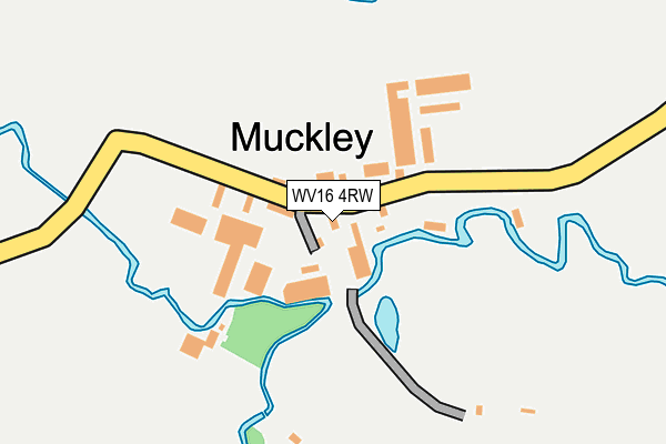
WV16 4RW lies on Muckley in Acton Round, Bridgnorth. WV16 4RW is located in the Brown Clee electoral ward, within the unitary authority of Shropshire and the English Parliamentary constituency of Ludlow. The Sub Integrated Care Board (ICB) Location is NHS Shropshire, Telford and Wrekin ICB - M2L0M and the police force is West Mercia. This postcode has been in use since January 1980.


GetTheData
Source: OS OpenMap – Local (Ordnance Survey)
Source: OS VectorMap District (Ordnance Survey)
Licence: Open Government Licence (requires attribution)
| Easting | 364240 |
| Northing | 295805 |
| Latitude | 52.558898 |
| Longitude | -2.528911 |
GetTheData
Source: Open Postcode Geo
Licence: Open Government Licence
| Street | Muckley |
| Locality | Acton Round |
| Town/City | Bridgnorth |
| Country | England |
| Postcode District | WV16 |
➜ See where WV16 is on a map ➜ Where is Muckley? | |
GetTheData
Source: Land Registry Price Paid Data
Licence: Open Government Licence
Elevation or altitude of WV16 4RW as distance above sea level:
| Metres | Feet | |
|---|---|---|
| Elevation | 110m | 361ft |
Elevation is measured from the approximate centre of the postcode, to the nearest point on an OS contour line from OS Terrain 50, which has contour spacing of ten vertical metres.
➜ How high above sea level am I? Find the elevation of your current position using your device's GPS.
GetTheData
Source: Open Postcode Elevation
Licence: Open Government Licence
| Ward | Brown Clee |
| Constituency | Ludlow |
GetTheData
Source: ONS Postcode Database
Licence: Open Government Licence
| Junction (A458) | Muckley Cross | 435m |
| Junction (A458) | Muckley Cross | 451m |
| Atterley Jct (A458) | Callaughton | 1,311m |
| Atterley Jct (A458) | Callaughton | 1,326m |
GetTheData
Source: NaPTAN
Licence: Open Government Licence
| Percentage of properties with Next Generation Access | 0.0% |
| Percentage of properties with Superfast Broadband | 0.0% |
| Percentage of properties with Ultrafast Broadband | 0.0% |
| Percentage of properties with Full Fibre Broadband | 0.0% |
Superfast Broadband is between 30Mbps and 300Mbps
Ultrafast Broadband is > 300Mbps
| Percentage of properties unable to receive 2Mbps | 0.0% |
| Percentage of properties unable to receive 5Mbps | 100.0% |
| Percentage of properties unable to receive 10Mbps | 100.0% |
| Percentage of properties unable to receive 30Mbps | 100.0% |
GetTheData
Source: Ofcom
Licence: Ofcom Terms of Use (requires attribution)
Estimated total energy consumption in WV16 4RW by fuel type, 2015.
| Consumption (kWh) | 77,572 |
|---|---|
| Meter count | 8 |
| Mean (kWh/meter) | 9,697 |
| Median (kWh/meter) | 6,508 |
GetTheData
Source: Postcode level gas estimates: 2015 (experimental)
Source: Postcode level electricity estimates: 2015 (experimental)
Licence: Open Government Licence
GetTheData
Source: ONS Postcode Database
Licence: Open Government Licence
| Last Collection | |||
|---|---|---|---|
| Location | Mon-Fri | Sat | Distance |
| Muckley Cross | 17:00 | 10:00 | 415m |
| Morville Wall Box | 17:15 | 10:00 | 3,193m |
| Morville Heath | 16:00 | 10:00 | 5,168m |
GetTheData
Source: Dracos
Licence: Creative Commons Attribution-ShareAlike
The below table lists the International Territorial Level (ITL) codes (formerly Nomenclature of Territorial Units for Statistics (NUTS) codes) and Local Administrative Units (LAU) codes for WV16 4RW:
| ITL 1 Code | Name |
|---|---|
| TLG | West Midlands (England) |
| ITL 2 Code | Name |
| TLG2 | Shropshire and Staffordshire |
| ITL 3 Code | Name |
| TLG22 | Shropshire |
| LAU 1 Code | Name |
| E06000051 | Shropshire |
GetTheData
Source: ONS Postcode Directory
Licence: Open Government Licence
The below table lists the Census Output Area (OA), Lower Layer Super Output Area (LSOA), and Middle Layer Super Output Area (MSOA) for WV16 4RW:
| Code | Name | |
|---|---|---|
| OA | E00146935 | |
| LSOA | E01028850 | Shropshire 029E |
| MSOA | E02006010 | Shropshire 029 |
GetTheData
Source: ONS Postcode Directory
Licence: Open Government Licence
| WV16 4RP | Muckley Cross | 557m |
| WV16 4RR | Muckley Cross | 907m |
| WV16 6XD | 1725m | |
| WV16 6XB | 2101m | |
| WV16 6SA | Beacon Hill | 2156m |
| WV16 4TG | Lower Shirlett | 2228m |
| WV16 6UU | Beaconhill Lane | 2719m |
| TF13 6PT | 2801m | |
| WV16 6SB | 2870m | |
| TF13 6PU | 2890m |
GetTheData
Source: Open Postcode Geo; Land Registry Price Paid Data
Licence: Open Government Licence