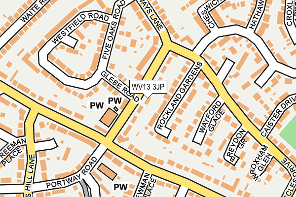
WV13 3JP lies on Dilloways Lane in Willenhall. WV13 3JP is located in the Bilston North electoral ward, within the metropolitan district of Wolverhampton and the English Parliamentary constituency of Wolverhampton South East. The Sub Integrated Care Board (ICB) Location is NHS Black Country ICB - D2P2L and the police force is West Midlands. This postcode has been in use since January 1980.


GetTheData
Source: OS OpenMap – Local (Ordnance Survey)
Source: OS VectorMap District (Ordnance Survey)
Licence: Open Government Licence (requires attribution)
| Easting | 395584 |
| Northing | 297660 |
| Latitude | 52.576737 |
| Longitude | -2.066597 |
GetTheData
Source: Open Postcode Geo
Licence: Open Government Licence
| Street | Dilloways Lane |
| Town/City | Willenhall |
| Country | England |
| Postcode District | WV13 |
➜ See where WV13 is on a map ➜ Where is Wolverhampton? | |
GetTheData
Source: Land Registry Price Paid Data
Licence: Open Government Licence
Elevation or altitude of WV13 3JP as distance above sea level:
| Metres | Feet | |
|---|---|---|
| Elevation | 130m | 427ft |
Elevation is measured from the approximate centre of the postcode, to the nearest point on an OS contour line from OS Terrain 50, which has contour spacing of ten vertical metres.
➜ How high above sea level am I? Find the elevation of your current position using your device's GPS.
GetTheData
Source: Open Postcode Elevation
Licence: Open Government Licence
| Ward | Bilston North |
| Constituency | Wolverhampton South East |
GetTheData
Source: ONS Postcode Database
Licence: Open Government Licence
| The Long Acres (Dilloways Lane) | Bunkers Hill | 76m |
| Dilloways Lane (Beccles Dr) | Bunkers Hill | 116m |
| Newman Place (Moseley Rd) | Bunkers Hill | 122m |
| Beccles Drive (Dilloways Lane) | Portobello | 153m |
| Newman Place (Moseley Rd) | Bunkers Hill | 161m |
| Bilston Central (Midland Metro Stop) (Church St) | Bilston | 1,339m |
| The Crescent (Midland Metro Stop) (The Crescent) | Bilston | 1,370m |
| Coseley Station | 3.8km |
| Wolverhampton Station | 3.8km |
| Bloxwich Station | 5.9km |
GetTheData
Source: NaPTAN
Licence: Open Government Licence
| Percentage of properties with Next Generation Access | 100.0% |
| Percentage of properties with Superfast Broadband | 100.0% |
| Percentage of properties with Ultrafast Broadband | 100.0% |
| Percentage of properties with Full Fibre Broadband | 0.0% |
Superfast Broadband is between 30Mbps and 300Mbps
Ultrafast Broadband is > 300Mbps
| Median download speed | 73.9Mbps |
| Average download speed | 64.5Mbps |
| Maximum download speed | 100.00Mbps |
| Median upload speed | 10.0Mbps |
| Average upload speed | 12.2Mbps |
| Maximum upload speed | 20.00Mbps |
| Percentage of properties unable to receive 2Mbps | 0.0% |
| Percentage of properties unable to receive 5Mbps | 0.0% |
| Percentage of properties unable to receive 10Mbps | 0.0% |
| Percentage of properties unable to receive 30Mbps | 0.0% |
GetTheData
Source: Ofcom
Licence: Ofcom Terms of Use (requires attribution)
Estimated total energy consumption in WV13 3JP by fuel type, 2015.
| Consumption (kWh) | 228,016 |
|---|---|
| Meter count | 33 |
| Mean (kWh/meter) | 6,910 |
| Median (kWh/meter) | 5,280 |
| Consumption (kWh) | 106,135 |
|---|---|
| Meter count | 32 |
| Mean (kWh/meter) | 3,317 |
| Median (kWh/meter) | 2,600 |
GetTheData
Source: Postcode level gas estimates: 2015 (experimental)
Source: Postcode level electricity estimates: 2015 (experimental)
Licence: Open Government Licence
GetTheData
Source: ONS Postcode Database
Licence: Open Government Licence


➜ Get more ratings from the Food Standards Agency
GetTheData
Source: Food Standards Agency
Licence: FSA terms & conditions
| Last Collection | |||
|---|---|---|---|
| Location | Mon-Fri | Sat | Distance |
| New Road | 17:30 | 12:00 | 953m |
| Mount Pleasant | 18:30 | 11:30 | 1,021m |
| Lichfield Street Post Office | 19:30 | 12:30 | 1,064m |
GetTheData
Source: Dracos
Licence: Creative Commons Attribution-ShareAlike
The below table lists the International Territorial Level (ITL) codes (formerly Nomenclature of Territorial Units for Statistics (NUTS) codes) and Local Administrative Units (LAU) codes for WV13 3JP:
| ITL 1 Code | Name |
|---|---|
| TLG | West Midlands (England) |
| ITL 2 Code | Name |
| TLG3 | West Midlands |
| ITL 3 Code | Name |
| TLG39 | Wolverhampton |
| LAU 1 Code | Name |
| E08000031 | Wolverhampton |
GetTheData
Source: ONS Postcode Directory
Licence: Open Government Licence
The below table lists the Census Output Area (OA), Lower Layer Super Output Area (LSOA), and Middle Layer Super Output Area (MSOA) for WV13 3JP:
| Code | Name | |
|---|---|---|
| OA | E00052623 | |
| LSOA | E01010421 | Wolverhampton 022B |
| MSOA | E02002170 | Wolverhampton 022 |
GetTheData
Source: ONS Postcode Directory
Licence: Open Government Licence
| WV13 3HP | Rockland Gardens | 66m |
| WV13 3JR | Glebe Road | 77m |
| WV13 3JT | Stokes Avenue | 115m |
| WV13 3HW | Beccles Drive | 117m |
| WV13 3JS | Five Oaks Road | 134m |
| WV13 3JW | Beccles Drive | 144m |
| WV13 3HR | Wayford Glade | 146m |
| WV14 6HZ | Moseley Road | 157m |
| WV13 3JY | Middle Avenue | 172m |
| WV13 3HJ | Dilloways Lane | 172m |
GetTheData
Source: Open Postcode Geo; Land Registry Price Paid Data
Licence: Open Government Licence