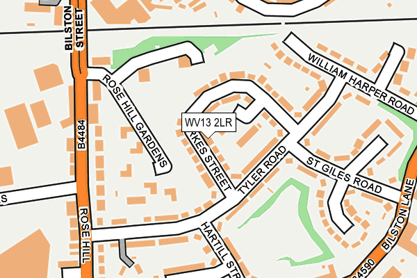
WV13 2LR lies on Parkes Street in Willenhall. WV13 2LR is located in the Willenhall South electoral ward, within the metropolitan district of Walsall and the English Parliamentary constituency of Walsall North. The Sub Integrated Care Board (ICB) Location is NHS Black Country ICB - D2P2L and the police force is West Midlands. This postcode has been in use since January 1980.


GetTheData
Source: OS OpenMap – Local (Ordnance Survey)
Source: OS VectorMap District (Ordnance Survey)
Licence: Open Government Licence (requires attribution)
| Easting | 396607 |
| Northing | 298083 |
| Latitude | 52.580548 |
| Longitude | -2.051506 |
GetTheData
Source: Open Postcode Geo
Licence: Open Government Licence
| Street | Parkes Street |
| Town/City | Willenhall |
| Country | England |
| Postcode District | WV13 |
➜ See where WV13 is on a map ➜ Where is Willenhall? | |
GetTheData
Source: Land Registry Price Paid Data
Licence: Open Government Licence
Elevation or altitude of WV13 2LR as distance above sea level:
| Metres | Feet | |
|---|---|---|
| Elevation | 130m | 427ft |
Elevation is measured from the approximate centre of the postcode, to the nearest point on an OS contour line from OS Terrain 50, which has contour spacing of ten vertical metres.
➜ How high above sea level am I? Find the elevation of your current position using your device's GPS.
GetTheData
Source: Open Postcode Elevation
Licence: Open Government Licence
| Ward | Willenhall South |
| Constituency | Walsall North |
GetTheData
Source: ONS Postcode Database
Licence: Open Government Licence
| Tyler Rd (Rose Hill) | Willenhall | 251m |
| Tyler Rd (Rose Hill) | Willenhall | 259m |
| The Dale (Bilston St) | Willenhall | 300m |
| Market Place (New Rd) | Willenhall | 338m |
| Gipsy Lane (Walsall St) | Willenhall | 352m |
| Bescot Stadium Station | 4.5km |
| Walsall Station | 4.5km |
| Coseley Station | 4.6km |
GetTheData
Source: NaPTAN
Licence: Open Government Licence
| Percentage of properties with Next Generation Access | 100.0% |
| Percentage of properties with Superfast Broadband | 100.0% |
| Percentage of properties with Ultrafast Broadband | 100.0% |
| Percentage of properties with Full Fibre Broadband | 0.0% |
Superfast Broadband is between 30Mbps and 300Mbps
Ultrafast Broadband is > 300Mbps
| Median download speed | 100.0Mbps |
| Average download speed | 120.8Mbps |
| Maximum download speed | 350.00Mbps |
| Median upload speed | 1.2Mbps |
| Average upload speed | 1.5Mbps |
| Maximum upload speed | 3.03Mbps |
| Percentage of properties unable to receive 2Mbps | 0.0% |
| Percentage of properties unable to receive 5Mbps | 0.0% |
| Percentage of properties unable to receive 10Mbps | 0.0% |
| Percentage of properties unable to receive 30Mbps | 0.0% |
GetTheData
Source: Ofcom
Licence: Ofcom Terms of Use (requires attribution)
Estimated total energy consumption in WV13 2LR by fuel type, 2015.
| Consumption (kWh) | 295,716 |
|---|---|
| Meter count | 29 |
| Mean (kWh/meter) | 10,197 |
| Median (kWh/meter) | 8,875 |
| Consumption (kWh) | 119,587 |
|---|---|
| Meter count | 26 |
| Mean (kWh/meter) | 4,599 |
| Median (kWh/meter) | 3,935 |
GetTheData
Source: Postcode level gas estimates: 2015 (experimental)
Source: Postcode level electricity estimates: 2015 (experimental)
Licence: Open Government Licence
GetTheData
Source: ONS Postcode Database
Licence: Open Government Licence


➜ Get more ratings from the Food Standards Agency
GetTheData
Source: Food Standards Agency
Licence: FSA terms & conditions
| Last Collection | |||
|---|---|---|---|
| Location | Mon-Fri | Sat | Distance |
| Lichfield Street Post Office | 19:30 | 12:30 | 359m |
| Willenhall Post Office | 18:30 | 12:30 | 414m |
| New Road | 17:30 | 12:00 | 502m |
GetTheData
Source: Dracos
Licence: Creative Commons Attribution-ShareAlike
The below table lists the International Territorial Level (ITL) codes (formerly Nomenclature of Territorial Units for Statistics (NUTS) codes) and Local Administrative Units (LAU) codes for WV13 2LR:
| ITL 1 Code | Name |
|---|---|
| TLG | West Midlands (England) |
| ITL 2 Code | Name |
| TLG3 | West Midlands |
| ITL 3 Code | Name |
| TLG38 | Walsall |
| LAU 1 Code | Name |
| E08000030 | Walsall |
GetTheData
Source: ONS Postcode Directory
Licence: Open Government Licence
The below table lists the Census Output Area (OA), Lower Layer Super Output Area (LSOA), and Middle Layer Super Output Area (MSOA) for WV13 2LR:
| Code | Name | |
|---|---|---|
| OA | E00052555 | |
| LSOA | E01010406 | Walsall 027C |
| MSOA | E02002136 | Walsall 027 |
GetTheData
Source: ONS Postcode Directory
Licence: Open Government Licence
| WV13 2JF | Tyler Road | 69m |
| WV13 2LP | Parkes Street | 76m |
| WV13 2LZ | Rosehill Gardens | 123m |
| WV13 2JD | Tyler Road | 144m |
| WV13 2LS | Tyler Road | 175m |
| WV13 2JG | Hartill Street | 182m |
| WV13 2AR | Rosehill | 196m |
| WV13 2EZ | Gipsy Lane | 198m |
| WV13 2LW | St Giles Road | 216m |
| WV13 2LN | St Giles Road | 220m |
GetTheData
Source: Open Postcode Geo; Land Registry Price Paid Data
Licence: Open Government Licence