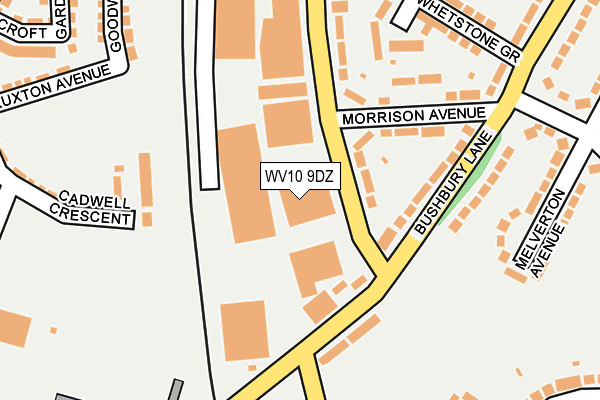
WV10 9DZ is located in the Bushbury South & Low Hill electoral ward, within the metropolitan district of Wolverhampton and the English Parliamentary constituency of Wolverhampton North East. The Sub Integrated Care Board (ICB) Location is NHS Black Country ICB - D2P2L and the police force is West Midlands. This postcode has been in use since September 2003.


GetTheData
Source: OS OpenMap – Local (Ordnance Survey)
Source: OS VectorMap District (Ordnance Survey)
Licence: Open Government Licence (requires attribution)
| Easting | 391748 |
| Northing | 301589 |
| Latitude | 52.612013 |
| Longitude | -2.123302 |
GetTheData
Source: Open Postcode Geo
Licence: Open Government Licence
| Country | England |
| Postcode District | WV10 |
➜ See where WV10 is on a map ➜ Where is Wolverhampton? | |
GetTheData
Source: Land Registry Price Paid Data
Licence: Open Government Licence
Elevation or altitude of WV10 9DZ as distance above sea level:
| Metres | Feet | |
|---|---|---|
| Elevation | 130m | 427ft |
Elevation is measured from the approximate centre of the postcode, to the nearest point on an OS contour line from OS Terrain 50, which has contour spacing of ten vertical metres.
➜ How high above sea level am I? Find the elevation of your current position using your device's GPS.
GetTheData
Source: Open Postcode Elevation
Licence: Open Government Licence
| Ward | Bushbury South & Low Hill |
| Constituency | Wolverhampton North East |
GetTheData
Source: ONS Postcode Database
Licence: Open Government Licence
| Fordhouse Rd (Bushbury Lane) | Low Hill | 116m |
| Morrison Avenue (Fordhouse Rd) | Low Hill | 121m |
| Fordhouse Rd (Bushbury Lane) | Low Hill | 132m |
| Steel Drive (Fordhouse Rd) | Oxley | 209m |
| Steel Drive (Fordhouse Rd) | Oxley | 234m |
| Wolverhampton Station | 2.7km |
| Bilbrook Station | 4.4km |
GetTheData
Source: NaPTAN
Licence: Open Government Licence
GetTheData
Source: ONS Postcode Database
Licence: Open Government Licence


➜ Get more ratings from the Food Standards Agency
GetTheData
Source: Food Standards Agency
Licence: FSA terms & conditions
| Last Collection | |||
|---|---|---|---|
| Location | Mon-Fri | Sat | Distance |
| Showell Road | 17:30 | 12:15 | 135m |
| Hammond Avenue | 17:30 | 12:00 | 402m |
| Greenwood Road | 17:30 | 13:00 | 566m |
GetTheData
Source: Dracos
Licence: Creative Commons Attribution-ShareAlike
The below table lists the International Territorial Level (ITL) codes (formerly Nomenclature of Territorial Units for Statistics (NUTS) codes) and Local Administrative Units (LAU) codes for WV10 9DZ:
| ITL 1 Code | Name |
|---|---|
| TLG | West Midlands (England) |
| ITL 2 Code | Name |
| TLG3 | West Midlands |
| ITL 3 Code | Name |
| TLG39 | Wolverhampton |
| LAU 1 Code | Name |
| E08000031 | Wolverhampton |
GetTheData
Source: ONS Postcode Directory
Licence: Open Government Licence
The below table lists the Census Output Area (OA), Lower Layer Super Output Area (LSOA), and Middle Layer Super Output Area (MSOA) for WV10 9DZ:
| Code | Name | |
|---|---|---|
| OA | E00052710 | |
| LSOA | E01010435 | Wolverhampton 006A |
| MSOA | E02002154 | Wolverhampton 006 |
GetTheData
Source: ONS Postcode Directory
Licence: Open Government Licence
| WV10 9TU | Bushbury Lane | 94m |
| WV10 9TZ | Morrison Avenue | 134m |
| WV10 9TY | Bushbury Lane | 134m |
| WV10 9TX | Bushbury Lane | 154m |
| WV10 9EE | Fordhouse Road | 200m |
| WV10 9HN | Melverton Avenue | 227m |
| WV10 9UB | Whetstone Grove | 249m |
| WV10 9UD | Bushbury Lane | 298m |
| WV10 9SN | Hawksford Crescent | 314m |
| WV10 9SW | Hawksford Crescent | 340m |
GetTheData
Source: Open Postcode Geo; Land Registry Price Paid Data
Licence: Open Government Licence