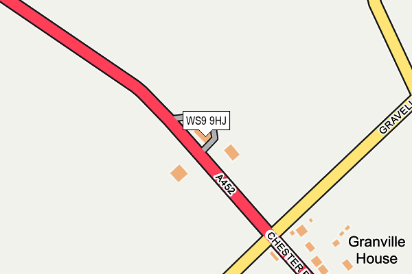
WS9 9HJ is located in the Little Aston & Stonnall electoral ward, within the local authority district of Lichfield and the English Parliamentary constituency of Tamworth. The Sub Integrated Care Board (ICB) Location is NHS Staffordshire and Stoke-on-Trent ICB - 05Q and the police force is Staffordshire. This postcode has been in use since January 1980.


GetTheData
Source: OS OpenMap – Local (Ordnance Survey)
Source: OS VectorMap District (Ordnance Survey)
Licence: Open Government Licence (requires attribution)
| Easting | 407149 |
| Northing | 302911 |
| Latitude | 52.623916 |
| Longitude | -1.895827 |
GetTheData
Source: Open Postcode Geo
Licence: Open Government Licence
| Country | England |
| Postcode District | WS9 |
➜ See where WS9 is on a map | |
GetTheData
Source: Land Registry Price Paid Data
Licence: Open Government Licence
Elevation or altitude of WS9 9HJ as distance above sea level:
| Metres | Feet | |
|---|---|---|
| Elevation | 140m | 459ft |
Elevation is measured from the approximate centre of the postcode, to the nearest point on an OS contour line from OS Terrain 50, which has contour spacing of ten vertical metres.
➜ How high above sea level am I? Find the elevation of your current position using your device's GPS.
GetTheData
Source: Open Postcode Elevation
Licence: Open Government Licence
| Ward | Little Aston & Stonnall |
| Constituency | Tamworth |
GetTheData
Source: ONS Postcode Database
Licence: Open Government Licence
| Gravelly Lane (Chester Rd) | Druid's Heath | 317m |
| Gravelly Lane (Chester Rd) | Druid's Heath | 350m |
| Main Street (Lazy Hill) | Stonnall | 588m |
| Main Street (Lazy Hill) | Stonnall | 595m |
| Royal Oak Ph (Main Street) | Stonnall | 777m |
| Shenstone Station | 3.9km |
| Blake Street Station | 4km |
| Butlers Lane Station | 5.2km |
GetTheData
Source: NaPTAN
Licence: Open Government Licence
GetTheData
Source: ONS Postcode Database
Licence: Open Government Licence


➜ Get more ratings from the Food Standards Agency
GetTheData
Source: Food Standards Agency
Licence: FSA terms & conditions
| Last Collection | |||
|---|---|---|---|
| Location | Mon-Fri | Sat | Distance |
| Gainsborough Hill | 17:00 | 11:45 | 320m |
| Glenwood Rise | 17:15 | 11:45 | 646m |
| Stonnall Post Office | 17:30 | 11:45 | 935m |
GetTheData
Source: Dracos
Licence: Creative Commons Attribution-ShareAlike
The below table lists the International Territorial Level (ITL) codes (formerly Nomenclature of Territorial Units for Statistics (NUTS) codes) and Local Administrative Units (LAU) codes for WS9 9HJ:
| ITL 1 Code | Name |
|---|---|
| TLG | West Midlands (England) |
| ITL 2 Code | Name |
| TLG2 | Shropshire and Staffordshire |
| ITL 3 Code | Name |
| TLG24 | Staffordshire CC |
| LAU 1 Code | Name |
| E07000194 | Lichfield |
GetTheData
Source: ONS Postcode Directory
Licence: Open Government Licence
The below table lists the Census Output Area (OA), Lower Layer Super Output Area (LSOA), and Middle Layer Super Output Area (MSOA) for WS9 9HJ:
| Code | Name | |
|---|---|---|
| OA | E00150433 | |
| LSOA | E01029523 | Lichfield 011E |
| MSOA | E02006156 | Lichfield 011 |
GetTheData
Source: ONS Postcode Directory
Licence: Open Government Licence
| WS9 9HH | Chester Road | 372m |
| WS9 9HL | Church Road | 572m |
| WS9 9DT | Lazy Hill | 579m |
| WS9 9DX | Main Street | 672m |
| WS9 9DU | Main Street | 695m |
| WS9 9DZ | Glenwood Rise | 698m |
| WS9 9EN | St Peters Close | 847m |
| WS9 9DB | Castle Hill Road | 850m |
| WS9 9DY | Main Street | 881m |
| WS9 0NQ | Stonnall Road | 886m |
GetTheData
Source: Open Postcode Geo; Land Registry Price Paid Data
Licence: Open Government Licence