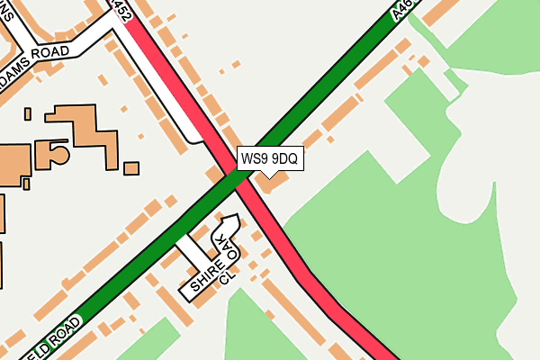
WS9 9DQ is located in the Aldridge North and Walsall Wood electoral ward, within the metropolitan district of Walsall and the English Parliamentary constituency of Aldridge-Brownhills. The Sub Integrated Care Board (ICB) Location is NHS Black Country ICB - D2P2L and the police force is West Midlands. This postcode has been in use since January 1980.


GetTheData
Source: OS OpenMap – Local (Ordnance Survey)
Source: OS VectorMap District (Ordnance Survey)
Licence: Open Government Licence (requires attribution)
| Easting | 405775 |
| Northing | 304224 |
| Latitude | 52.635736 |
| Longitude | -1.916101 |
GetTheData
Source: Open Postcode Geo
Licence: Open Government Licence
| Country | England |
| Postcode District | WS9 |
➜ See where WS9 is on a map ➜ Where is Brownhills? | |
GetTheData
Source: Land Registry Price Paid Data
Licence: Open Government Licence
Elevation or altitude of WS9 9DQ as distance above sea level:
| Metres | Feet | |
|---|---|---|
| Elevation | 170m | 558ft |
Elevation is measured from the approximate centre of the postcode, to the nearest point on an OS contour line from OS Terrain 50, which has contour spacing of ten vertical metres.
➜ How high above sea level am I? Find the elevation of your current position using your device's GPS.
GetTheData
Source: Open Postcode Elevation
Licence: Open Government Licence
| Ward | Aldridge North And Walsall Wood |
| Constituency | Aldridge-brownhills |
GetTheData
Source: ONS Postcode Database
Licence: Open Government Licence
| Shire Oak (Lichfield Rd) | Shire Oak | 77m |
| Shire Oak (Lichfield Rd) | Shire Oak | 94m |
| Adams Rd (Chester Rd) | Shire Oak | 191m |
| Adams Rd (Chester Rd) | Shire Oak | 211m |
| Shire Oak House (Lichfield Rd) | Shire Oak | 316m |
| Shenstone Station | 4.9km |
| Blake Street Station | 5.9km |
GetTheData
Source: NaPTAN
Licence: Open Government Licence
GetTheData
Source: ONS Postcode Database
Licence: Open Government Licence


➜ Get more ratings from the Food Standards Agency
GetTheData
Source: Food Standards Agency
Licence: FSA terms & conditions
| Last Collection | |||
|---|---|---|---|
| Location | Mon-Fri | Sat | Distance |
| Shire Oak | 17:30 | 11:30 | 58m |
| Anchor Bridge | 16:15 | 11:30 | 745m |
| Wolverson Road | 17:30 | 11:30 | 832m |
GetTheData
Source: Dracos
Licence: Creative Commons Attribution-ShareAlike
The below table lists the International Territorial Level (ITL) codes (formerly Nomenclature of Territorial Units for Statistics (NUTS) codes) and Local Administrative Units (LAU) codes for WS9 9DQ:
| ITL 1 Code | Name |
|---|---|
| TLG | West Midlands (England) |
| ITL 2 Code | Name |
| TLG3 | West Midlands |
| ITL 3 Code | Name |
| TLG38 | Walsall |
| LAU 1 Code | Name |
| E08000030 | Walsall |
GetTheData
Source: ONS Postcode Directory
Licence: Open Government Licence
The below table lists the Census Output Area (OA), Lower Layer Super Output Area (LSOA), and Middle Layer Super Output Area (MSOA) for WS9 9DQ:
| Code | Name | |
|---|---|---|
| OA | E00051839 | |
| LSOA | E01010250 | Walsall 004B |
| MSOA | E02002113 | Walsall 004 |
GetTheData
Source: ONS Postcode Directory
Licence: Open Government Licence
| WS9 9PG | Shire Oak Close | 128m |
| WS8 6DS | Chester Road | 160m |
| WS8 6DT | Chester Road | 171m |
| WS9 9PB | Lichfield Road | 199m |
| WS9 9DF | Chester Road | 219m |
| WS8 7AL | Adams Road | 281m |
| WS9 9PE | Lichfield Road | 284m |
| WS9 9DH | Lichfield Road | 286m |
| WS8 6DR | Paterson Place | 309m |
| WS8 7AN | Adams Road | 320m |
GetTheData
Source: Open Postcode Geo; Land Registry Price Paid Data
Licence: Open Government Licence