WS9 0RP maps, stats, and open data
WS9 0RP lies on Cavendish Way in Walsall. WS9 0RP is located in the Aldridge Central and South electoral ward, within the metropolitan district of Walsall and the English Parliamentary constituency of Aldridge-Brownhills. The Sub Integrated Care Board (ICB) Location is NHS Black Country ICB - D2P2L and the police force is West Midlands. This postcode has been in use since January 1980.
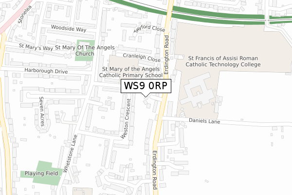
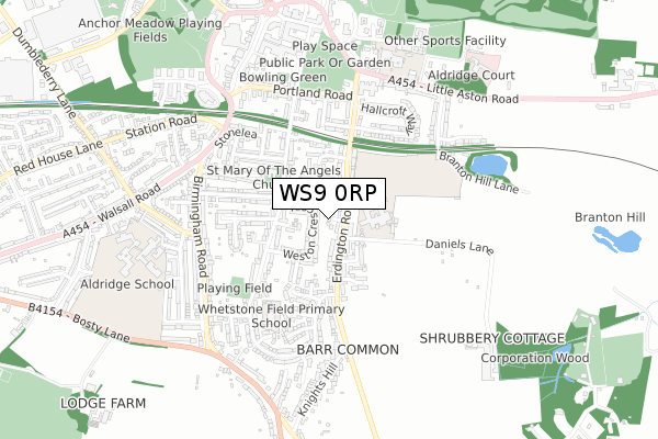
WS9 0RP maps


Licence: Open Government Licence (requires attribution)
Attribution: Contains OS data © Crown copyright and database right 2025
Source: Open Postcode Geo
Licence: Open Government Licence (requires attribution)
Attribution: Contains OS data © Crown copyright and database right 2025; Contains Royal Mail data © Royal Mail copyright and database right 2025; Source: Office for National Statistics licensed under the Open Government Licence v.3.0
WS9 0RP geodata
| Easting | 405905 |
| Northing | 300062 |
| Latitude | 52.598319 |
| Longitude | -1.914253 |
Where is WS9 0RP?
| Street | Cavendish Way |
| Town/City | Walsall |
| Country | England |
| Postcode District | WS9 |
WS9 0RP Elevation
Elevation or altitude of WS9 0RP as distance above sea level:
| Metres | Feet | |
|---|---|---|
| Elevation | 160m | 525ft |
Elevation is measured from the approximate centre of the postcode, to the nearest point on an OS contour line from OS Terrain 50, which has contour spacing of ten vertical metres.
➜ How high above sea level am I? Find the elevation of your current position using your device's GPS.
Politics
| Ward | Aldridge Central And South |
|---|---|
| Constituency | Aldridge-brownhills |
House Prices
Sales of detached houses in WS9 0RP
2025 13 MAR £605,000 |
2023 26 MAY £402,500 |
2003 18 DEC £295,000 |
5, CAVENDISH WAY, WALSALL, WS9 0RP 2003 5 SEP £225,000 |
2002 23 AUG £249,950 |
2001 11 APR £215,000 |
1999 30 APR £105,000 |
1997 4 JUL £44,000 |
Licence: Contains HM Land Registry data © Crown copyright and database right 2025. This data is licensed under the Open Government Licence v3.0.
Transport
Nearest bus stops to WS9 0RP
| St Francis School (Erdington Rd) | Aldridge | 110m |
| St Francis School (Erdington Rd) | Aldridge | 133m |
| Hallcroft Way (Erdington Rd) | Aldridge | 419m |
| Hallcroft Way (Erdington Rd) | Aldridge | 430m |
| Knights Hill (Erdington Rd) | Barr Common | 470m |
Nearest railway stations to WS9 0RP
| Blake Street Station | 4.8km |
| Walsall Station | 5km |
| Shenstone Station | 6.6km |
Broadband
Broadband access in WS9 0RP (2020 data)
| Percentage of properties with Next Generation Access | 100.0% |
| Percentage of properties with Superfast Broadband | 100.0% |
| Percentage of properties with Ultrafast Broadband | 100.0% |
| Percentage of properties with Full Fibre Broadband | 0.0% |
Superfast Broadband is between 30Mbps and 300Mbps
Ultrafast Broadband is > 300Mbps
Broadband limitations in WS9 0RP (2020 data)
| Percentage of properties unable to receive 2Mbps | 0.0% |
| Percentage of properties unable to receive 5Mbps | 0.0% |
| Percentage of properties unable to receive 10Mbps | 0.0% |
| Percentage of properties unable to receive 30Mbps | 0.0% |
Deprivation
12.9% of English postcodes are less deprived than WS9 0RP:Food Standards Agency
Three nearest food hygiene ratings to WS9 0RP (metres)


➜ Get more ratings from the Food Standards Agency
Nearest post box to WS9 0RP
| Last Collection | |||
|---|---|---|---|
| Location | Mon-Fri | Sat | Distance |
| Erdington Road | 16:30 | 11:00 | 94m |
| Whetstone Lane | 17:00 | 11:00 | 260m |
| Barr Common | 16:30 | 11:00 | 659m |
WS9 0RP ITL and WS9 0RP LAU
The below table lists the International Territorial Level (ITL) codes (formerly Nomenclature of Territorial Units for Statistics (NUTS) codes) and Local Administrative Units (LAU) codes for WS9 0RP:
| ITL 1 Code | Name |
|---|---|
| TLG | West Midlands (England) |
| ITL 2 Code | Name |
| TLG3 | West Midlands |
| ITL 3 Code | Name |
| TLG38 | Walsall |
| LAU 1 Code | Name |
| E08000030 | Walsall |
WS9 0RP census areas
The below table lists the Census Output Area (OA), Lower Layer Super Output Area (LSOA), and Middle Layer Super Output Area (MSOA) for WS9 0RP:
| Code | Name | |
|---|---|---|
| OA | E00051771 | |
| LSOA | E01010245 | Walsall 022A |
| MSOA | E02002131 | Walsall 022 |
Nearest postcodes to WS9 0RP
| WS9 0HA | Weston Crescent | 77m |
| WS9 0HB | Weston Crescent | 94m |
| WS9 0RN | Erdington Road | 117m |
| WS9 0ER | Appletree Grove | 129m |
| WS9 0RW | Cranleigh Close | 167m |
| WS9 0RT | Erdington Road | 180m |
| WS9 0SR | Wheatland Grove | 185m |
| WS9 0JD | Whetstone Lane | 196m |
| WS9 0EU | Whetstone Lane | 226m |
| WS9 0SN | Twyford Close | 226m |