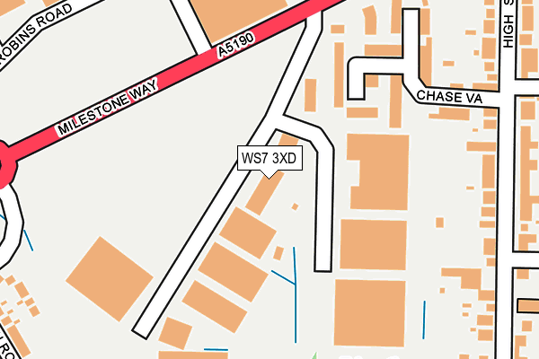
WS7 3XD is located in the Chasetown electoral ward, within the local authority district of Lichfield and the English Parliamentary constituency of Lichfield. The Sub Integrated Care Board (ICB) Location is NHS Staffordshire and Stoke-on-Trent ICB - 05Q and the police force is Staffordshire. This postcode has been in use since March 2003.


GetTheData
Source: OS OpenMap – Local (Ordnance Survey)
Source: OS VectorMap District (Ordnance Survey)
Licence: Open Government Licence (requires attribution)
| Easting | 404293 |
| Northing | 308802 |
| Latitude | 52.676920 |
| Longitude | -1.937935 |
GetTheData
Source: Open Postcode Geo
Licence: Open Government Licence
| Country | England |
| Postcode District | WS7 |
➜ See where WS7 is on a map ➜ Where is Burntwood? | |
GetTheData
Source: Land Registry Price Paid Data
Licence: Open Government Licence
Elevation or altitude of WS7 3XD as distance above sea level:
| Metres | Feet | |
|---|---|---|
| Elevation | 160m | 525ft |
Elevation is measured from the approximate centre of the postcode, to the nearest point on an OS contour line from OS Terrain 50, which has contour spacing of ten vertical metres.
➜ How high above sea level am I? Find the elevation of your current position using your device's GPS.
GetTheData
Source: Open Postcode Elevation
Licence: Open Government Licence
| Ward | Chasetown |
| Constituency | Lichfield |
GetTheData
Source: ONS Postcode Database
Licence: Open Government Licence
| Chase View (High Street) | Chasetown | 268m |
| Chase View (High Street) | Chasetown | 293m |
| Chase Vale (High Street (N)) | Chase Terrace | 341m |
| Chase Vale (High Street (S)) | Chase Terrace | 344m |
| High Street (Burntwood Bypass) | Chase Terrace | 471m |
| Hednesford Station | 5.7km |
GetTheData
Source: NaPTAN
Licence: Open Government Licence
| Median download speed | 48.9Mbps |
| Average download speed | 46.8Mbps |
| Maximum download speed | 59.10Mbps |
| Median upload speed | 7.7Mbps |
| Average upload speed | 7.6Mbps |
| Maximum upload speed | 9.77Mbps |
GetTheData
Source: Ofcom
Licence: Ofcom Terms of Use (requires attribution)
GetTheData
Source: ONS Postcode Database
Licence: Open Government Licence


➜ Get more ratings from the Food Standards Agency
GetTheData
Source: Food Standards Agency
Licence: FSA terms & conditions
| Last Collection | |||
|---|---|---|---|
| Location | Mon-Fri | Sat | Distance |
| Sankeys Corner Post Office | 18:00 | 11:45 | 540m |
| Chasetown Post Office | 18:00 | 12:00 | 591m |
| Lichfield Road | 16:30 | 10:45 | 1,593m |
GetTheData
Source: Dracos
Licence: Creative Commons Attribution-ShareAlike
The below table lists the International Territorial Level (ITL) codes (formerly Nomenclature of Territorial Units for Statistics (NUTS) codes) and Local Administrative Units (LAU) codes for WS7 3XD:
| ITL 1 Code | Name |
|---|---|
| TLG | West Midlands (England) |
| ITL 2 Code | Name |
| TLG2 | Shropshire and Staffordshire |
| ITL 3 Code | Name |
| TLG24 | Staffordshire CC |
| LAU 1 Code | Name |
| E07000194 | Lichfield |
GetTheData
Source: ONS Postcode Directory
Licence: Open Government Licence
The below table lists the Census Output Area (OA), Lower Layer Super Output Area (LSOA), and Middle Layer Super Output Area (MSOA) for WS7 3XD:
| Code | Name | |
|---|---|---|
| OA | E00150288 | |
| LSOA | E01029497 | Lichfield 006E |
| MSOA | E02006151 | Lichfield 006 |
GetTheData
Source: ONS Postcode Directory
Licence: Open Government Licence
| WS7 3GD | Chase Vale | 188m |
| WS7 3GE | The Orchard | 262m |
| WS7 3XL | High Street | 276m |
| WS7 3XN | High Street | 297m |
| WS7 3GA | Elunda Grove | 338m |
| WS7 3XH | High Street | 341m |
| WS7 3XU | Hill Street | 348m |
| WS7 3XG | High Street | 421m |
| WS7 3XA | Milestone Way | 440m |
| WS7 3XX | Union Street | 443m |
GetTheData
Source: Open Postcode Geo; Land Registry Price Paid Data
Licence: Open Government Licence