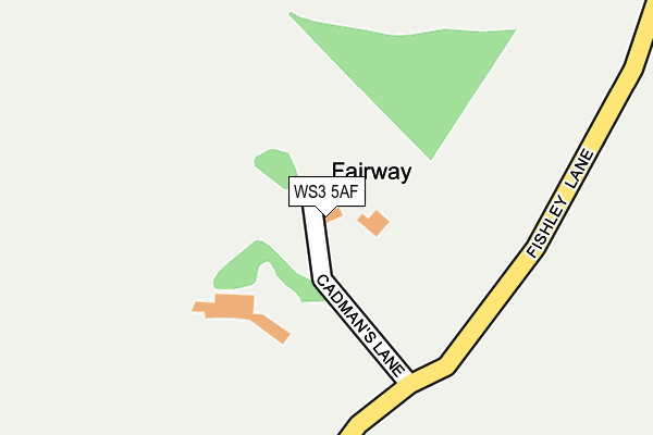
WS3 5AF is located in the Essington electoral ward, within the local authority district of South Staffordshire and the English Parliamentary constituency of South Staffordshire. The Sub Integrated Care Board (ICB) Location is NHS Staffordshire and Stoke-on-Trent ICB - 04Y and the police force is Staffordshire. This postcode has been in use since January 1980.


GetTheData
Source: OS OpenMap – Local (Ordnance Survey)
Source: OS VectorMap District (Ordnance Survey)
Licence: Open Government Licence (requires attribution)
| Easting | 400896 |
| Northing | 304880 |
| Latitude | 52.641662 |
| Longitude | -1.988193 |
GetTheData
Source: Open Postcode Geo
Licence: Open Government Licence
| Country | England |
| Postcode District | WS3 |
➜ See where WS3 is on a map | |
GetTheData
Source: Land Registry Price Paid Data
Licence: Open Government Licence
Elevation or altitude of WS3 5AF as distance above sea level:
| Metres | Feet | |
|---|---|---|
| Elevation | 140m | 459ft |
Elevation is measured from the approximate centre of the postcode, to the nearest point on an OS contour line from OS Terrain 50, which has contour spacing of ten vertical metres.
➜ How high above sea level am I? Find the elevation of your current position using your device's GPS.
GetTheData
Source: Open Postcode Elevation
Licence: Open Government Licence
| Ward | Essington |
| Constituency | South Staffordshire |
GetTheData
Source: ONS Postcode Database
Licence: Open Government Licence
| Oak Rd (Trevor Rd) | Pelsall Wood | 1,231m |
| Oak Rd (Trevor Rd) | Pelsall Wood | 1,237m |
| Huddocks View (Trevor Rd) | Pelsall Wood | 1,257m |
| Huddocks View (Trevor Rd) | Pelsall Wood | 1,264m |
| Trevor Rd | Pelsall Wood | 1,330m |
| Bloxwich North Station | 2.7km |
| Landywood Station | 2.8km |
| Bloxwich Station | 3km |
GetTheData
Source: NaPTAN
Licence: Open Government Licence
GetTheData
Source: ONS Postcode Database
Licence: Open Government Licence


➜ Get more ratings from the Food Standards Agency
GetTheData
Source: Food Standards Agency
Licence: FSA terms & conditions
| Last Collection | |||
|---|---|---|---|
| Location | Mon-Fri | Sat | Distance |
| Wood Lane | 16:45 | 11:00 | 1,463m |
| Finger Post | 16:45 | 11:00 | 1,606m |
| Buxton Road | 17:00 | 11:45 | 1,645m |
GetTheData
Source: Dracos
Licence: Creative Commons Attribution-ShareAlike
The below table lists the International Territorial Level (ITL) codes (formerly Nomenclature of Territorial Units for Statistics (NUTS) codes) and Local Administrative Units (LAU) codes for WS3 5AF:
| ITL 1 Code | Name |
|---|---|
| TLG | West Midlands (England) |
| ITL 2 Code | Name |
| TLG2 | Shropshire and Staffordshire |
| ITL 3 Code | Name |
| TLG24 | Staffordshire CC |
| LAU 1 Code | Name |
| E07000196 | South Staffordshire |
GetTheData
Source: ONS Postcode Directory
Licence: Open Government Licence
The below table lists the Census Output Area (OA), Lower Layer Super Output Area (LSOA), and Middle Layer Super Output Area (MSOA) for WS3 5AF:
| Code | Name | |
|---|---|---|
| OA | E00150985 | |
| LSOA | E01029632 | South Staffordshire 007A |
| MSOA | E02006180 | South Staffordshire 007 |
GetTheData
Source: ONS Postcode Directory
Licence: Open Government Licence
| WS3 5DZ | Wood Lane | 1063m |
| WS3 5DS | Forge Road | 1078m |
| WS3 5DR | Oak Road | 1090m |
| WS6 6AS | Hobble End Lane | 1099m |
| WS3 5AD | Norton Road | 1120m |
| WS3 5DP | Woodlands Crescent | 1122m |
| WS3 5DW | Oak Road | 1188m |
| WS3 5EY | Wood Common Grange | 1234m |
| WS3 5DN | Trevor Road | 1249m |
| WS3 5DB | Trevor Road | 1284m |
GetTheData
Source: Open Postcode Geo; Land Registry Price Paid Data
Licence: Open Government Licence