WS2 9AN maps, stats, and open data
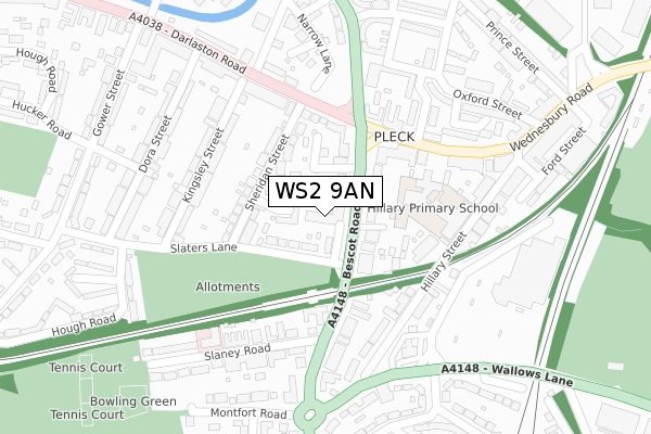
WS2 9AN lies on Slaters Place in Walsall. WS2 9AN is located in the Pleck electoral ward, within the metropolitan district of Walsall and the English Parliamentary constituency of Walsall South. The Sub Integrated Care Board (ICB) Location is NHS Black Country ICB - D2P2L and the police force is West Midlands. This postcode has been in use since January 1980.
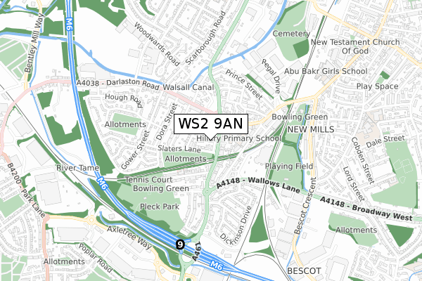
WS2 9AN maps


Licence: Open Government Licence (requires attribution)
Attribution: Contains OS data © Crown copyright and database right 2025
Source: Open Postcode Geo
Licence: Open Government Licence (requires attribution)
Attribution: Contains OS data © Crown copyright and database right 2025; Contains Royal Mail data © Royal Mail copyright and database right 2025; Source: Office for National Statistics licensed under the Open Government Licence v.3.0
WS2 9AN geodata
| Easting | 400001 |
| Northing | 297176 |
| Latitude | 52.572405 |
| Longitude | -2.001417 |
Where is WS2 9AN?
| Street | Slaters Place |
| Town/City | Walsall |
| Country | England |
| Postcode District | WS2 |
WS2 9AN Elevation
Elevation or altitude of WS2 9AN as distance above sea level:
| Metres | Feet | |
|---|---|---|
| Elevation | 120m | 394ft |
Elevation is measured from the approximate centre of the postcode, to the nearest point on an OS contour line from OS Terrain 50, which has contour spacing of ten vertical metres.
➜ How high above sea level am I? Find the elevation of your current position using your device's GPS.
Politics
| Ward | Pleck |
|---|---|
| Constituency | Walsall South |
Transport
Nearest bus stops to WS2 9AN
| Slater's Lane (Bescot Rd) | New Mills | 55m |
| The Brown Lion (Bescot Rd) | New Mills | 90m |
| Slater's Lane (Bescot Rd) | New Mills | 111m |
| Pleck Rd (Wednesbury Rd) | New Mills | 176m |
| Pleck Rd (Wednesbury Rd) | New Mills | 199m |
Nearest railway stations to WS2 9AN
| Bescot Stadium Station | 1.2km |
| Walsall Station | 1.7km |
| Tame Bridge Parkway Station | 2.8km |
Broadband
Broadband access in WS2 9AN (2020 data)
| Percentage of properties with Next Generation Access | 100.0% |
| Percentage of properties with Superfast Broadband | 100.0% |
| Percentage of properties with Ultrafast Broadband | 100.0% |
| Percentage of properties with Full Fibre Broadband | 0.0% |
Superfast Broadband is between 30Mbps and 300Mbps
Ultrafast Broadband is > 300Mbps
Broadband speed in WS2 9AN (2019 data)
Download
| Median download speed | 40.0Mbps |
| Average download speed | 40.2Mbps |
| Maximum download speed | 152.00Mbps |
Upload
| Median upload speed | 5.4Mbps |
| Average upload speed | 6.9Mbps |
| Maximum upload speed | 19.53Mbps |
Broadband limitations in WS2 9AN (2020 data)
| Percentage of properties unable to receive 2Mbps | 0.0% |
| Percentage of properties unable to receive 5Mbps | 0.0% |
| Percentage of properties unable to receive 10Mbps | 0.0% |
| Percentage of properties unable to receive 30Mbps | 0.0% |
WS2 9AN gas and electricity consumption
Estimated total energy consumption in WS2 9AN by fuel type, 2015.
Gas
| Consumption (kWh) | 281,149 |
|---|---|
| Meter count | 43 |
| Mean (kWh/meter) | 6,538 |
| Median (kWh/meter) | 5,426 |
Electricity
| Consumption (kWh) | 47,511 |
|---|---|
| Meter count | 23 |
| Mean (kWh/meter) | 2,066 |
| Median (kWh/meter) | 1,931 |
- Consumption: The estimated total energy consumption, in kWh, across all meters in WS2 9AN, for 2015.
- Meter count: The total number of meters in WS2 9AN.
- Mean: The mean average consumption per meter, in kWh.
- Median: The median average consumption per meter, in kWh.
Source: Postcode level electricity estimates: 2015 (experimental)
Licence: Open Government Licence
Deprivation
91.3% of English postcodes are less deprived than WS2 9AN:Food Standards Agency
Three nearest food hygiene ratings to WS2 9AN (metres)


➜ Get more ratings from the Food Standards Agency
Nearest post box to WS2 9AN
| Last Collection | |||
|---|---|---|---|
| Location | Mon-Fri | Sat | Distance |
| Bescot Road | 16:00 | 12:00 | 117m |
| Darlaston Road | 17:30 | 12:00 | 400m |
| Aldis Road | 16:00 | 12:00 | 543m |
WS2 9AN ITL and WS2 9AN LAU
The below table lists the International Territorial Level (ITL) codes (formerly Nomenclature of Territorial Units for Statistics (NUTS) codes) and Local Administrative Units (LAU) codes for WS2 9AN:
| ITL 1 Code | Name |
|---|---|
| TLG | West Midlands (England) |
| ITL 2 Code | Name |
| TLG3 | West Midlands |
| ITL 3 Code | Name |
| TLG38 | Walsall |
| LAU 1 Code | Name |
| E08000030 | Walsall |
WS2 9AN census areas
The below table lists the Census Output Area (OA), Lower Layer Super Output Area (LSOA), and Middle Layer Super Output Area (MSOA) for WS2 9AN:
| Code | Name | |
|---|---|---|
| OA | E00052365 | |
| LSOA | E01010365 | Walsall 031C |
| MSOA | E02002140 | Walsall 031 |
Nearest postcodes to WS2 9AN
| WS2 9QQ | Sheridan Close | 48m |
| WS2 9AQ | Slaters Lane | 63m |
| WS2 9AA | Bescot Road | 68m |
| WS2 9AD | Bescot Road | 75m |
| WS2 9AR | Slaney Court | 78m |
| WS2 9BL | Bescot Road | 88m |
| WS2 9QX | Sheridan Street | 108m |
| WS2 9QU | Sheridan Street | 139m |
| WS2 9QJ | Wednesbury Road | 170m |
| WS2 9AE | Bescot Road | 177m |