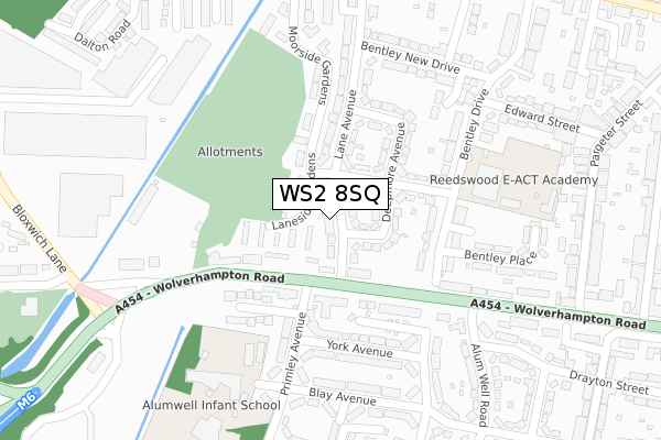
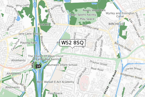
WS2 8SQ lies on Lane Avenue in Walsall. WS2 8SQ is located in the Pleck electoral ward, within the metropolitan district of Walsall and the English Parliamentary constituency of Walsall South. The Sub Integrated Care Board (ICB) Location is NHS Black Country ICB - D2P2L and the police force is West Midlands. This postcode has been in use since January 1980.


GetTheData
Source: OS Open Zoomstack (Ordnance Survey)
Licence: Open Government Licence (requires attribution)
Attribution: Contains OS data © Crown copyright and database right 2025
Source: Open Postcode Geo
Licence: Open Government Licence (requires attribution)
Attribution: Contains OS data © Crown copyright and database right 2025; Contains Royal Mail data © Royal Mail copyright and database right 2025; Source: Office for National Statistics licensed under the Open Government Licence v.3.0
| Easting | 399721 |
| Northing | 298906 |
| Latitude | 52.587957 |
| Longitude | -2.005551 |
GetTheData
Source: Open Postcode Geo
Licence: Open Government Licence
| Street | Lane Avenue |
| Town/City | Walsall |
| Country | England |
| Postcode District | WS2 |
➜ See where WS2 is on a map ➜ Where is Walsall? | |
GetTheData
Source: Land Registry Price Paid Data
Licence: Open Government Licence
Elevation or altitude of WS2 8SQ as distance above sea level:
| Metres | Feet | |
|---|---|---|
| Elevation | 130m | 427ft |
Elevation is measured from the approximate centre of the postcode, to the nearest point on an OS contour line from OS Terrain 50, which has contour spacing of ten vertical metres.
➜ How high above sea level am I? Find the elevation of your current position using your device's GPS.
GetTheData
Source: Open Postcode Elevation
Licence: Open Government Licence
| Ward | Pleck |
| Constituency | Walsall South |
GetTheData
Source: ONS Postcode Database
Licence: Open Government Licence
| Primley Avenue (Wolverhampton Road) | Reedswood | 84m |
| Primley Close (Primley Ave) | Reedswood | 148m |
| Primley Avenue (Wolverhampton Road) | Reedswood | 166m |
| Bentley Drive (Wolverhampton Road) | Reedswood | 178m |
| Bentley Drive (Wolverhampton Road) | Reedswood | 204m |
| Walsall Station | 1.5km |
| Bescot Stadium Station | 2.9km |
| Bloxwich Station | 3.4km |
GetTheData
Source: NaPTAN
Licence: Open Government Licence
| Percentage of properties with Next Generation Access | 100.0% |
| Percentage of properties with Superfast Broadband | 100.0% |
| Percentage of properties with Ultrafast Broadband | 100.0% |
| Percentage of properties with Full Fibre Broadband | 0.0% |
Superfast Broadband is between 30Mbps and 300Mbps
Ultrafast Broadband is > 300Mbps
| Median download speed | 77.5Mbps |
| Average download speed | 77.5Mbps |
| Maximum download speed | 350.00Mbps |
| Median upload speed | 10.0Mbps |
| Average upload speed | 9.7Mbps |
| Maximum upload speed | 20.00Mbps |
| Percentage of properties unable to receive 2Mbps | 0.0% |
| Percentage of properties unable to receive 5Mbps | 0.0% |
| Percentage of properties unable to receive 10Mbps | 0.0% |
| Percentage of properties unable to receive 30Mbps | 0.0% |
GetTheData
Source: Ofcom
Licence: Ofcom Terms of Use (requires attribution)
Estimated total energy consumption in WS2 8SQ by fuel type, 2015.
| Consumption (kWh) | 276,372 |
|---|---|
| Meter count | 25 |
| Mean (kWh/meter) | 11,055 |
| Median (kWh/meter) | 10,768 |
| Consumption (kWh) | 77,393 |
|---|---|
| Meter count | 23 |
| Mean (kWh/meter) | 3,365 |
| Median (kWh/meter) | 3,175 |
GetTheData
Source: Postcode level gas estimates: 2015 (experimental)
Source: Postcode level electricity estimates: 2015 (experimental)
Licence: Open Government Licence
GetTheData
Source: ONS Postcode Database
Licence: Open Government Licence


➜ Get more ratings from the Food Standards Agency
GetTheData
Source: Food Standards Agency
Licence: FSA terms & conditions
| Last Collection | |||
|---|---|---|---|
| Location | Mon-Fri | Sat | Distance |
| Southbourne Avenue | 16:00 | 11:30 | 577m |
| Ida Road | 17:30 | 11:30 | 776m |
| Queen Elizabeth Avenue | 17:15 | 12:00 | 1,158m |
GetTheData
Source: Dracos
Licence: Creative Commons Attribution-ShareAlike
The below table lists the International Territorial Level (ITL) codes (formerly Nomenclature of Territorial Units for Statistics (NUTS) codes) and Local Administrative Units (LAU) codes for WS2 8SQ:
| ITL 1 Code | Name |
|---|---|
| TLG | West Midlands (England) |
| ITL 2 Code | Name |
| TLG3 | West Midlands |
| ITL 3 Code | Name |
| TLG38 | Walsall |
| LAU 1 Code | Name |
| E08000030 | Walsall |
GetTheData
Source: ONS Postcode Directory
Licence: Open Government Licence
The below table lists the Census Output Area (OA), Lower Layer Super Output Area (LSOA), and Middle Layer Super Output Area (MSOA) for WS2 8SQ:
| Code | Name | |
|---|---|---|
| OA | E00051924 | |
| LSOA | E01010270 | Walsall 026B |
| MSOA | E02002135 | Walsall 026 |
GetTheData
Source: ONS Postcode Directory
Licence: Open Government Licence
| WS2 8SH | Laneside Gardens | 62m |
| WS2 8SG | Deepmore Avenue | 69m |
| WS2 8RH | Wolverhampton Road | 93m |
| WS2 8RJ | Wolverhampton Road | 108m |
| WS2 8SA | Friezeland Road | 129m |
| WS2 8RL | Wolverhampton Road | 138m |
| WS2 8RY | Bentley Drive | 149m |
| WS2 8RN | Wolverhampton Road | 154m |
| WS2 8SF | Deepmore Avenue | 161m |
| WS2 9UZ | Primley Avenue | 171m |
GetTheData
Source: Open Postcode Geo; Land Registry Price Paid Data
Licence: Open Government Licence