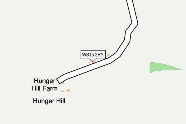
WS15 3RY is located in the Colton & the Ridwares electoral ward, within the local authority district of Lichfield and the English Parliamentary constituency of Lichfield. The Sub Integrated Care Board (ICB) Location is NHS Staffordshire and Stoke-on-Trent ICB - 05D and the police force is Staffordshire. This postcode has been in use since January 1980.


GetTheData
Source: OS OpenMap – Local (Ordnance Survey)
Source: OS VectorMap District (Ordnance Survey)
Licence: Open Government Licence (requires attribution)
| Easting | 410055 |
| Northing | 318765 |
| Latitude | 52.766409 |
| Longitude | -1.852414 |
GetTheData
Source: Open Postcode Geo
Licence: Open Government Licence
| Country | England |
| Postcode District | WS15 |
➜ See where WS15 is on a map | |
GetTheData
Source: Land Registry Price Paid Data
Licence: Open Government Licence
Elevation or altitude of WS15 3RY as distance above sea level:
| Metres | Feet | |
|---|---|---|
| Elevation | 90m | 295ft |
Elevation is measured from the approximate centre of the postcode, to the nearest point on an OS contour line from OS Terrain 50, which has contour spacing of ten vertical metres.
➜ How high above sea level am I? Find the elevation of your current position using your device's GPS.
GetTheData
Source: Open Postcode Elevation
Licence: Open Government Licence
| Ward | Colton & The Ridwares |
| Constituency | Lichfield |
GetTheData
Source: ONS Postcode Database
Licence: Open Government Licence
| Yoxall Road (Blithbury Rd) | Hamstall Ridware | 749m |
| Yoxall Road (Blithbury Rd) | Hamstall Ridware | 755m |
| St. James' Church (Pipe Lane) | Pipe Ridware | 1,126m |
| St. James' Church (Pipe Lane) | Pipe Ridware | 1,133m |
GetTheData
Source: NaPTAN
Licence: Open Government Licence
| Percentage of properties with Next Generation Access | 100.0% |
| Percentage of properties with Superfast Broadband | 100.0% |
| Percentage of properties with Ultrafast Broadband | 0.0% |
| Percentage of properties with Full Fibre Broadband | 0.0% |
Superfast Broadband is between 30Mbps and 300Mbps
Ultrafast Broadband is > 300Mbps
| Percentage of properties unable to receive 2Mbps | 0.0% |
| Percentage of properties unable to receive 5Mbps | 0.0% |
| Percentage of properties unable to receive 10Mbps | 0.0% |
| Percentage of properties unable to receive 30Mbps | 0.0% |
GetTheData
Source: Ofcom
Licence: Ofcom Terms of Use (requires attribution)
GetTheData
Source: ONS Postcode Database
Licence: Open Government Licence


➜ Get more ratings from the Food Standards Agency
GetTheData
Source: Food Standards Agency
Licence: FSA terms & conditions
| Last Collection | |||
|---|---|---|---|
| Location | Mon-Fri | Sat | Distance |
| Hill Ridware | 16:45 | 08:30 | 2,232m |
| Morrey | 16:15 | 07:15 | 2,540m |
| Mavesyn Ridware | 16:30 | 08:30 | 2,675m |
GetTheData
Source: Dracos
Licence: Creative Commons Attribution-ShareAlike
The below table lists the International Territorial Level (ITL) codes (formerly Nomenclature of Territorial Units for Statistics (NUTS) codes) and Local Administrative Units (LAU) codes for WS15 3RY:
| ITL 1 Code | Name |
|---|---|
| TLG | West Midlands (England) |
| ITL 2 Code | Name |
| TLG2 | Shropshire and Staffordshire |
| ITL 3 Code | Name |
| TLG24 | Staffordshire CC |
| LAU 1 Code | Name |
| E07000194 | Lichfield |
GetTheData
Source: ONS Postcode Directory
Licence: Open Government Licence
The below table lists the Census Output Area (OA), Lower Layer Super Output Area (LSOA), and Middle Layer Super Output Area (MSOA) for WS15 3RY:
| Code | Name | |
|---|---|---|
| OA | E00150358 | |
| LSOA | E01029509 | Lichfield 002D |
| MSOA | E02006147 | Lichfield 002 |
GetTheData
Source: ONS Postcode Directory
Licence: Open Government Licence
| WS15 3QQ | Lichfield Road | 630m |
| WS15 3JJ | 631m | |
| WS15 3RS | Blithbury Road | 696m |
| WS15 3RR | Blithbury Road | 717m |
| WS15 3RP | The Green | 747m |
| WS15 3QG | Lichfield Road | 749m |
| WS15 3RZ | Yoxall Road | 830m |
| WS15 3QL | Pipe Ridware | 1145m |
| WS15 3QJ | Nethertown | 1187m |
| WS15 3SA | Yoxall Road | 1239m |
GetTheData
Source: Open Postcode Geo; Land Registry Price Paid Data
Licence: Open Government Licence