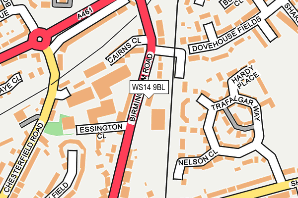
WS14 9BL is located in the St John's electoral ward, within the local authority district of Lichfield and the English Parliamentary constituency of Lichfield. The Sub Integrated Care Board (ICB) Location is NHS Staffordshire and Stoke-on-Trent ICB - 05Q and the police force is Staffordshire. This postcode has been in use since January 1993.


GetTheData
Source: OS OpenMap – Local (Ordnance Survey)
Source: OS VectorMap District (Ordnance Survey)
Licence: Open Government Licence (requires attribution)
| Easting | 411526 |
| Northing | 308475 |
| Latitude | 52.673860 |
| Longitude | -1.830976 |
GetTheData
Source: Open Postcode Geo
Licence: Open Government Licence
| Country | England |
| Postcode District | WS14 |
➜ See where WS14 is on a map ➜ Where is Lichfield? | |
GetTheData
Source: Land Registry Price Paid Data
Licence: Open Government Licence
Elevation or altitude of WS14 9BL as distance above sea level:
| Metres | Feet | |
|---|---|---|
| Elevation | 90m | 295ft |
Elevation is measured from the approximate centre of the postcode, to the nearest point on an OS contour line from OS Terrain 50, which has contour spacing of ten vertical metres.
➜ How high above sea level am I? Find the elevation of your current position using your device's GPS.
GetTheData
Source: Open Postcode Elevation
Licence: Open Government Licence
| Ward | St John's |
| Constituency | Lichfield |
GetTheData
Source: ONS Postcode Database
Licence: Open Government Licence
| Shortbutts Lane (Birmingham Road) | Sandfields | 209m |
| Maxtock Avenue (Sainte Foy Avenue) | Lichfield | 216m |
| Maxtock Avenue (Sainte Foy Avenue) | Lichfield | 231m |
| Shortbutts Lane (Birmingham Road) | Sandfields | 239m |
| Friary Avenue (Birmingham Road) | Lichfield Town Centre | 322m |
| Lichfield City Station | 0.8km |
| Lichfield Trent Valley High Level Station | 2.5km |
| Lichfield Trent Valley Station | 2.5km |
GetTheData
Source: NaPTAN
Licence: Open Government Licence
GetTheData
Source: ONS Postcode Database
Licence: Open Government Licence


➜ Get more ratings from the Food Standards Agency
GetTheData
Source: Food Standards Agency
Licence: FSA terms & conditions
| Last Collection | |||
|---|---|---|---|
| Location | Mon-Fri | Sat | Distance |
| Chesterfield Road | 16:45 | 11:00 | 210m |
| Fosseway | 18:00 | 11:00 | 349m |
| St John Street | 18:30 | 11:00 | 602m |
GetTheData
Source: Dracos
Licence: Creative Commons Attribution-ShareAlike
The below table lists the International Territorial Level (ITL) codes (formerly Nomenclature of Territorial Units for Statistics (NUTS) codes) and Local Administrative Units (LAU) codes for WS14 9BL:
| ITL 1 Code | Name |
|---|---|
| TLG | West Midlands (England) |
| ITL 2 Code | Name |
| TLG2 | Shropshire and Staffordshire |
| ITL 3 Code | Name |
| TLG24 | Staffordshire CC |
| LAU 1 Code | Name |
| E07000194 | Lichfield |
GetTheData
Source: ONS Postcode Directory
Licence: Open Government Licence
The below table lists the Census Output Area (OA), Lower Layer Super Output Area (LSOA), and Middle Layer Super Output Area (MSOA) for WS14 9BL:
| Code | Name | |
|---|---|---|
| OA | E00168378 | |
| LSOA | E01029518 | Lichfield 007D |
| MSOA | E02006152 | Lichfield 007 |
GetTheData
Source: ONS Postcode Directory
Licence: Open Government Licence
| WS14 9FR | Victory Close | 71m |
| WS14 9FN | Victory Close | 78m |
| WS14 9FL | Victory Close | 96m |
| WS14 9TP | Cairns Close | 100m |
| WS14 9FS | Victory Close | 108m |
| WS14 9FE | Trafalgar Way | 114m |
| WS14 9BW | Birmingham Road | 122m |
| WS14 9DA | Wyrley Close | 127m |
| WS14 9BJ | Birmingham Road | 138m |
| WS14 0AP | The Maltings | 145m |
GetTheData
Source: Open Postcode Geo; Land Registry Price Paid Data
Licence: Open Government Licence