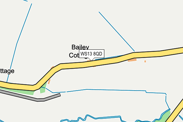
WS13 8QD lies on Park Lane in Lichfield. WS13 8QD is located in the Whittington & Streethay electoral ward, within the local authority district of Lichfield and the English Parliamentary constituency of Lichfield. The Sub Integrated Care Board (ICB) Location is NHS Staffordshire and Stoke-on-Trent ICB - 05Q and the police force is Staffordshire. This postcode has been in use since January 1980.


GetTheData
Source: OS OpenMap – Local (Ordnance Survey)
Source: OS VectorMap District (Ordnance Survey)
Licence: Open Government Licence (requires attribution)
| Easting | 416213 |
| Northing | 309745 |
| Latitude | 52.685158 |
| Longitude | -1.761597 |
GetTheData
Source: Open Postcode Geo
Licence: Open Government Licence
| Street | Park Lane |
| Town/City | Lichfield |
| Country | England |
| Postcode District | WS13 |
➜ See where WS13 is on a map | |
GetTheData
Source: Land Registry Price Paid Data
Licence: Open Government Licence
Elevation or altitude of WS13 8QD as distance above sea level:
| Metres | Feet | |
|---|---|---|
| Elevation | 60m | 197ft |
Elevation is measured from the approximate centre of the postcode, to the nearest point on an OS contour line from OS Terrain 50, which has contour spacing of ten vertical metres.
➜ How high above sea level am I? Find the elevation of your current position using your device's GPS.
GetTheData
Source: Open Postcode Elevation
Licence: Open Government Licence
| Ward | Whittington & Streethay |
| Constituency | Lichfield |
GetTheData
Source: ONS Postcode Database
Licence: Open Government Licence
| Back Lane (Main Street) | Whittington | 1,146m |
| Blacksmith Lane (Back Lane) | Whittington | 1,148m |
| Chapel Lane (Back Lane) | Whittington | 1,249m |
| Langton Crescent (Main Street) | Whittington | 1,294m |
| Langton Crescent (Main Street) | Whittington | 1,310m |
| Lichfield Trent Valley Station | 2.6km |
| Lichfield Trent Valley High Level Station | 2.6km |
| Lichfield City Station | 4.4km |
GetTheData
Source: NaPTAN
Licence: Open Government Licence
| Percentage of properties with Next Generation Access | 100.0% |
| Percentage of properties with Superfast Broadband | 0.0% |
| Percentage of properties with Ultrafast Broadband | 0.0% |
| Percentage of properties with Full Fibre Broadband | 0.0% |
Superfast Broadband is between 30Mbps and 300Mbps
Ultrafast Broadband is > 300Mbps
| Percentage of properties unable to receive 2Mbps | 0.0% |
| Percentage of properties unable to receive 5Mbps | 0.0% |
| Percentage of properties unable to receive 10Mbps | 100.0% |
| Percentage of properties unable to receive 30Mbps | 100.0% |
GetTheData
Source: Ofcom
Licence: Ofcom Terms of Use (requires attribution)
GetTheData
Source: ONS Postcode Database
Licence: Open Government Licence


➜ Get more ratings from the Food Standards Agency
GetTheData
Source: Food Standards Agency
Licence: FSA terms & conditions
| Last Collection | |||
|---|---|---|---|
| Location | Mon-Fri | Sat | Distance |
| Whittington | 17:00 | 10:45 | 1,342m |
| Babbington Close | 17:00 | 07:00 | 1,505m |
| Hademore | 17:00 | 07:30 | 2,025m |
GetTheData
Source: Dracos
Licence: Creative Commons Attribution-ShareAlike
The below table lists the International Territorial Level (ITL) codes (formerly Nomenclature of Territorial Units for Statistics (NUTS) codes) and Local Administrative Units (LAU) codes for WS13 8QD:
| ITL 1 Code | Name |
|---|---|
| TLG | West Midlands (England) |
| ITL 2 Code | Name |
| TLG2 | Shropshire and Staffordshire |
| ITL 3 Code | Name |
| TLG24 | Staffordshire CC |
| LAU 1 Code | Name |
| E07000194 | Lichfield |
GetTheData
Source: ONS Postcode Directory
Licence: Open Government Licence
The below table lists the Census Output Area (OA), Lower Layer Super Output Area (LSOA), and Middle Layer Super Output Area (MSOA) for WS13 8QD:
| Code | Name | |
|---|---|---|
| OA | E00150474 | |
| LSOA | E01029530 | Lichfield 008C |
| MSOA | E02006153 | Lichfield 008 |
GetTheData
Source: ONS Postcode Directory
Licence: Open Government Licence
| WS13 8QE | Fisherwick Wood Lane | 418m |
| WS13 8QL | Brookhay Lane | 604m |
| WS13 8QF | Fisherwick Wood Lane | 709m |
| WS14 9NS | Burton Road | 798m |
| WS14 9PP | Old Swan Close | 844m |
| WS13 8PY | 850m | |
| WS14 9NP | Burton Road | 852m |
| WS14 9BF | Swan Croft | 872m |
| WS14 9NU | Swan Road | 913m |
| WS14 9PA | Noddington Lane | 917m |
GetTheData
Source: Open Postcode Geo; Land Registry Price Paid Data
Licence: Open Government Licence