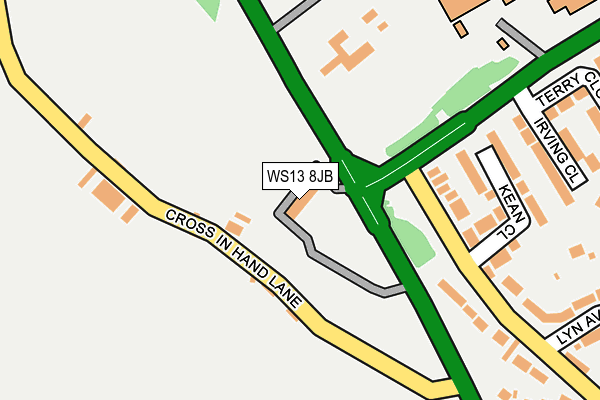
WS13 8JB is located in the Leomansley electoral ward, within the local authority district of Lichfield and the English Parliamentary constituency of Lichfield. The Sub Integrated Care Board (ICB) Location is NHS Staffordshire and Stoke-on-Trent ICB - 05Q and the police force is Staffordshire. This postcode has been in use since January 1980.


GetTheData
Source: OS OpenMap – Local (Ordnance Survey)
Source: OS VectorMap District (Ordnance Survey)
Licence: Open Government Licence (requires attribution)
| Easting | 410252 |
| Northing | 310537 |
| Latitude | 52.692422 |
| Longitude | -1.849754 |
GetTheData
Source: Open Postcode Geo
Licence: Open Government Licence
| Country | England |
| Postcode District | WS13 |
➜ See where WS13 is on a map ➜ Where is Lichfield? | |
GetTheData
Source: Land Registry Price Paid Data
Licence: Open Government Licence
Elevation or altitude of WS13 8JB as distance above sea level:
| Metres | Feet | |
|---|---|---|
| Elevation | 110m | 361ft |
Elevation is measured from the approximate centre of the postcode, to the nearest point on an OS contour line from OS Terrain 50, which has contour spacing of ten vertical metres.
➜ How high above sea level am I? Find the elevation of your current position using your device's GPS.
GetTheData
Source: Open Postcode Elevation
Licence: Open Government Licence
| Ward | Leomansley |
| Constituency | Lichfield |
GetTheData
Source: ONS Postcode Database
Licence: Open Government Licence
| Kean Close (Stafford Road) | Christ Church | 156m |
| Kean Close (Stafford Road) | Christ Church | 160m |
| Eastern Avenue (Stafford Road) | Christ Church | 160m |
| Eastern Avenue (Stafford Road) | Christ Church | 180m |
| Friary High School (Eastern Ave) | Christ Church | 229m |
| Lichfield City Station | 2.1km |
| Lichfield Trent Valley High Level Station | 3.4km |
| Lichfield Trent Valley Station | 3.4km |
GetTheData
Source: NaPTAN
Licence: Open Government Licence
GetTheData
Source: ONS Postcode Database
Licence: Open Government Licence


➜ Get more ratings from the Food Standards Agency
GetTheData
Source: Food Standards Agency
Licence: FSA terms & conditions
| Last Collection | |||
|---|---|---|---|
| Location | Mon-Fri | Sat | Distance |
| Stafford Road | 17:30 | 11:00 | 297m |
| Nursery Croft | 17:30 | 11:00 | 557m |
| Wheel Lane | 17:30 | 11:00 | 742m |
GetTheData
Source: Dracos
Licence: Creative Commons Attribution-ShareAlike
The below table lists the International Territorial Level (ITL) codes (formerly Nomenclature of Territorial Units for Statistics (NUTS) codes) and Local Administrative Units (LAU) codes for WS13 8JB:
| ITL 1 Code | Name |
|---|---|
| TLG | West Midlands (England) |
| ITL 2 Code | Name |
| TLG2 | Shropshire and Staffordshire |
| ITL 3 Code | Name |
| TLG24 | Staffordshire CC |
| LAU 1 Code | Name |
| E07000194 | Lichfield |
GetTheData
Source: ONS Postcode Directory
Licence: Open Government Licence
The below table lists the Census Output Area (OA), Lower Layer Super Output Area (LSOA), and Middle Layer Super Output Area (MSOA) for WS13 8JB:
| Code | Name | |
|---|---|---|
| OA | E00150374 | |
| LSOA | E01029511 | Lichfield 007B |
| MSOA | E02006152 | Lichfield 007 |
GetTheData
Source: ONS Postcode Directory
Licence: Open Government Licence
| WS13 8EA | Cross In Hand Lane | 94m |
| WS13 7EL | Kean Close | 188m |
| WS13 7EN | Irving Close | 246m |
| WS13 7BZ | Stafford Road | 268m |
| WS13 7DA | Lyn Avenue | 325m |
| WS13 7EJ | Terry Close | 336m |
| WS13 7DW | Ferndale Road | 339m |
| WS13 7BY | Cross In Hand Lane | 379m |
| WS13 7EH | Siddons Close | 400m |
| WS13 7DS | Garrick Close | 405m |
GetTheData
Source: Open Postcode Geo; Land Registry Price Paid Data
Licence: Open Government Licence