WS11 7ZE maps, stats, and open data
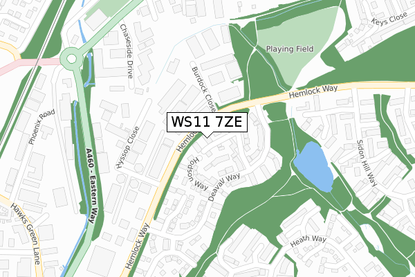
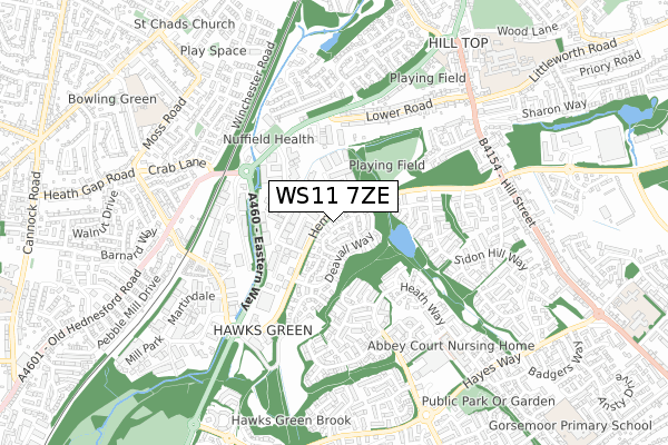
WS11 7ZE lies on Tranter Crescent in Cannock. WS11 7ZE is located in the Hawks Green electoral ward, within the local authority district of Cannock Chase and the English Parliamentary constituency of Cannock Chase. The Sub Integrated Care Board (ICB) Location is NHS Staffordshire and Stoke-on-Trent ICB - 04Y and the police force is Staffordshire. This postcode has been in use since March 2003.
WS11 7ZE maps


Licence: Open Government Licence (requires attribution)
Attribution: Contains OS data © Crown copyright and database right 2025
Source: Open Postcode Geo
Licence: Open Government Licence (requires attribution)
Attribution: Contains OS data © Crown copyright and database right 2025; Contains Royal Mail data © Royal Mail copyright and database right 2025; Source: Office for National Statistics licensed under the Open Government Licence v.3.0
WS11 7ZE geodata
| Easting | 399791 |
| Northing | 311039 |
| Latitude | 52.697030 |
| Longitude | -2.004530 |
Where is WS11 7ZE?
| Street | Tranter Crescent |
| Town/City | Cannock |
| Country | England |
| Postcode District | WS11 |
WS11 7ZE Elevation
Elevation or altitude of WS11 7ZE as distance above sea level:
| Metres | Feet | |
|---|---|---|
| Elevation | 160m | 525ft |
Elevation is measured from the approximate centre of the postcode, to the nearest point on an OS contour line from OS Terrain 50, which has contour spacing of ten vertical metres.
➜ How high above sea level am I? Find the elevation of your current position using your device's GPS.
Politics
| Ward | Hawks Green |
|---|---|
| Constituency | Cannock Chase |
House Prices
Sales of detached houses in WS11 7ZE
2020 8 APR £210,000 |
2018 15 JUN £247,000 |
2014 28 NOV £210,000 |
2014 28 FEB £215,000 |
2013 5 JUL £190,000 |
2010 26 FEB £195,000 |
2007 7 JUN £193,500 |
8, TRANTER CRESCENT, CANNOCK, WS11 7ZE 2006 10 FEB £175,000 |
2001 9 NOV £112,000 |
2, TRANTER CRESCENT, CANNOCK, WS11 7ZE 2001 17 AUG £109,000 |
Licence: Contains HM Land Registry data © Crown copyright and database right 2025. This data is licensed under the Open Government Licence v3.0.
Transport
Nearest bus stops to WS11 7ZE
| Globe Inn Ph (Old Hednesford Rd) | Hawks Green | 365m |
| Globe Inn Ph (Old Hednesford Road) | Hawks Green | 392m |
| Oaklands Industrial Estate (Lower Road) | Hawks Green | 396m |
| Oaklands Industrial Estate (Lower Road) | Hawks Green | 403m |
| No 62 (Lower Road) | Hednesford | 460m |
Nearest railway stations to WS11 7ZE
| Hednesford Station | 1.5km |
| Cannock Station | 1.7km |
| Landywood Station | 4.6km |
Broadband
Broadband access in WS11 7ZE (2020 data)
| Percentage of properties with Next Generation Access | 100.0% |
| Percentage of properties with Superfast Broadband | 100.0% |
| Percentage of properties with Ultrafast Broadband | 0.0% |
| Percentage of properties with Full Fibre Broadband | 0.0% |
Superfast Broadband is between 30Mbps and 300Mbps
Ultrafast Broadband is > 300Mbps
Broadband speed in WS11 7ZE (2019 data)
Download
| Median download speed | 68.2Mbps |
| Average download speed | 61.6Mbps |
| Maximum download speed | 78.12Mbps |
Upload
| Median upload speed | 19.5Mbps |
| Average upload speed | 15.5Mbps |
| Maximum upload speed | 20.00Mbps |
Broadband limitations in WS11 7ZE (2020 data)
| Percentage of properties unable to receive 2Mbps | 0.0% |
| Percentage of properties unable to receive 5Mbps | 0.0% |
| Percentage of properties unable to receive 10Mbps | 0.0% |
| Percentage of properties unable to receive 30Mbps | 0.0% |
WS11 7ZE gas and electricity consumption
Estimated total energy consumption in WS11 7ZE by fuel type, 2015.
Gas
| Consumption (kWh) | 101,758 |
|---|---|
| Meter count | 8 |
| Mean (kWh/meter) | 12,720 |
| Median (kWh/meter) | 12,447 |
- Consumption: The estimated total energy consumption, in kWh, across all meters in WS11 7ZE, for 2015.
- Meter count: The total number of meters in WS11 7ZE.
- Mean: The mean average consumption per meter, in kWh.
- Median: The median average consumption per meter, in kWh.
Source: Postcode level electricity estimates: 2015 (experimental)
Licence: Open Government Licence
Deprivation
14.2% of English postcodes are less deprived than WS11 7ZE:Food Standards Agency
Three nearest food hygiene ratings to WS11 7ZE (metres)


➜ Get more ratings from the Food Standards Agency
Nearest post box to WS11 7ZE
| Last Collection | |||
|---|---|---|---|
| Location | Mon-Fri | Sat | Distance |
| Market Street | 18:00 | 11:15 | 1,303m |
| Cannock Delivery Office | 18:30 | 12:00 | 1,388m |
| Cannock Post Office | 18:30 | 12:15 | 1,715m |
WS11 7ZE ITL and WS11 7ZE LAU
The below table lists the International Territorial Level (ITL) codes (formerly Nomenclature of Territorial Units for Statistics (NUTS) codes) and Local Administrative Units (LAU) codes for WS11 7ZE:
| ITL 1 Code | Name |
|---|---|
| TLG | West Midlands (England) |
| ITL 2 Code | Name |
| TLG2 | Shropshire and Staffordshire |
| ITL 3 Code | Name |
| TLG24 | Staffordshire CC |
| LAU 1 Code | Name |
| E07000192 | Cannock Chase |
WS11 7ZE census areas
The below table lists the Census Output Area (OA), Lower Layer Super Output Area (LSOA), and Middle Layer Super Output Area (MSOA) for WS11 7ZE:
| Code | Name | |
|---|---|---|
| OA | E00149680 | |
| LSOA | E01029377 | Cannock Chase 010C |
| MSOA | E02006127 | Cannock Chase 010 |
Nearest postcodes to WS11 7ZE
| WS11 7ZG | Wootton Close | 59m |
| WS11 7ZD | Newhall Crescent | 60m |
| WS11 7ZQ | Hodson Way | 94m |
| WS11 7ZB | Deavall Way | 119m |
| WS11 7XB | Hyssop Close | 179m |
| WS11 7ZA | Holt Crescent | 183m |
| WS11 7GB | Burdock Close | 222m |
| WS11 7XA | Hyssop Close | 261m |
| WS11 7YQ | Edmonton Close | 274m |
| WS11 7WJ | Woodpecker Way | 274m |