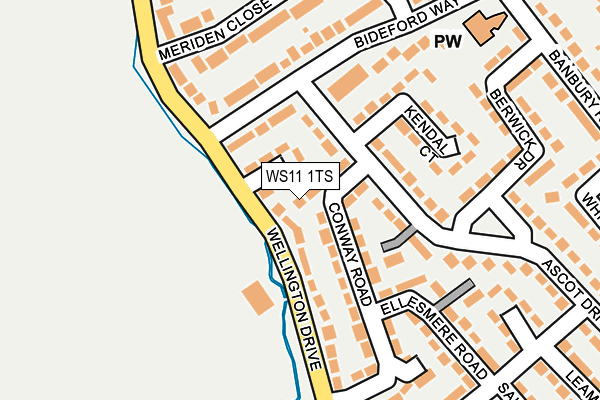
WS11 1TS lies on Conway Road in Cannock. WS11 1TS is located in the Cannock South electoral ward, within the local authority district of Cannock Chase and the English Parliamentary constituency of Cannock Chase. The Sub Integrated Care Board (ICB) Location is NHS Staffordshire and Stoke-on-Trent ICB - 04Y and the police force is Staffordshire. This postcode has been in use since January 2011.


GetTheData
Source: OS OpenMap – Local (Ordnance Survey)
Source: OS VectorMap District (Ordnance Survey)
Licence: Open Government Licence (requires attribution)
| Easting | 396772 |
| Northing | 309686 |
| Latitude | 52.684856 |
| Longitude | -2.049188 |
GetTheData
Source: Open Postcode Geo
Licence: Open Government Licence
| Street | Conway Road |
| Town/City | Cannock |
| Country | England |
| Postcode District | WS11 |
➜ See where WS11 is on a map ➜ Where is Cannock? | |
GetTheData
Source: Land Registry Price Paid Data
Licence: Open Government Licence
Elevation or altitude of WS11 1TS as distance above sea level:
| Metres | Feet | |
|---|---|---|
| Elevation | 120m | 394ft |
Elevation is measured from the approximate centre of the postcode, to the nearest point on an OS contour line from OS Terrain 50, which has contour spacing of ten vertical metres.
➜ How high above sea level am I? Find the elevation of your current position using your device's GPS.
GetTheData
Source: Open Postcode Elevation
Licence: Open Government Licence
| Ward | Cannock South |
| Constituency | Cannock Chase |
GetTheData
Source: ONS Postcode Database
Licence: Open Government Licence
3, THE SHIRES, CONWAY ROAD, CANNOCK, WS11 1TS 2009 15 SEP £137,500 |
GetTheData
Source: HM Land Registry Price Paid Data
Licence: Contains HM Land Registry data © Crown copyright and database right 2025. This data is licensed under the Open Government Licence v3.0.
| Hazlemere Grove (Ascot Dr) | Longford Estate | 75m |
| Hazlemere Grove (Ascot Dr) | Longford Estate | 88m |
| Berwick Drive (Ascot Dr) | Longford Estate | 197m |
| Berwick Drive (Ascot Dr) | Longford Estate | 209m |
| Leamington Close (Carlisle Rd) | Longford Estate | 269m |
| Cannock Station | 1.8km |
| Landywood Station | 3.7km |
| Hednesford Station | 4.3km |
GetTheData
Source: NaPTAN
Licence: Open Government Licence
| Percentage of properties with Next Generation Access | 100.0% |
| Percentage of properties with Superfast Broadband | 100.0% |
| Percentage of properties with Ultrafast Broadband | 0.0% |
| Percentage of properties with Full Fibre Broadband | 0.0% |
Superfast Broadband is between 30Mbps and 300Mbps
Ultrafast Broadband is > 300Mbps
| Percentage of properties unable to receive 2Mbps | 0.0% |
| Percentage of properties unable to receive 5Mbps | 0.0% |
| Percentage of properties unable to receive 10Mbps | 0.0% |
| Percentage of properties unable to receive 30Mbps | 0.0% |
GetTheData
Source: Ofcom
Licence: Ofcom Terms of Use (requires attribution)
GetTheData
Source: ONS Postcode Database
Licence: Open Government Licence


➜ Get more ratings from the Food Standards Agency
GetTheData
Source: Food Standards Agency
Licence: FSA terms & conditions
| Last Collection | |||
|---|---|---|---|
| Location | Mon-Fri | Sat | Distance |
| Bridgetown Post Office | 18:30 | 11:00 | 1,360m |
| Anson Road | 16:00 | 10:00 | 1,685m |
| Darges Lane | 17:00 | 10:00 | 2,756m |
GetTheData
Source: Dracos
Licence: Creative Commons Attribution-ShareAlike
The below table lists the International Territorial Level (ITL) codes (formerly Nomenclature of Territorial Units for Statistics (NUTS) codes) and Local Administrative Units (LAU) codes for WS11 1TS:
| ITL 1 Code | Name |
|---|---|
| TLG | West Midlands (England) |
| ITL 2 Code | Name |
| TLG2 | Shropshire and Staffordshire |
| ITL 3 Code | Name |
| TLG24 | Staffordshire CC |
| LAU 1 Code | Name |
| E07000192 | Cannock Chase |
GetTheData
Source: ONS Postcode Directory
Licence: Open Government Licence
The below table lists the Census Output Area (OA), Lower Layer Super Output Area (LSOA), and Middle Layer Super Output Area (MSOA) for WS11 1TS:
| Code | Name | |
|---|---|---|
| OA | E00149596 | |
| LSOA | E01029363 | Cannock Chase 012E |
| MSOA | E02006129 | Cannock Chase 012 |
GetTheData
Source: ONS Postcode Directory
Licence: Open Government Licence
| WS11 1PZ | Stirling Place | 54m |
| WS11 1PF | Ascot Drive | 98m |
| WS11 1PY | Wellington Drive | 105m |
| WS11 1GB | Cheltenham Court | 109m |
| WS11 1PH | Conway Road | 112m |
| WS11 1PQ | Kendal Court | 133m |
| WS11 1QA | Bideford Way | 134m |
| WS11 1PG | Haslemere Grove | 152m |
| WS11 1QG | Meriden Close | 177m |
| WS11 1PJ | Ellesmere Road | 184m |
GetTheData
Source: Open Postcode Geo; Land Registry Price Paid Data
Licence: Open Government Licence