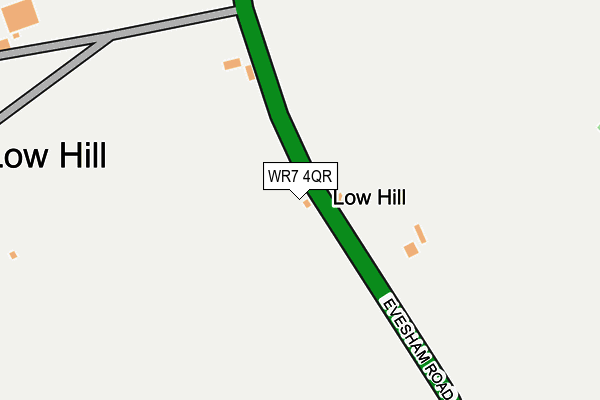
WR7 4QR lies on Evesham Road in Egdon, Worcester. WR7 4QR is located in the Upton Snodsbury electoral ward, within the local authority district of Wychavon and the English Parliamentary constituency of Mid Worcestershire. The Sub Integrated Care Board (ICB) Location is NHS Herefordshire and Worcestershire ICB - 18C and the police force is West Mercia. This postcode has been in use since January 1980.


GetTheData
Source: OS OpenMap – Local (Ordnance Survey)
Source: OS VectorMap District (Ordnance Survey)
Licence: Open Government Licence (requires attribution)
| Easting | 391203 |
| Northing | 252352 |
| Latitude | 52.169372 |
| Longitude | -2.130035 |
GetTheData
Source: Open Postcode Geo
Licence: Open Government Licence
| Street | Evesham Road |
| Locality | Egdon |
| Town/City | Worcester |
| Country | England |
| Postcode District | WR7 |
➜ See where WR7 is on a map ➜ Where is Low Hill? | |
GetTheData
Source: Land Registry Price Paid Data
Licence: Open Government Licence
Elevation or altitude of WR7 4QR as distance above sea level:
| Metres | Feet | |
|---|---|---|
| Elevation | 60m | 197ft |
Elevation is measured from the approximate centre of the postcode, to the nearest point on an OS contour line from OS Terrain 50, which has contour spacing of ten vertical metres.
➜ How high above sea level am I? Find the elevation of your current position using your device's GPS.
GetTheData
Source: Open Postcode Elevation
Licence: Open Government Licence
| Ward | Upton Snodsbury |
| Constituency | Mid Worcestershire |
GetTheData
Source: ONS Postcode Database
Licence: Open Government Licence
| Shelter (Edward's Lane) | White Ladies Aston | 947m |
| Shelter (Edward's Road) | White Ladies Aston | 961m |
| The Nightingale (Evesham Road) | Sneachill | 986m |
| The Nightingale (Evesham Road) | Sneachill | 988m |
| White Ladies Aston (Village Road) | White Ladies Aston | 1,001m |
| Pershore Station | 5.9km |
GetTheData
Source: NaPTAN
Licence: Open Government Licence
| Percentage of properties with Next Generation Access | 40.0% |
| Percentage of properties with Superfast Broadband | 40.0% |
| Percentage of properties with Ultrafast Broadband | 40.0% |
| Percentage of properties with Full Fibre Broadband | 40.0% |
Superfast Broadband is between 30Mbps and 300Mbps
Ultrafast Broadband is > 300Mbps
| Median download speed | 7.3Mbps |
| Average download speed | 8.2Mbps |
| Maximum download speed | 14.33Mbps |
| Median upload speed | 1.1Mbps |
| Average upload speed | 1.1Mbps |
| Maximum upload speed | 1.28Mbps |
| Percentage of properties unable to receive 2Mbps | 0.0% |
| Percentage of properties unable to receive 5Mbps | 0.0% |
| Percentage of properties unable to receive 10Mbps | 0.0% |
| Percentage of properties unable to receive 30Mbps | 60.0% |
GetTheData
Source: Ofcom
Licence: Ofcom Terms of Use (requires attribution)
Estimated total energy consumption in WR7 4QR by fuel type, 2015.
| Consumption (kWh) | 28,922 |
|---|---|
| Meter count | 9 |
| Mean (kWh/meter) | 3,214 |
| Median (kWh/meter) | 4,192 |
GetTheData
Source: Postcode level gas estimates: 2015 (experimental)
Source: Postcode level electricity estimates: 2015 (experimental)
Licence: Open Government Licence
GetTheData
Source: ONS Postcode Database
Licence: Open Government Licence


➜ Get more ratings from the Food Standards Agency
GetTheData
Source: Food Standards Agency
Licence: FSA terms & conditions
| Last Collection | |||
|---|---|---|---|
| Location | Mon-Fri | Sat | Distance |
| Spetchley P.o. | 17:00 | 09:00 | 712m |
| White Ladies Aston | 17:00 | 07:15 | 1,005m |
| Churchill Wood | 17:15 | 07:00 | 1,611m |
GetTheData
Source: Dracos
Licence: Creative Commons Attribution-ShareAlike
The below table lists the International Territorial Level (ITL) codes (formerly Nomenclature of Territorial Units for Statistics (NUTS) codes) and Local Administrative Units (LAU) codes for WR7 4QR:
| ITL 1 Code | Name |
|---|---|
| TLG | West Midlands (England) |
| ITL 2 Code | Name |
| TLG1 | Herefordshire, Worcestershire and Warwickshire |
| ITL 3 Code | Name |
| TLG12 | Worcestershire CC |
| LAU 1 Code | Name |
| E07000238 | Wychavon |
GetTheData
Source: ONS Postcode Directory
Licence: Open Government Licence
The below table lists the Census Output Area (OA), Lower Layer Super Output Area (LSOA), and Middle Layer Super Output Area (MSOA) for WR7 4QR:
| Code | Name | |
|---|---|---|
| OA | E00165339 | |
| LSOA | E01032417 | Wychavon 007D |
| MSOA | E02006754 | Wychavon 007 |
GetTheData
Source: ONS Postcode Directory
Licence: Open Government Licence
| WR7 4QS | Evesham Road | 848m |
| WR7 4QT | Edwards Lane | 881m |
| WR7 4QL | Evesham Road | 944m |
| WR7 4QQ | 998m | |
| WR7 4QH | 1000m | |
| WR7 4QF | Edwards Lane | 1043m |
| WR7 4QG | Edwards Lane | 1075m |
| WR7 4QJ | 1271m | |
| WR7 4QN | Egdon Lane | 1569m |
| WR7 4QE | 1591m |
GetTheData
Source: Open Postcode Geo; Land Registry Price Paid Data
Licence: Open Government Licence