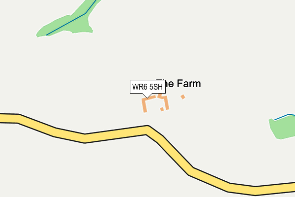
WR6 5SH lies on Whitbourne Hall Park in Whitbourne, Worcester. WR6 5SH is located in the Bromyard Bringsty electoral ward, within the unitary authority of Herefordshire, County of and the English Parliamentary constituency of North Herefordshire. The Sub Integrated Care Board (ICB) Location is NHS Herefordshire and Worcestershire ICB - 18C and the police force is West Mercia. This postcode has been in use since January 1980.


GetTheData
Source: OS OpenMap – Local (Ordnance Survey)
Source: OS VectorMap District (Ordnance Survey)
Licence: Open Government Licence (requires attribution)
| Easting | 368915 |
| Northing | 256781 |
| Latitude | 52.208367 |
| Longitude | -2.456322 |
GetTheData
Source: Open Postcode Geo
Licence: Open Government Licence
| Street | Whitbourne Hall Park |
| Locality | Whitbourne |
| Town/City | Worcester |
| Country | England |
| Postcode District | WR6 |
➜ See where WR6 is on a map | |
GetTheData
Source: Land Registry Price Paid Data
Licence: Open Government Licence
Elevation or altitude of WR6 5SH as distance above sea level:
| Metres | Feet | |
|---|---|---|
| Elevation | 90m | 295ft |
Elevation is measured from the approximate centre of the postcode, to the nearest point on an OS contour line from OS Terrain 50, which has contour spacing of ten vertical metres.
➜ How high above sea level am I? Find the elevation of your current position using your device's GPS.
GetTheData
Source: Open Postcode Elevation
Licence: Open Government Licence
| Ward | Bromyard Bringsty |
| Constituency | North Herefordshire |
GetTheData
Source: ONS Postcode Database
Licence: Open Government Licence
| Percentage of properties with Next Generation Access | 100.0% |
| Percentage of properties with Superfast Broadband | 0.0% |
| Percentage of properties with Ultrafast Broadband | 0.0% |
| Percentage of properties with Full Fibre Broadband | 0.0% |
Superfast Broadband is between 30Mbps and 300Mbps
Ultrafast Broadband is > 300Mbps
| Percentage of properties unable to receive 2Mbps | 0.0% |
| Percentage of properties unable to receive 5Mbps | 66.7% |
| Percentage of properties unable to receive 10Mbps | 100.0% |
| Percentage of properties unable to receive 30Mbps | 100.0% |
GetTheData
Source: Ofcom
Licence: Ofcom Terms of Use (requires attribution)
GetTheData
Source: ONS Postcode Database
Licence: Open Government Licence


➜ Get more ratings from the Food Standards Agency
GetTheData
Source: Food Standards Agency
Licence: FSA terms & conditions
| Last Collection | |||
|---|---|---|---|
| Location | Mon-Fri | Sat | Distance |
| Bringsty Common | 16:15 | 10:30 | 2,073m |
| Bringsty P.o. | 16:15 | 08:45 | 2,280m |
| Brockhampton Lodge | 16:15 | 10:30 | 2,358m |
GetTheData
Source: Dracos
Licence: Creative Commons Attribution-ShareAlike
The below table lists the International Territorial Level (ITL) codes (formerly Nomenclature of Territorial Units for Statistics (NUTS) codes) and Local Administrative Units (LAU) codes for WR6 5SH:
| ITL 1 Code | Name |
|---|---|
| TLG | West Midlands (England) |
| ITL 2 Code | Name |
| TLG1 | Herefordshire, Worcestershire and Warwickshire |
| ITL 3 Code | Name |
| TLG11 | Herefordshire, County of |
| LAU 1 Code | Name |
| E06000019 | Herefordshire, County of |
GetTheData
Source: ONS Postcode Directory
Licence: Open Government Licence
The below table lists the Census Output Area (OA), Lower Layer Super Output Area (LSOA), and Middle Layer Super Output Area (MSOA) for WR6 5SH:
| Code | Name | |
|---|---|---|
| OA | E00168514 | |
| LSOA | E01014001 | Herefordshire 005B |
| MSOA | E02002909 | Herefordshire 005 |
GetTheData
Source: ONS Postcode Directory
Licence: Open Government Licence
| WR6 5SJ | Badley Wood | 793m |
| WR6 5SE | 1499m | |
| HR7 4PJ | 1569m | |
| WR6 5SS | 1715m | |
| WR6 5UG | 1738m | |
| WR6 5UQ | 1796m | |
| WR6 5TB | Brockhampton Park | 1843m |
| HR7 4PS | 1928m | |
| HR7 4PR | 1945m | |
| HR7 4PE | 1992m |
GetTheData
Source: Open Postcode Geo; Land Registry Price Paid Data
Licence: Open Government Licence