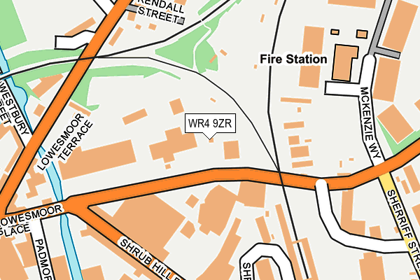
WR4 9ZR is located in the Cathedral electoral ward, within the local authority district of Worcester and the English Parliamentary constituency of Worcester. The Sub Integrated Care Board (ICB) Location is NHS Herefordshire and Worcestershire ICB - 18C and the police force is West Mercia. This postcode has been in use since June 1999.


GetTheData
Source: OS OpenMap – Local (Ordnance Survey)
Source: OS VectorMap District (Ordnance Survey)
Licence: Open Government Licence (requires attribution)
| Easting | 385661 |
| Northing | 255390 |
| Latitude | 52.196555 |
| Longitude | -2.211201 |
GetTheData
Source: Open Postcode Geo
Licence: Open Government Licence
| Country | England |
| Postcode District | WR4 |
➜ See where WR4 is on a map ➜ Where is Worcester? | |
GetTheData
Source: Land Registry Price Paid Data
Licence: Open Government Licence
Elevation or altitude of WR4 9ZR as distance above sea level:
| Metres | Feet | |
|---|---|---|
| Elevation | 30m | 98ft |
Elevation is measured from the approximate centre of the postcode, to the nearest point on an OS contour line from OS Terrain 50, which has contour spacing of ten vertical metres.
➜ How high above sea level am I? Find the elevation of your current position using your device's GPS.
GetTheData
Source: Open Postcode Elevation
Licence: Open Government Licence
| Ward | Cathedral |
| Constituency | Worcester |
GetTheData
Source: ONS Postcode Database
Licence: Open Government Licence
| Station Steps (Tolladine Road (B4637)) | Tolladine | 78m |
| Station Steps (Tolladine Road) | Tolladine | 97m |
| Shrub Hill Road (Shrub Hill Road (B4205)) | Worcester | 193m |
| Kenilworth Close (Rainbow Hill) | Rainbow Hill | 222m |
| Kenilworth Close (B4550) | Rainbow Hill | 229m |
| Worcester Shrub Hill Station | 0.2km |
| Worcester Foregate Street Station | 0.7km |
GetTheData
Source: NaPTAN
Licence: Open Government Licence
GetTheData
Source: ONS Postcode Database
Licence: Open Government Licence


➜ Get more ratings from the Food Standards Agency
GetTheData
Source: Food Standards Agency
Licence: FSA terms & conditions
| Last Collection | |||
|---|---|---|---|
| Location | Mon-Fri | Sat | Distance |
| Lansdowne Crescent | 17:00 | 11:30 | 241m |
| Shrub Hill | 245m | ||
| Shrub Hill Station | 18:15 | 11:30 | 247m |
GetTheData
Source: Dracos
Licence: Creative Commons Attribution-ShareAlike
The below table lists the International Territorial Level (ITL) codes (formerly Nomenclature of Territorial Units for Statistics (NUTS) codes) and Local Administrative Units (LAU) codes for WR4 9ZR:
| ITL 1 Code | Name |
|---|---|
| TLG | West Midlands (England) |
| ITL 2 Code | Name |
| TLG1 | Herefordshire, Worcestershire and Warwickshire |
| ITL 3 Code | Name |
| TLG12 | Worcestershire CC |
| LAU 1 Code | Name |
| E07000237 | Worcester |
GetTheData
Source: ONS Postcode Directory
Licence: Open Government Licence
The below table lists the Census Output Area (OA), Lower Layer Super Output Area (LSOA), and Middle Layer Super Output Area (MSOA) for WR4 9ZR:
| Code | Name | |
|---|---|---|
| OA | E00172268 | |
| LSOA | E01033248 | Worcester 011E |
| MSOA | E02006744 | Worcester 011 |
GetTheData
Source: ONS Postcode Directory
Licence: Open Government Licence
| WR4 9GX | Shrub Hill Road | 198m |
| WR3 8LX | Rainbow Hill | 199m |
| WR3 8NB | Terrace Walk | 210m |
| WR3 8NA | Crescent Villas | 217m |
| WR3 8LZ | Rainbow Hill | 230m |
| WR3 8NE | Kenilworth Close | 248m |
| WR1 2RX | Lowesmoor Terrace | 275m |
| WR3 8NG | Rainbow Hill Terrace | 295m |
| WR3 8JF | Colehurst Park | 301m |
| WR4 9GN | Mckenzie Way | 301m |
GetTheData
Source: Open Postcode Geo; Land Registry Price Paid Data
Licence: Open Government Licence