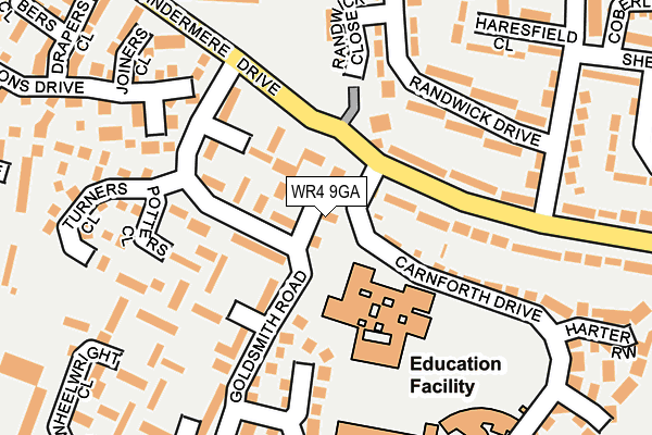
WR4 9GA is located in the Warndon electoral ward, within the local authority district of Worcester and the English Parliamentary constituency of Worcester. The Sub Integrated Care Board (ICB) Location is NHS Herefordshire and Worcestershire ICB - 18C and the police force is West Mercia. This postcode has been in use since March 2016.


GetTheData
Source: OS OpenMap – Local (Ordnance Survey)
Source: OS VectorMap District (Ordnance Survey)
Licence: Open Government Licence (requires attribution)
| Easting | 386826 |
| Northing | 256806 |
| Latitude | 52.209328 |
| Longitude | -2.194208 |
GetTheData
Source: Open Postcode Geo
Licence: Open Government Licence
| Country | England |
| Postcode District | WR4 |
➜ See where WR4 is on a map ➜ Where is Worcester? | |
GetTheData
Source: Land Registry Price Paid Data
Licence: Open Government Licence
Elevation or altitude of WR4 9GA as distance above sea level:
| Metres | Feet | |
|---|---|---|
| Elevation | 50m | 164ft |
Elevation is measured from the approximate centre of the postcode, to the nearest point on an OS contour line from OS Terrain 50, which has contour spacing of ten vertical metres.
➜ How high above sea level am I? Find the elevation of your current position using your device's GPS.
GetTheData
Source: Open Postcode Elevation
Licence: Open Government Licence
| Ward | Warndon |
| Constituency | Worcester |
GetTheData
Source: ONS Postcode Database
Licence: Open Government Licence
| Regency High School (Windermere Drive) | Warndon | 89m |
| Regency High School (Windermere Drive) | Warndon | 128m |
| Sainsburys (Windermere Drive) | Blackpole | 214m |
| Sainsburys (Windermere Drive) | Blackpole | 247m |
| Haresfield Close (Tetbury Drive) | Warndon | 259m |
| Worcester Shrub Hill Station | 1.9km |
| Worcester Foregate Street Station | 2.4km |
GetTheData
Source: NaPTAN
Licence: Open Government Licence
| Percentage of properties with Next Generation Access | 100.0% |
| Percentage of properties with Superfast Broadband | 100.0% |
| Percentage of properties with Ultrafast Broadband | 0.0% |
| Percentage of properties with Full Fibre Broadband | 0.0% |
Superfast Broadband is between 30Mbps and 300Mbps
Ultrafast Broadband is > 300Mbps
| Percentage of properties unable to receive 2Mbps | 0.0% |
| Percentage of properties unable to receive 5Mbps | 0.0% |
| Percentage of properties unable to receive 10Mbps | 0.0% |
| Percentage of properties unable to receive 30Mbps | 0.0% |
GetTheData
Source: Ofcom
Licence: Ofcom Terms of Use (requires attribution)
GetTheData
Source: ONS Postcode Database
Licence: Open Government Licence


➜ Get more ratings from the Food Standards Agency
GetTheData
Source: Food Standards Agency
Licence: FSA terms & conditions
| Last Collection | |||
|---|---|---|---|
| Location | Mon-Fri | Sat | Distance |
| Goldsmith Road | 16:45 | 11:30 | 88m |
| Randwick Drive | 17:15 | 11:30 | 400m |
| Langdale Drive | 16:45 | 11:30 | 434m |
GetTheData
Source: Dracos
Licence: Creative Commons Attribution-ShareAlike
The below table lists the International Territorial Level (ITL) codes (formerly Nomenclature of Territorial Units for Statistics (NUTS) codes) and Local Administrative Units (LAU) codes for WR4 9GA:
| ITL 1 Code | Name |
|---|---|
| TLG | West Midlands (England) |
| ITL 2 Code | Name |
| TLG1 | Herefordshire, Worcestershire and Warwickshire |
| ITL 3 Code | Name |
| TLG12 | Worcestershire CC |
| LAU 1 Code | Name |
| E07000237 | Worcester |
GetTheData
Source: ONS Postcode Directory
Licence: Open Government Licence
The below table lists the Census Output Area (OA), Lower Layer Super Output Area (LSOA), and Middle Layer Super Output Area (MSOA) for WR4 9GA:
| Code | Name | |
|---|---|---|
| OA | E00172264 | |
| LSOA | E01032333 | Worcester 005F |
| MSOA | E02006738 | Worcester 005 |
GetTheData
Source: ONS Postcode Directory
Licence: Open Government Licence
| WR4 9JW | Windermere Drive | 43m |
| WR4 9FW | Goldsmith Road | 48m |
| WR4 9JE | Windermere Drive | 128m |
| WR4 9JR | Saddlers Walk | 129m |
| WR4 9LN | Randwick Drive | 140m |
| WR4 9JP | Goldsmith Road | 152m |
| WR4 9SL | Ploughmans Close | 156m |
| WR4 9NJ | Randwick Close | 166m |
| WR4 9XP | Shipwright Close | 177m |
| WR4 9LW | Randwick Drive | 177m |
GetTheData
Source: Open Postcode Geo; Land Registry Price Paid Data
Licence: Open Government Licence