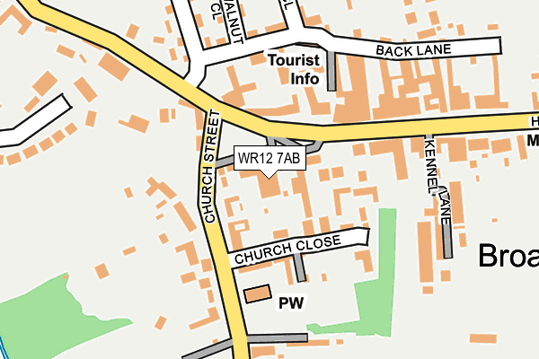
WR12 7AB is located in the Broadway, Sedgeberrow & Childswickham electoral ward, within the local authority district of Wychavon and the English Parliamentary constituency of Mid Worcestershire. The Sub Integrated Care Board (ICB) Location is NHS Herefordshire and Worcestershire ICB - 18C and the police force is West Mercia. This postcode has been in use since January 1980.


GetTheData
Source: OS OpenMap – Local (Ordnance Survey)
Source: OS VectorMap District (Ordnance Survey)
Licence: Open Government Licence (requires attribution)
| Easting | 409495 |
| Northing | 237465 |
| Latitude | 52.035510 |
| Longitude | -1.862997 |
GetTheData
Source: Open Postcode Geo
Licence: Open Government Licence
| Country | England |
| Postcode District | WR12 |
➜ See where WR12 is on a map ➜ Where is Broadway? | |
GetTheData
Source: Land Registry Price Paid Data
Licence: Open Government Licence
Elevation or altitude of WR12 7AB as distance above sea level:
| Metres | Feet | |
|---|---|---|
| Elevation | 90m | 295ft |
Elevation is measured from the approximate centre of the postcode, to the nearest point on an OS contour line from OS Terrain 50, which has contour spacing of ten vertical metres.
➜ How high above sea level am I? Find the elevation of your current position using your device's GPS.
GetTheData
Source: Open Postcode Elevation
Licence: Open Government Licence
| Ward | Broadway, Sedgeberrow & Childswickham |
| Constituency | Mid Worcestershire |
GetTheData
Source: ONS Postcode Database
Licence: Open Government Licence
| Lifford Hall (High Street) | Broadway | 165m |
| Lifford Hall (High Street) | Broadway | 187m |
| The Lygon Arms (High Street) | Broadway | 206m |
| The Lygon Arms (High Street) | Broadway | 224m |
| Clock (High Street) | Broadway | 374m |
GetTheData
Source: NaPTAN
Licence: Open Government Licence
GetTheData
Source: ONS Postcode Database
Licence: Open Government Licence


➜ Get more ratings from the Food Standards Agency
GetTheData
Source: Food Standards Agency
Licence: FSA terms & conditions
| Last Collection | |||
|---|---|---|---|
| Location | Mon-Fri | Sat | Distance |
| Broadway Post Office | 17:45 | 11:00 | 232m |
| Springfield Lane | 17:15 | 11:00 | 386m |
| Cheltenham Road | 17:30 | 11:00 | 479m |
GetTheData
Source: Dracos
Licence: Creative Commons Attribution-ShareAlike
The below table lists the International Territorial Level (ITL) codes (formerly Nomenclature of Territorial Units for Statistics (NUTS) codes) and Local Administrative Units (LAU) codes for WR12 7AB:
| ITL 1 Code | Name |
|---|---|
| TLG | West Midlands (England) |
| ITL 2 Code | Name |
| TLG1 | Herefordshire, Worcestershire and Warwickshire |
| ITL 3 Code | Name |
| TLG12 | Worcestershire CC |
| LAU 1 Code | Name |
| E07000238 | Wychavon |
GetTheData
Source: ONS Postcode Directory
Licence: Open Government Licence
The below table lists the Census Output Area (OA), Lower Layer Super Output Area (LSOA), and Middle Layer Super Output Area (MSOA) for WR12 7AB:
| Code | Name | |
|---|---|---|
| OA | E00165005 | |
| LSOA | E01032353 | Wychavon 018C |
| MSOA | E02006765 | Wychavon 018 |
GetTheData
Source: ONS Postcode Directory
Licence: Open Government Licence
| WR12 7AA | The Green | 24m |
| WR12 7AE | Church Street | 77m |
| WR12 7AH | Church Close | 78m |
| WR12 7NZ | Croft Gardens | 99m |
| WR12 7AP | Russell Square | 143m |
| WR12 7DU | High Street | 144m |
| WR12 7BS | Walnut Close | 198m |
| WR12 7DP | High Street | 225m |
| WR12 7BJ | Gordon Close | 235m |
| WR12 7BP | Back Lane | 240m |
GetTheData
Source: Open Postcode Geo; Land Registry Price Paid Data
Licence: Open Government Licence