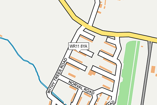
WR11 8YA lies on Withy Trees Road in South Littleton, Evesham. WR11 8YA is located in the Honeybourne, Pebworth & The Littletons electoral ward, within the local authority district of Wychavon and the English Parliamentary constituency of Mid Worcestershire. The Sub Integrated Care Board (ICB) Location is NHS Herefordshire and Worcestershire ICB - 18C and the police force is West Mercia. This postcode has been in use since December 2001.


GetTheData
Source: OS OpenMap – Local (Ordnance Survey)
Source: OS VectorMap District (Ordnance Survey)
Licence: Open Government Licence (requires attribution)
| Easting | 409413 |
| Northing | 245816 |
| Latitude | 52.110604 |
| Longitude | -1.863955 |
GetTheData
Source: Open Postcode Geo
Licence: Open Government Licence
| Street | Withy Trees Road |
| Locality | South Littleton |
| Town/City | Evesham |
| Country | England |
| Postcode District | WR11 |
➜ See where WR11 is on a map | |
GetTheData
Source: Land Registry Price Paid Data
Licence: Open Government Licence
Elevation or altitude of WR11 8YA as distance above sea level:
| Metres | Feet | |
|---|---|---|
| Elevation | 40m | 131ft |
Elevation is measured from the approximate centre of the postcode, to the nearest point on an OS contour line from OS Terrain 50, which has contour spacing of ten vertical metres.
➜ How high above sea level am I? Find the elevation of your current position using your device's GPS.
GetTheData
Source: Open Postcode Elevation
Licence: Open Government Licence
| Ward | Honeybourne, Pebworth & The Littletons |
| Constituency | Mid Worcestershire |
GetTheData
Source: ONS Postcode Database
Licence: Open Government Licence
| Norval Road | Long Lartin | 119m |
| Long Lartin Prison (Little Road) | Long Lartin | 802m |
| Long Lartin Prison (Little Road) | Long Lartin | 856m |
| Shinehill Lane | South Littleton | 1,361m |
| Shinehill Lane | South Littleton | 1,369m |
| Honeybourne Station | 2.3km |
GetTheData
Source: NaPTAN
Licence: Open Government Licence
| Percentage of properties with Next Generation Access | 100.0% |
| Percentage of properties with Superfast Broadband | 100.0% |
| Percentage of properties with Ultrafast Broadband | 0.0% |
| Percentage of properties with Full Fibre Broadband | 0.0% |
Superfast Broadband is between 30Mbps and 300Mbps
Ultrafast Broadband is > 300Mbps
| Median download speed | 77.5Mbps |
| Average download speed | 55.8Mbps |
| Maximum download speed | 80.00Mbps |
| Median upload speed | 19.5Mbps |
| Average upload speed | 14.2Mbps |
| Maximum upload speed | 20.00Mbps |
| Percentage of properties unable to receive 2Mbps | 0.0% |
| Percentage of properties unable to receive 5Mbps | 0.0% |
| Percentage of properties unable to receive 10Mbps | 0.0% |
| Percentage of properties unable to receive 30Mbps | 0.0% |
GetTheData
Source: Ofcom
Licence: Ofcom Terms of Use (requires attribution)
Estimated total energy consumption in WR11 8YA by fuel type, 2015.
| Consumption (kWh) | 294,795 |
|---|---|
| Meter count | 29 |
| Mean (kWh/meter) | 10,165 |
| Median (kWh/meter) | 9,629 |
| Consumption (kWh) | 127,891 |
|---|---|
| Meter count | 27 |
| Mean (kWh/meter) | 4,737 |
| Median (kWh/meter) | 4,899 |
GetTheData
Source: Postcode level gas estimates: 2015 (experimental)
Source: Postcode level electricity estimates: 2015 (experimental)
Licence: Open Government Licence
GetTheData
Source: ONS Postcode Database
Licence: Open Government Licence


➜ Get more ratings from the Food Standards Agency
GetTheData
Source: Food Standards Agency
Licence: FSA terms & conditions
| Last Collection | |||
|---|---|---|---|
| Location | Mon-Fri | Sat | Distance |
| Long Lartin | 16:00 | 09:30 | 165m |
| Shineshill Lane | 16:00 | 10:15 | 1,443m |
| Ivy Lane | 16:45 | 10:15 | 1,609m |
GetTheData
Source: Dracos
Licence: Creative Commons Attribution-ShareAlike
The below table lists the International Territorial Level (ITL) codes (formerly Nomenclature of Territorial Units for Statistics (NUTS) codes) and Local Administrative Units (LAU) codes for WR11 8YA:
| ITL 1 Code | Name |
|---|---|
| TLG | West Midlands (England) |
| ITL 2 Code | Name |
| TLG1 | Herefordshire, Worcestershire and Warwickshire |
| ITL 3 Code | Name |
| TLG12 | Worcestershire CC |
| LAU 1 Code | Name |
| E07000238 | Wychavon |
GetTheData
Source: ONS Postcode Directory
Licence: Open Government Licence
The below table lists the Census Output Area (OA), Lower Layer Super Output Area (LSOA), and Middle Layer Super Output Area (MSOA) for WR11 8YA:
| Code | Name | |
|---|---|---|
| OA | E00165326 | |
| LSOA | E01032415 | Wychavon 011D |
| MSOA | E02006758 | Wychavon 011 |
GetTheData
Source: ONS Postcode Directory
Licence: Open Government Licence
| WR11 8YE | Meadow Road | 139m |
| WR11 8YD | Norval Road | 159m |
| WR11 8YB | Withy Trees Road | 259m |
| WR11 8YF | Little Road | 902m |
| WR11 8TP | Shinehill Lane | 1006m |
| WR11 8TR | Shinehill Lane | 1152m |
| WR11 8AE | Orchard Close | 1229m |
| WR11 8QL | Pebworth Road | 1293m |
| WR11 8TY | Clevedon Green | 1407m |
| WR11 7HR | Grange Road | 1481m |
GetTheData
Source: Open Postcode Geo; Land Registry Price Paid Data
Licence: Open Government Licence