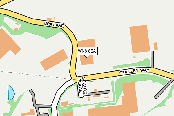
WN8 8EA lies on Stanley Way in Stanley Industrial Estate, Skelmersdale. WN8 8EA is located in the Skelmersdale North electoral ward, within the local authority district of West Lancashire and the English Parliamentary constituency of West Lancashire. The Sub Integrated Care Board (ICB) Location is NHS Lancashire and South Cumbria ICB - 02G and the police force is Lancashire. This postcode has been in use since August 1993.


GetTheData
Source: OS OpenMap – Local (Ordnance Survey)
Source: OS VectorMap District (Ordnance Survey)
Licence: Open Government Licence (requires attribution)
| Easting | 347126 |
| Northing | 407573 |
| Latitude | 53.562112 |
| Longitude | -2.799727 |
GetTheData
Source: Open Postcode Geo
Licence: Open Government Licence
| Street | Stanley Way |
| Locality | Stanley Industrial Estate |
| Town/City | Skelmersdale |
| Country | England |
| Postcode District | WN8 |
➜ See where WN8 is on a map ➜ Where is Skelmersdale? | |
GetTheData
Source: Land Registry Price Paid Data
Licence: Open Government Licence
Elevation or altitude of WN8 8EA as distance above sea level:
| Metres | Feet | |
|---|---|---|
| Elevation | 50m | 164ft |
Elevation is measured from the approximate centre of the postcode, to the nearest point on an OS contour line from OS Terrain 50, which has contour spacing of ten vertical metres.
➜ How high above sea level am I? Find the elevation of your current position using your device's GPS.
GetTheData
Source: Open Postcode Elevation
Licence: Open Government Licence
| Ward | Skelmersdale North |
| Constituency | West Lancashire |
GetTheData
Source: ONS Postcode Database
Licence: Open Government Licence
| Lathom High School (Glenburn Road) | Skelmersdale | 382m |
| Lathom Hs (Glenburn Road) | Skelmersdale | 444m |
| Our Ladys Rchs (Glenburn Road) | Skelmersdale | 476m |
| Asda Depot (Statham Road) | Stanley | 525m |
| Asda Depot (Statham Road) | Stanley | 546m |
| Parbold Station | 3.7km |
| Hoscar Station | 4km |
| Burscough Junction Station | 4.8km |
GetTheData
Source: NaPTAN
Licence: Open Government Licence
GetTheData
Source: ONS Postcode Database
Licence: Open Government Licence


➜ Get more ratings from the Food Standards Agency
GetTheData
Source: Food Standards Agency
Licence: FSA terms & conditions
| Last Collection | |||
|---|---|---|---|
| Location | Mon-Fri | Sat | Distance |
| Winsters P O | 18:30 | 11:15 | 1,362m |
| Ashurst P O | 18:35 | 11:00 | 1,742m |
| Birch Green Road/ Feltons | 16:20 | 11:00 | 1,928m |
GetTheData
Source: Dracos
Licence: Creative Commons Attribution-ShareAlike
The below table lists the International Territorial Level (ITL) codes (formerly Nomenclature of Territorial Units for Statistics (NUTS) codes) and Local Administrative Units (LAU) codes for WN8 8EA:
| ITL 1 Code | Name |
|---|---|
| TLD | North West (England) |
| ITL 2 Code | Name |
| TLD4 | Lancashire |
| ITL 3 Code | Name |
| TLD47 | Chorley and West Lancashire |
| LAU 1 Code | Name |
| E07000127 | West Lancashire |
GetTheData
Source: ONS Postcode Directory
Licence: Open Government Licence
The below table lists the Census Output Area (OA), Lower Layer Super Output Area (LSOA), and Middle Layer Super Output Area (MSOA) for WN8 8EA:
| Code | Name | |
|---|---|---|
| OA | E00129503 | |
| LSOA | E01025522 | West Lancashire 009D |
| MSOA | E02005312 | West Lancashire 009 |
GetTheData
Source: ONS Postcode Directory
Licence: Open Government Licence
| WN8 8EB | Seddon Place | 316m |
| L40 6JH | Vale Lane | 516m |
| WN8 6XJ | Summer Street | 685m |
| WN8 8EF | Selby Place | 700m |
| L40 6JQ | Spa Lane | 720m |
| WN8 8PD | Thurcroft Drive | 756m |
| WN8 8QU | Thurston | 792m |
| WN8 8QS | Millbrook Close | 828m |
| WN8 8PB | Thealby Close | 830m |
| WN8 8PE | Tintagel | 847m |
GetTheData
Source: Open Postcode Geo; Land Registry Price Paid Data
Licence: Open Government Licence