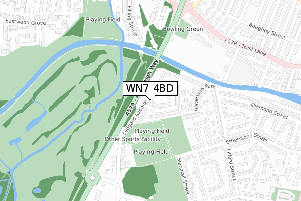
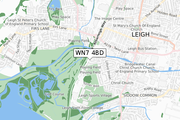
WN7 4BD lies on Ledgard Avenue in Leigh. WN7 4BD is located in the Leigh South electoral ward, within the metropolitan district of Wigan and the English Parliamentary constituency of Leigh. The Sub Integrated Care Board (ICB) Location is NHS Greater Manchester ICB - 02H and the police force is Greater Manchester. This postcode has been in use since August 2008.


GetTheData
Source: OS Open Zoomstack (Ordnance Survey)
Licence: Open Government Licence (requires attribution)
Attribution: Contains OS data © Crown copyright and database right 2025
Source: Open Postcode Geo
Licence: Open Government Licence (requires attribution)
Attribution: Contains OS data © Crown copyright and database right 2025; Contains Royal Mail data © Royal Mail copyright and database right 2025; Source: Office for National Statistics licensed under the Open Government Licence v.3.0
| Easting | 364975 |
| Northing | 399841 |
| Latitude | 53.494099 |
| Longitude | -2.529404 |
GetTheData
Source: Open Postcode Geo
Licence: Open Government Licence
| Street | Ledgard Avenue |
| Town/City | Leigh |
| Country | England |
| Postcode District | WN7 |
➜ See where WN7 is on a map | |
GetTheData
Source: Land Registry Price Paid Data
Licence: Open Government Licence
Elevation or altitude of WN7 4BD as distance above sea level:
| Metres | Feet | |
|---|---|---|
| Elevation | 30m | 98ft |
Elevation is measured from the approximate centre of the postcode, to the nearest point on an OS contour line from OS Terrain 50, which has contour spacing of ten vertical metres.
➜ How high above sea level am I? Find the elevation of your current position using your device's GPS.
GetTheData
Source: Open Postcode Elevation
Licence: Open Government Licence
| Ward | Leigh South |
| Constituency | Leigh |
GetTheData
Source: ONS Postcode Database
Licence: Open Government Licence
| Etherstone Street (Nebnd) (Etherstone St) | Pennington | 214m |
| Marshall St (S Bound) (Marshall Street) | Pennington | 223m |
| Twist Ln/Leigh Miners Club (Twist Ln) | Firs Lane | 306m |
| Sale Way/Leigh Sports Village (Sale Way) | Pennington | 333m |
| Marshall Street (Nnd) (Marshall Street) | Pennington | 352m |
| Hag Fold Station | 5km |
| Atherton Station | 5.1km |
GetTheData
Source: NaPTAN
Licence: Open Government Licence
| Percentage of properties with Next Generation Access | 100.0% |
| Percentage of properties with Superfast Broadband | 100.0% |
| Percentage of properties with Ultrafast Broadband | 0.0% |
| Percentage of properties with Full Fibre Broadband | 0.0% |
Superfast Broadband is between 30Mbps and 300Mbps
Ultrafast Broadband is > 300Mbps
| Median download speed | 53.0Mbps |
| Average download speed | 43.7Mbps |
| Maximum download speed | 75.91Mbps |
| Median upload speed | 13.6Mbps |
| Average upload speed | 12.2Mbps |
| Maximum upload speed | 19.53Mbps |
| Percentage of properties unable to receive 2Mbps | 0.0% |
| Percentage of properties unable to receive 5Mbps | 0.0% |
| Percentage of properties unable to receive 10Mbps | 0.0% |
| Percentage of properties unable to receive 30Mbps | 0.0% |
GetTheData
Source: Ofcom
Licence: Ofcom Terms of Use (requires attribution)
Estimated total energy consumption in WN7 4BD by fuel type, 2015.
| Consumption (kWh) | 227,203 |
|---|---|
| Meter count | 24 |
| Mean (kWh/meter) | 9,467 |
| Median (kWh/meter) | 7,975 |
| Consumption (kWh) | 61,622 |
|---|---|
| Meter count | 18 |
| Mean (kWh/meter) | 3,423 |
| Median (kWh/meter) | 3,357 |
GetTheData
Source: Postcode level gas estimates: 2015 (experimental)
Source: Postcode level electricity estimates: 2015 (experimental)
Licence: Open Government Licence
GetTheData
Source: ONS Postcode Database
Licence: Open Government Licence


➜ Get more ratings from the Food Standards Agency
GetTheData
Source: Food Standards Agency
Licence: FSA terms & conditions
| Last Collection | |||
|---|---|---|---|
| Location | Mon-Fri | Sat | Distance |
| 2 Bonneywell Road | 18:15 | 12:00 | 676m |
| Charles Street | 18:10 | 11:35 | 832m |
| Leigh Branch Office | 19:15 | 12:30 | 939m |
GetTheData
Source: Dracos
Licence: Creative Commons Attribution-ShareAlike
The below table lists the International Territorial Level (ITL) codes (formerly Nomenclature of Territorial Units for Statistics (NUTS) codes) and Local Administrative Units (LAU) codes for WN7 4BD:
| ITL 1 Code | Name |
|---|---|
| TLD | North West (England) |
| ITL 2 Code | Name |
| TLD3 | Greater Manchester |
| ITL 3 Code | Name |
| TLD36 | Greater Manchester North West |
| LAU 1 Code | Name |
| E08000010 | Wigan |
GetTheData
Source: ONS Postcode Directory
Licence: Open Government Licence
The below table lists the Census Output Area (OA), Lower Layer Super Output Area (LSOA), and Middle Layer Super Output Area (MSOA) for WN7 4BD:
| Code | Name | |
|---|---|---|
| OA | E00031915 | |
| LSOA | E01006299 | Wigan 037C |
| MSOA | E02001323 | Wigan 037 |
GetTheData
Source: ONS Postcode Directory
Licence: Open Government Licence
| WN7 4BL | Wintergreen Close | 52m |
| WN7 4BG | Ledgard Avenue | 107m |
| WN7 4JS | Waterview Park | 155m |
| WN7 4JP | Waterview Park | 166m |
| WN7 4BN | Ledgard Avenue | 204m |
| WN7 4HZ | Overton Street | 212m |
| WN7 4JN | Lilford Street | 225m |
| WN7 4HY | Etherstone Street | 272m |
| WN7 4ET | Pilling Street | 288m |
| WN7 4EW | Sanderson Street | 288m |
GetTheData
Source: Open Postcode Geo; Land Registry Price Paid Data
Licence: Open Government Licence