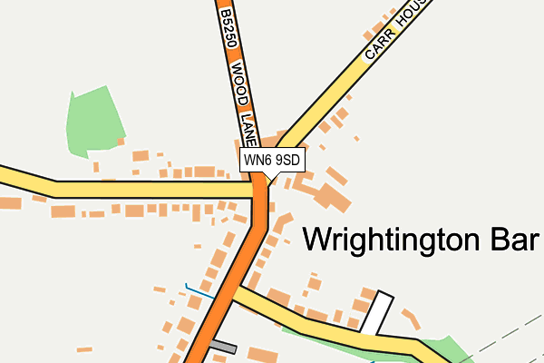
WN6 9SD lies on Wrightington Bar in Wrightington, Wigan. WN6 9SD is located in the Rural North East electoral ward, within the local authority district of West Lancashire and the English Parliamentary constituency of West Lancashire. The Sub Integrated Care Board (ICB) Location is NHS Lancashire and South Cumbria ICB - 02G and the police force is Lancashire. This postcode has been in use since January 1980.


GetTheData
Source: OS OpenMap – Local (Ordnance Survey)
Source: OS VectorMap District (Ordnance Survey)
Licence: Open Government Licence (requires attribution)
| Easting | 353513 |
| Northing | 413489 |
| Latitude | 53.615872 |
| Longitude | -2.704193 |
GetTheData
Source: Open Postcode Geo
Licence: Open Government Licence
| Street | Wrightington Bar |
| Locality | Wrightington |
| Town/City | Wigan |
| Country | England |
| Postcode District | WN6 |
➜ See where WN6 is on a map ➜ Where is Wrightington Bar? | |
GetTheData
Source: Land Registry Price Paid Data
Licence: Open Government Licence
Elevation or altitude of WN6 9SD as distance above sea level:
| Metres | Feet | |
|---|---|---|
| Elevation | 80m | 262ft |
Elevation is measured from the approximate centre of the postcode, to the nearest point on an OS contour line from OS Terrain 50, which has contour spacing of ten vertical metres.
➜ How high above sea level am I? Find the elevation of your current position using your device's GPS.
GetTheData
Source: Open Postcode Elevation
Licence: Open Government Licence
| Ward | Rural North East |
| Constituency | West Lancashire |
GetTheData
Source: ONS Postcode Database
Licence: Open Government Licence
| Church Lane (Wood Lane) | Wrightington Bar | 21m |
| Corner House (Wood Lane) | Wrightington Bar | 99m |
| Broadhurst Lane (Mossy Lea Road) | Wrightington Bar | 173m |
| Rivington View (Wood Lane) | Heskin | 463m |
| Raby Fold (Mossy Lea Road) | Mossy Lea | 472m |
| Appley Bridge Station | 4.3km |
| Parbold Station | 5.2km |
| Euxton Balshaw Lane Station | 5.4km |
GetTheData
Source: NaPTAN
Licence: Open Government Licence
| Percentage of properties with Next Generation Access | 100.0% |
| Percentage of properties with Superfast Broadband | 100.0% |
| Percentage of properties with Ultrafast Broadband | 0.0% |
| Percentage of properties with Full Fibre Broadband | 0.0% |
Superfast Broadband is between 30Mbps and 300Mbps
Ultrafast Broadband is > 300Mbps
| Percentage of properties unable to receive 2Mbps | 0.0% |
| Percentage of properties unable to receive 5Mbps | 0.0% |
| Percentage of properties unable to receive 10Mbps | 0.0% |
| Percentage of properties unable to receive 30Mbps | 0.0% |
GetTheData
Source: Ofcom
Licence: Ofcom Terms of Use (requires attribution)
GetTheData
Source: ONS Postcode Database
Licence: Open Government Licence


➜ Get more ratings from the Food Standards Agency
GetTheData
Source: Food Standards Agency
Licence: FSA terms & conditions
| Last Collection | |||
|---|---|---|---|
| Location | Mon-Fri | Sat | Distance |
| Heskin Post Office | 17:00 | 11:00 | 1,522m |
| 2 Tansley Avenue, Coppull | 16:30 | 11:00 | 2,363m |
| Coppull Post Office | 17:00 | 11:00 | 2,389m |
GetTheData
Source: Dracos
Licence: Creative Commons Attribution-ShareAlike
The below table lists the International Territorial Level (ITL) codes (formerly Nomenclature of Territorial Units for Statistics (NUTS) codes) and Local Administrative Units (LAU) codes for WN6 9SD:
| ITL 1 Code | Name |
|---|---|
| TLD | North West (England) |
| ITL 2 Code | Name |
| TLD4 | Lancashire |
| ITL 3 Code | Name |
| TLD47 | Chorley and West Lancashire |
| LAU 1 Code | Name |
| E07000127 | West Lancashire |
GetTheData
Source: ONS Postcode Directory
Licence: Open Government Licence
The below table lists the Census Output Area (OA), Lower Layer Super Output Area (LSOA), and Middle Layer Super Output Area (MSOA) for WN6 9SD:
| Code | Name | |
|---|---|---|
| OA | E00129593 | |
| LSOA | E01025538 | West Lancashire 005D |
| MSOA | E02005308 | West Lancashire 005 |
GetTheData
Source: ONS Postcode Directory
Licence: Open Government Licence
| WN6 9SF | Wrightington Bar | 29m |
| WN6 9SQ | Wood Lane | 60m |
| WN6 9RY | Broadhurst Lane | 143m |
| WN6 9SN | Church Lane | 177m |
| WN6 9RZ | Mossy Lea Road | 185m |
| WN6 9SL | Church Lane | 258m |
| WN6 9SB | Mossy Lea Road | 442m |
| WN6 9SH | Carr House Lane | 454m |
| WN6 9RX | Broadhurst Lane | 471m |
| PR7 5NT | Wood Lane | 489m |
GetTheData
Source: Open Postcode Geo; Land Registry Price Paid Data
Licence: Open Government Licence