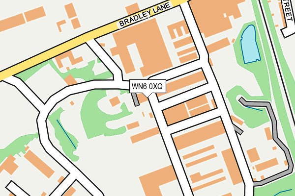
WN6 0XQ lies on Bradley Hall Trading Estate in Standish, Wigan. WN6 0XQ is located in the Standish with Langtree electoral ward, within the metropolitan district of Wigan and the English Parliamentary constituency of Wigan. The Sub Integrated Care Board (ICB) Location is NHS Greater Manchester ICB - 02H and the police force is Greater Manchester. This postcode has been in use since October 1984.


GetTheData
Source: OS OpenMap – Local (Ordnance Survey)
Source: OS VectorMap District (Ordnance Survey)
Licence: Open Government Licence (requires attribution)
| Easting | 357147 |
| Northing | 410969 |
| Latitude | 53.593549 |
| Longitude | -2.648915 |
GetTheData
Source: Open Postcode Geo
Licence: Open Government Licence
| Street | Bradley Hall Trading Estate |
| Locality | Standish |
| Town/City | Wigan |
| Country | England |
| Postcode District | WN6 |
➜ See where WN6 is on a map ➜ Where is Standish? | |
GetTheData
Source: Land Registry Price Paid Data
Licence: Open Government Licence
Elevation or altitude of WN6 0XQ as distance above sea level:
| Metres | Feet | |
|---|---|---|
| Elevation | 70m | 230ft |
Elevation is measured from the approximate centre of the postcode, to the nearest point on an OS contour line from OS Terrain 50, which has contour spacing of ten vertical metres.
➜ How high above sea level am I? Find the elevation of your current position using your device's GPS.
GetTheData
Source: Open Postcode Elevation
Licence: Open Government Licence
| Ward | Standish With Langtree |
| Constituency | Wigan |
GetTheData
Source: ONS Postcode Database
Licence: Open Government Licence
UNIT 71B, BRADLEY HALL TRADING ESTATE, STANDISH, WIGAN, WN6 0XQ 1995 27 SEP £85,000 |
GetTheData
Source: HM Land Registry Price Paid Data
Licence: Contains HM Land Registry data © Crown copyright and database right 2025. This data is licensed under the Open Government Licence v3.0.
| Bradley Ln/Bradley Mills (Bradley Ln) | Standish | 224m |
| Bradley Ln/Bradley Mills (Bradley Ln) | Standish | 236m |
| Bradley Ln/Industrial Est (Bradley Ln) | Standish | 327m |
| Bradley Ln/Industrial Est (Bradley Ln) | Standish | 343m |
| Copeland Dr/Churchlands La (Sebnd) (Copeland Drive) | Standish | 532m |
| Adlington (Lancs) Station | 3.7km |
| Gathurst Station | 4.8km |
| Appley Bridge Station | 4.9km |
GetTheData
Source: NaPTAN
Licence: Open Government Licence
| Median download speed | 55.1Mbps |
| Average download speed | 45.0Mbps |
| Maximum download speed | 80.00Mbps |
| Median upload speed | 12.9Mbps |
| Average upload speed | 11.0Mbps |
| Maximum upload speed | 20.00Mbps |
GetTheData
Source: Ofcom
Licence: Ofcom Terms of Use (requires attribution)
GetTheData
Source: ONS Postcode Database
Licence: Open Government Licence


➜ Get more ratings from the Food Standards Agency
GetTheData
Source: Food Standards Agency
Licence: FSA terms & conditions
| Last Collection | |||
|---|---|---|---|
| Location | Mon-Fri | Sat | Distance |
| Coppull Post Office | 17:00 | 11:00 | 2,065m |
| 2 Tansley Avenue, Coppull | 16:30 | 11:00 | 2,290m |
| Elmfield Road | 18:20 | 11:10 | 2,862m |
GetTheData
Source: Dracos
Licence: Creative Commons Attribution-ShareAlike
The below table lists the International Territorial Level (ITL) codes (formerly Nomenclature of Territorial Units for Statistics (NUTS) codes) and Local Administrative Units (LAU) codes for WN6 0XQ:
| ITL 1 Code | Name |
|---|---|
| TLD | North West (England) |
| ITL 2 Code | Name |
| TLD3 | Greater Manchester |
| ITL 3 Code | Name |
| TLD36 | Greater Manchester North West |
| LAU 1 Code | Name |
| E08000010 | Wigan |
GetTheData
Source: ONS Postcode Directory
Licence: Open Government Licence
The below table lists the Census Output Area (OA), Lower Layer Super Output Area (LSOA), and Middle Layer Super Output Area (MSOA) for WN6 0XQ:
| Code | Name | |
|---|---|---|
| OA | E00031601 | |
| LSOA | E01006237 | Wigan 002D |
| MSOA | E02001288 | Wigan 002 |
GetTheData
Source: ONS Postcode Directory
Licence: Open Government Licence
| WN1 2XD | Hutton Street | 334m |
| WN6 0GL | Bradley Close | 415m |
| WN1 2XE | Bradley Lane | 444m |
| WN6 0XF | Bradley Lane | 456m |
| WN6 0XW | Canon Close | 462m |
| WN6 0XY | Belfry Crescent | 469m |
| WN6 0XD | Rectory Lane | 535m |
| WN6 0XR | Copeland Drive | 537m |
| WN6 0NB | Bentham Place | 567m |
| WN6 0XG | Templegate Close | 595m |
GetTheData
Source: Open Postcode Geo; Land Registry Price Paid Data
Licence: Open Government Licence