WN5 7PN maps, stats, and open data
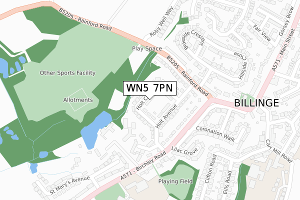
WN5 7PN lies on Holt Crescent in Billinge, Wigan. WN5 7PN is located in the Billinge & Seneley Green electoral ward, within the metropolitan district of St. Helens and the English Parliamentary constituency of St Helens North. The Sub Integrated Care Board (ICB) Location is NHS Cheshire and Merseyside ICB - 01X and the police force is Merseyside. This postcode has been in use since January 1980.
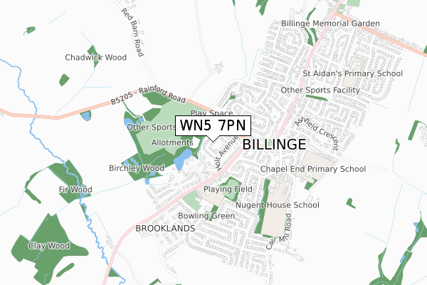
WN5 7PN maps


Licence: Open Government Licence (requires attribution)
Attribution: Contains OS data © Crown copyright and database right 2025
Source: Open Postcode Geo
Licence: Open Government Licence (requires attribution)
Attribution: Contains OS data © Crown copyright and database right 2025; Contains Royal Mail data © Royal Mail copyright and database right 2025; Source: Office for National Statistics licensed under the Open Government Licence v.3.0
WN5 7PN geodata
| Easting | 352574 |
| Northing | 399924 |
| Latitude | 53.493871 |
| Longitude | -2.716324 |
Where is WN5 7PN?
| Street | Holt Crescent |
| Locality | Billinge |
| Town/City | Wigan |
| Country | England |
| Postcode District | WN5 |
WN5 7PN Elevation
Elevation or altitude of WN5 7PN as distance above sea level:
| Metres | Feet | |
|---|---|---|
| Elevation | 80m | 262ft |
Elevation is measured from the approximate centre of the postcode, to the nearest point on an OS contour line from OS Terrain 50, which has contour spacing of ten vertical metres.
➜ How high above sea level am I? Find the elevation of your current position using your device's GPS.
Politics
| Ward | Billinge & Seneley Green |
|---|---|
| Constituency | St Helens North |
Transport
Nearest bus stops to WN5 7PN
| Roby Well Way Hail And Ride (Rainford Road) | Billinge | 145m |
| Braeside Crescent (Rainford Road) | Billinge | 157m |
| Lilac Grove (Birchley Road) | Birchley Road | 164m |
| Holt Avenue (Birchley Road) | Birchley Road | 202m |
| Beulah Avenue (Rainford Road) | Billinge | 246m |
Nearest railway stations to WN5 7PN
| Garswood Station | 3km |
| Orrell Station | 4.1km |
| Upholland Station | 4.2km |
Broadband
Broadband access in WN5 7PN (2020 data)
| Percentage of properties with Next Generation Access | 100.0% |
| Percentage of properties with Superfast Broadband | 100.0% |
| Percentage of properties with Ultrafast Broadband | 100.0% |
| Percentage of properties with Full Fibre Broadband | 0.0% |
Superfast Broadband is between 30Mbps and 300Mbps
Ultrafast Broadband is > 300Mbps
Broadband speed in WN5 7PN (2019 data)
Download
| Median download speed | 78.1Mbps |
| Average download speed | 102.1Mbps |
| Maximum download speed | 350.00Mbps |
Upload
| Median upload speed | 10.0Mbps |
| Average upload speed | 9.4Mbps |
| Maximum upload speed | 20.00Mbps |
Broadband limitations in WN5 7PN (2020 data)
| Percentage of properties unable to receive 2Mbps | 0.0% |
| Percentage of properties unable to receive 5Mbps | 0.0% |
| Percentage of properties unable to receive 10Mbps | 0.0% |
| Percentage of properties unable to receive 30Mbps | 0.0% |
WN5 7PN gas and electricity consumption
Estimated total energy consumption in WN5 7PN by fuel type, 2015.
Gas
| Consumption (kWh) | 630,412 |
|---|---|
| Meter count | 54 |
| Mean (kWh/meter) | 11,674 |
| Median (kWh/meter) | 12,071 |
Electricity
| Consumption (kWh) | 135,089 |
|---|---|
| Meter count | 39 |
| Mean (kWh/meter) | 3,464 |
| Median (kWh/meter) | 2,894 |
- Consumption: The estimated total energy consumption, in kWh, across all meters in WN5 7PN, for 2015.
- Meter count: The total number of meters in WN5 7PN.
- Mean: The mean average consumption per meter, in kWh.
- Median: The median average consumption per meter, in kWh.
Source: Postcode level electricity estimates: 2015 (experimental)
Licence: Open Government Licence
Deprivation
57.3% of English postcodes are less deprived than WN5 7PN:Food Standards Agency
Three nearest food hygiene ratings to WN5 7PN (metres)


➜ Get more ratings from the Food Standards Agency
Nearest post box to WN5 7PN
| Last Collection | |||
|---|---|---|---|
| Location | Mon-Fri | Sat | Distance |
| Broad Lane | 17:00 | 11:00 | 1,538m |
| Clinkham Wood Post Office | 17:00 | 12:00 | 2,135m |
| Pimbo Lane | 17:30 | 08:00 | 2,205m |
WN5 7PN ITL and WN5 7PN LAU
The below table lists the International Territorial Level (ITL) codes (formerly Nomenclature of Territorial Units for Statistics (NUTS) codes) and Local Administrative Units (LAU) codes for WN5 7PN:
| ITL 1 Code | Name |
|---|---|
| TLD | North West (England) |
| ITL 2 Code | Name |
| TLD7 | Merseyside |
| ITL 3 Code | Name |
| TLD71 | East Merseyside |
| LAU 1 Code | Name |
| E08000013 | St. Helens |
WN5 7PN census areas
The below table lists the Census Output Area (OA), Lower Layer Super Output Area (LSOA), and Middle Layer Super Output Area (MSOA) for WN5 7PN:
| Code | Name | |
|---|---|---|
| OA | E00034494 | |
| LSOA | E01006802 | St. Helens 002A |
| MSOA | E02001407 | St. Helens 002 |
Nearest postcodes to WN5 7PN
| WN5 7PW | Holt Avenue | 89m |
| WN5 7PG | Rainford Road | 124m |
| WN5 7QH | Birchley Road | 134m |
| WN5 7QZ | Delph Meadow Gardens | 178m |
| WN5 7QQ | Lilac Grove | 211m |
| WN5 7QJ | Birchley Road | 227m |
| WN5 7PF | Rainford Road | 230m |
| WN5 7PQ | Braeside Crescent | 237m |
| WN5 7QE | Coronation Walk | 247m |
| WN5 7PJ | Hillside Close | 252m |