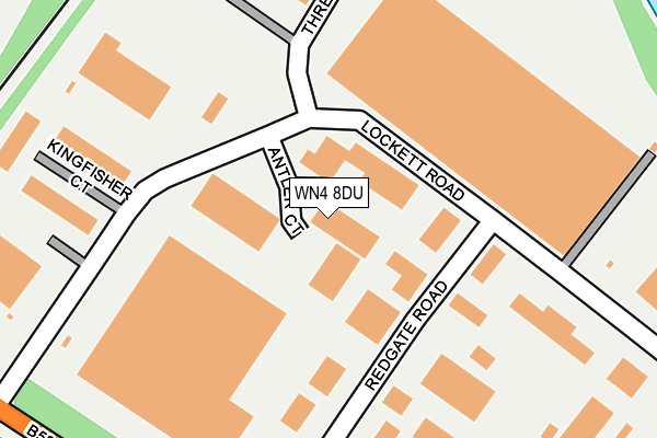
WN4 8DU is located in the Bryn with Ashton-in-Makerfield North electoral ward, within the metropolitan district of Wigan and the English Parliamentary constituency of Makerfield. The Sub Integrated Care Board (ICB) Location is NHS Greater Manchester ICB - 02H and the police force is Greater Manchester. This postcode has been in use since January 1991.


GetTheData
Source: OS OpenMap – Local (Ordnance Survey)
Source: OS VectorMap District (Ordnance Survey)
Licence: Open Government Licence (requires attribution)
| Easting | 357786 |
| Northing | 400778 |
| Latitude | 53.501991 |
| Longitude | -2.637884 |
GetTheData
Source: Open Postcode Geo
Licence: Open Government Licence
| Country | England |
| Postcode District | WN4 |
➜ See where WN4 is on a map ➜ Where is Ashton-in-Makerfield? | |
GetTheData
Source: Land Registry Price Paid Data
Licence: Open Government Licence
Elevation or altitude of WN4 8DU as distance above sea level:
| Metres | Feet | |
|---|---|---|
| Elevation | 60m | 197ft |
Elevation is measured from the approximate centre of the postcode, to the nearest point on an OS contour line from OS Terrain 50, which has contour spacing of ten vertical metres.
➜ How high above sea level am I? Find the elevation of your current position using your device's GPS.
GetTheData
Source: Open Postcode Elevation
Licence: Open Government Licence
| Ward | Bryn With Ashton-in-makerfield North |
| Constituency | Makerfield |
GetTheData
Source: ONS Postcode Database
Licence: Open Government Licence
| Lockett Rd/Antler Court (Lockett Rd) | Bryn | 120m |
| Lockett Rd/Redgate Rd (Lockett Rd) | Bryn | 177m |
| Bryn Rd/Nicol Mere Dr (Bryn Rd) | Bryn | 313m |
| Bryn Rd/Nicol Mere Dr (Bryn Rd) | Bryn | 334m |
| Bryn Rd/Ashton Grange Ind. Est (Bryn Rd) | Bryn | 371m |
| Bryn Station | 0.7km |
| Garswood Station | 2.7km |
| Pemberton Station | 3.8km |
GetTheData
Source: NaPTAN
Licence: Open Government Licence
| Median download speed | 80.0Mbps |
| Average download speed | 63.8Mbps |
| Maximum download speed | 80.00Mbps |
| Median upload speed | 20.0Mbps |
| Average upload speed | 15.3Mbps |
| Maximum upload speed | 20.00Mbps |
GetTheData
Source: Ofcom
Licence: Ofcom Terms of Use (requires attribution)
GetTheData
Source: ONS Postcode Database
Licence: Open Government Licence


➜ Get more ratings from the Food Standards Agency
GetTheData
Source: Food Standards Agency
Licence: FSA terms & conditions
| Last Collection | |||
|---|---|---|---|
| Location | Mon-Fri | Sat | Distance |
| Ashland Avenue | 18:00 | 11:20 | 884m |
| Ashton P O | 19:00 | 12:00 | 1,539m |
| Ashton P O | 19:00 | 12:00 | 1,566m |
GetTheData
Source: Dracos
Licence: Creative Commons Attribution-ShareAlike
The below table lists the International Territorial Level (ITL) codes (formerly Nomenclature of Territorial Units for Statistics (NUTS) codes) and Local Administrative Units (LAU) codes for WN4 8DU:
| ITL 1 Code | Name |
|---|---|
| TLD | North West (England) |
| ITL 2 Code | Name |
| TLD3 | Greater Manchester |
| ITL 3 Code | Name |
| TLD36 | Greater Manchester North West |
| LAU 1 Code | Name |
| E08000010 | Wigan |
GetTheData
Source: ONS Postcode Directory
Licence: Open Government Licence
The below table lists the Census Output Area (OA), Lower Layer Super Output Area (LSOA), and Middle Layer Super Output Area (MSOA) for WN4 8DU:
| Code | Name | |
|---|---|---|
| OA | E00031734 | |
| LSOA | E01006268 | Wigan 032E |
| MSOA | E02001318 | Wigan 032 |
GetTheData
Source: ONS Postcode Directory
Licence: Open Government Licence
| WN4 8BX | Ashton Grange Industrial Estate | 238m |
| WN4 9DW | Kingfisher Court | 253m |
| WN4 8DE | Lockett Road | 309m |
| WN4 8DA | Bryn Road | 348m |
| WN4 8ED | Whitewood Close | 387m |
| WN4 8EE | Highwoods Close | 388m |
| WN4 8BU | Bryn Road | 390m |
| WN4 8EB | Oakenden Close | 413m |
| WN4 8DH | Nicol Mere Drive | 439m |
| WN4 8DQ | Nicol Mere Drive | 467m |
GetTheData
Source: Open Postcode Geo; Land Registry Price Paid Data
Licence: Open Government Licence