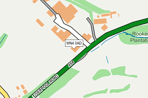
WN4 0AD is located in the Haydock electoral ward, within the metropolitan district of St. Helens and the English Parliamentary constituency of St Helens North. The Sub Integrated Care Board (ICB) Location is NHS Cheshire and Merseyside ICB - 01X and the police force is Merseyside. This postcode has been in use since March 2015.


GetTheData
Source: OS OpenMap – Local (Ordnance Survey)
Source: OS VectorMap District (Ordnance Survey)
Licence: Open Government Licence (requires attribution)
| Easting | 356259 |
| Northing | 398942 |
| Latitude | 53.485365 |
| Longitude | -2.660646 |
GetTheData
Source: Open Postcode Geo
Licence: Open Government Licence
| Country | England |
| Postcode District | WN4 |
➜ See where WN4 is on a map | |
GetTheData
Source: Land Registry Price Paid Data
Licence: Open Government Licence
Elevation or altitude of WN4 0AD as distance above sea level:
| Metres | Feet | |
|---|---|---|
| Elevation | 70m | 230ft |
Elevation is measured from the approximate centre of the postcode, to the nearest point on an OS contour line from OS Terrain 50, which has contour spacing of ten vertical metres.
➜ How high above sea level am I? Find the elevation of your current position using your device's GPS.
GetTheData
Source: Open Postcode Elevation
Licence: Open Government Licence
| Ward | Haydock |
| Constituency | St Helens North |
GetTheData
Source: ONS Postcode Database
Licence: Open Government Licence
| Fishwicks Trading Estate (Liverpool Road) | Garswood | 50m |
| Fishwicks Trading Estate (Liverpool Road) | Garswood | 133m |
| Liverpool Road (Tithebarn Road) | Ashton Cross | 331m |
| Millfield Lane (Tithebarn Road) | Ashton Cross | 342m |
| Liverpool Road (Millfield Lane) | Ashton Cross | 362m |
| Garswood Station | 0.8km |
| Bryn Station | 1.8km |
| Earlestown Station | 4.1km |
GetTheData
Source: NaPTAN
Licence: Open Government Licence
GetTheData
Source: ONS Postcode Database
Licence: Open Government Licence


➜ Get more ratings from the Food Standards Agency
GetTheData
Source: Food Standards Agency
Licence: FSA terms & conditions
| Last Collection | |||
|---|---|---|---|
| Location | Mon-Fri | Sat | Distance |
| Ashton Cross | 16:45 | 11:55 | 390m |
| Kilbuck Lane | 18:15 | 1,251m | |
| North Florida Road | 18:15 | 07:15 | 1,442m |
GetTheData
Source: Dracos
Licence: Creative Commons Attribution-ShareAlike
The below table lists the International Territorial Level (ITL) codes (formerly Nomenclature of Territorial Units for Statistics (NUTS) codes) and Local Administrative Units (LAU) codes for WN4 0AD:
| ITL 1 Code | Name |
|---|---|
| TLD | North West (England) |
| ITL 2 Code | Name |
| TLD7 | Merseyside |
| ITL 3 Code | Name |
| TLD71 | East Merseyside |
| LAU 1 Code | Name |
| E08000013 | St. Helens |
GetTheData
Source: ONS Postcode Directory
Licence: Open Government Licence
The below table lists the Census Output Area (OA), Lower Layer Super Output Area (LSOA), and Middle Layer Super Output Area (MSOA) for WN4 0AD:
| Code | Name | |
|---|---|---|
| OA | E00034520 | |
| LSOA | E01006803 | St. Helens 003A |
| MSOA | E02001408 | St. Helens 003 |
GetTheData
Source: ONS Postcode Directory
Licence: Open Government Licence
| WN4 0YF | Millfield Lane | 450m |
| WN4 0YX | The Fairways | 451m |
| WN4 0YD | Tithebarn Road | 478m |
| WN4 0YT | Liverpool Road | 531m |
| WN4 9NJ | Lazenby Crescent | 680m |
| WN4 9LT | Houghwood Grange | 682m |
| WN4 9NH | Salkeld Avenue | 685m |
| WN4 9NG | Melmerby Close | 714m |
| WN4 0PA | Skitters Grove | 734m |
| WN4 0RX | Strange Road | 748m |
GetTheData
Source: Open Postcode Geo; Land Registry Price Paid Data
Licence: Open Government Licence