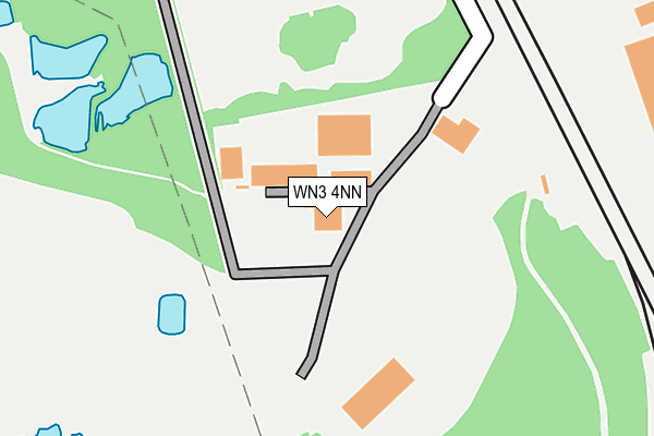
WN3 4NN lies on Cemetery Road in Ince, Wigan. WN3 4NN is located in the Worsley Mesnes electoral ward, within the metropolitan district of Wigan and the English Parliamentary constituency of Makerfield. The Sub Integrated Care Board (ICB) Location is NHS Greater Manchester ICB - 02H and the police force is Greater Manchester. This postcode has been in use since January 1980.


GetTheData
Source: OS OpenMap – Local (Ordnance Survey)
Source: OS VectorMap District (Ordnance Survey)
Licence: Open Government Licence (requires attribution)
| Easting | 359005 |
| Northing | 403674 |
| Latitude | 53.528117 |
| Longitude | -2.619887 |
GetTheData
Source: Open Postcode Geo
Licence: Open Government Licence
| Street | Cemetery Road |
| Locality | Ince |
| Town/City | Wigan |
| Country | England |
| Postcode District | WN3 |
➜ See where WN3 is on a map ➜ Where is Ince-in-Makerfield? | |
GetTheData
Source: Land Registry Price Paid Data
Licence: Open Government Licence
Elevation or altitude of WN3 4NN as distance above sea level:
| Metres | Feet | |
|---|---|---|
| Elevation | 30m | 98ft |
Elevation is measured from the approximate centre of the postcode, to the nearest point on an OS contour line from OS Terrain 50, which has contour spacing of ten vertical metres.
➜ How high above sea level am I? Find the elevation of your current position using your device's GPS.
GetTheData
Source: Open Postcode Elevation
Licence: Open Government Licence
| Ward | Worsley Mesnes |
| Constituency | Makerfield |
GetTheData
Source: ONS Postcode Database
Licence: Open Government Licence
| Warrington Rd/Marlborough Ave (Warrington Rd) | Spring View | 441m |
| Warrington Rd/Marlborough Ave (Warrington Rd) | Spring View | 451m |
| Marlborough Ave/Warrington Rd (Marlborough Ave) | Spring View | 513m |
| Marlborough Ave/Warrington Rd (Marlborough Ave) | Spring View | 516m |
| Warrington Rd/Taylors Ln (Warrington Rd) | Spring View | 541m |
| Ince (Manchester) Station | 1.3km |
| Wigan North Western Station | 1.9km |
| Wigan Wallgate Station | 2.1km |
GetTheData
Source: NaPTAN
Licence: Open Government Licence
GetTheData
Source: ONS Postcode Database
Licence: Open Government Licence


➜ Get more ratings from the Food Standards Agency
GetTheData
Source: Food Standards Agency
Licence: FSA terms & conditions
| Last Collection | |||
|---|---|---|---|
| Location | Mon-Fri | Sat | Distance |
| Woodville Road | 18:15 | 11:05 | 858m |
| Pool Street | 17:50 | 11:25 | 1,387m |
| Hawley P O | 18:30 | 11:50 | 1,511m |
GetTheData
Source: Dracos
Licence: Creative Commons Attribution-ShareAlike
The below table lists the International Territorial Level (ITL) codes (formerly Nomenclature of Territorial Units for Statistics (NUTS) codes) and Local Administrative Units (LAU) codes for WN3 4NN:
| ITL 1 Code | Name |
|---|---|
| TLD | North West (England) |
| ITL 2 Code | Name |
| TLD3 | Greater Manchester |
| ITL 3 Code | Name |
| TLD36 | Greater Manchester North West |
| LAU 1 Code | Name |
| E08000010 | Wigan |
GetTheData
Source: ONS Postcode Directory
Licence: Open Government Licence
The below table lists the Census Output Area (OA), Lower Layer Super Output Area (LSOA), and Middle Layer Super Output Area (MSOA) for WN3 4NN:
| Code | Name | |
|---|---|---|
| OA | E00031969 | |
| LSOA | E01006310 | Wigan 012D |
| MSOA | E02001298 | Wigan 012 |
GetTheData
Source: ONS Postcode Directory
Licence: Open Government Licence
| WN3 4NL | Cemetery Road | 412m |
| WN3 4TS | Cecil Street | 432m |
| WN3 4TR | Spring Street | 436m |
| WN3 4NH | Warrington Road | 445m |
| WN3 4TT | Hope Street | 453m |
| WN3 4UA | Elizabethan Drive | 455m |
| WN3 4TN | Cross Street | 489m |
| WN3 4TY | Arley Street | 514m |
| WN3 4JE | Westbourne Close | 532m |
| WN3 4TQ | Warrington Road | 532m |
GetTheData
Source: Open Postcode Geo; Land Registry Price Paid Data
Licence: Open Government Licence