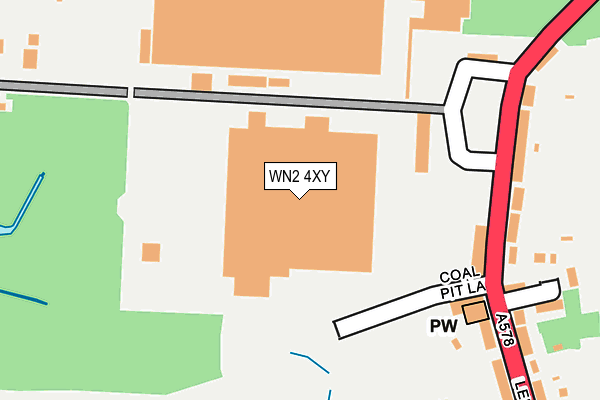
WN2 4XY is located in the Hindley Green electoral ward, within the metropolitan district of Wigan and the English Parliamentary constituency of Makerfield. The Sub Integrated Care Board (ICB) Location is NHS Greater Manchester ICB - 02H and the police force is Greater Manchester. This postcode has been in use since June 1981.


GetTheData
Source: OS OpenMap – Local (Ordnance Survey)
Source: OS VectorMap District (Ordnance Survey)
Licence: Open Government Licence (requires attribution)
| Easting | 363628 |
| Northing | 402314 |
| Latitude | 53.516235 |
| Longitude | -2.549994 |
GetTheData
Source: Open Postcode Geo
Licence: Open Government Licence
| Country | England |
| Postcode District | WN2 |
➜ See where WN2 is on a map ➜ Where is Leigh? | |
GetTheData
Source: Land Registry Price Paid Data
Licence: Open Government Licence
Elevation or altitude of WN2 4XY as distance above sea level:
| Metres | Feet | |
|---|---|---|
| Elevation | 40m | 131ft |
Elevation is measured from the approximate centre of the postcode, to the nearest point on an OS contour line from OS Terrain 50, which has contour spacing of ten vertical metres.
➜ How high above sea level am I? Find the elevation of your current position using your device's GPS.
GetTheData
Source: Open Postcode Elevation
Licence: Open Government Licence
| Ward | Hindley Green |
| Constituency | Makerfield |
GetTheData
Source: ONS Postcode Database
Licence: Open Government Licence
| Leigh Rd/Business Park (Leigh Rd) | Hindley Green | 192m |
| Leigh Rd/Business Park (Leigh Rd) | Hindley Green | 206m |
| Smiths Ln/Leigh Rd (Smiths Ln) | Tamer Lane End | 351m |
| Smiths Ln/Owens Farm (Smiths Ln) | Bickershaw | 373m |
| Leigh Rd/Smiths Ln (Leigh Rd) | Tamer Lane End | 389m |
| Hindley Station | 3.4km |
| Daisy Hill Station | 3.4km |
| Hag Fold Station | 4.1km |
GetTheData
Source: NaPTAN
Licence: Open Government Licence
GetTheData
Source: ONS Postcode Database
Licence: Open Government Licence


➜ Get more ratings from the Food Standards Agency
GetTheData
Source: Food Standards Agency
Licence: FSA terms & conditions
| Last Collection | |||
|---|---|---|---|
| Location | Mon-Fri | Sat | Distance |
| Howe Bridge | 17:30 | 11:30 | 1,110m |
| Platt Bridge P O | 18:45 | 12:05 | 1,275m |
| Hindley Green P O | 18:30 | 11:55 | 2,441m |
GetTheData
Source: Dracos
Licence: Creative Commons Attribution-ShareAlike
The below table lists the International Territorial Level (ITL) codes (formerly Nomenclature of Territorial Units for Statistics (NUTS) codes) and Local Administrative Units (LAU) codes for WN2 4XY:
| ITL 1 Code | Name |
|---|---|
| TLD | North West (England) |
| ITL 2 Code | Name |
| TLD3 | Greater Manchester |
| ITL 3 Code | Name |
| TLD36 | Greater Manchester North West |
| LAU 1 Code | Name |
| E08000010 | Wigan |
GetTheData
Source: ONS Postcode Directory
Licence: Open Government Licence
The below table lists the Census Output Area (OA), Lower Layer Super Output Area (LSOA), and Middle Layer Super Output Area (MSOA) for WN2 4XY:
| Code | Name | |
|---|---|---|
| OA | E00032056 | |
| LSOA | E01006322 | Wigan 026D |
| MSOA | E02001312 | Wigan 026 |
GetTheData
Source: ONS Postcode Directory
Licence: Open Government Licence
| WN2 4XG | Leigh Road | 217m |
| WN2 4XW | Leigh Road | 265m |
| WN2 4XT | Slackey Fold | 277m |
| WN2 4XR | Smiths Lane | 352m |
| WN2 4XS | Smiths Lane | 356m |
| WN2 4GQ | Meadow Field | 444m |
| WN2 4XL | Leigh Road | 451m |
| WN2 4LL | Longacre | 476m |
| WN2 4XN | Boydells Houses | 495m |
| WN2 4AG | Belmont Avenue | 512m |
GetTheData
Source: Open Postcode Geo; Land Registry Price Paid Data
Licence: Open Government Licence