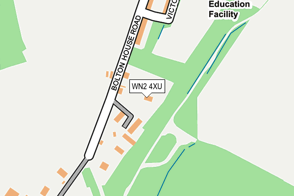
WN2 4XU is located in the Abram electoral ward, within the metropolitan district of Wigan and the English Parliamentary constituency of Makerfield. The Sub Integrated Care Board (ICB) Location is NHS Greater Manchester ICB - 02H and the police force is Greater Manchester. This postcode has been in use since September 1991.


GetTheData
Source: OS OpenMap – Local (Ordnance Survey)
Source: OS VectorMap District (Ordnance Survey)
Licence: Open Government Licence (requires attribution)
| Easting | 362862 |
| Northing | 401561 |
| Latitude | 53.509413 |
| Longitude | -2.561456 |
GetTheData
Source: Open Postcode Geo
Licence: Open Government Licence
| Country | England |
| Postcode District | WN2 |
➜ See where WN2 is on a map ➜ Where is Bickershaw? | |
GetTheData
Source: Land Registry Price Paid Data
Licence: Open Government Licence
Elevation or altitude of WN2 4XU as distance above sea level:
| Metres | Feet | |
|---|---|---|
| Elevation | 40m | 131ft |
Elevation is measured from the approximate centre of the postcode, to the nearest point on an OS contour line from OS Terrain 50, which has contour spacing of ten vertical metres.
➜ How high above sea level am I? Find the elevation of your current position using your device's GPS.
GetTheData
Source: Open Postcode Elevation
Licence: Open Government Licence
| Ward | Abram |
| Constituency | Makerfield |
GetTheData
Source: ONS Postcode Database
Licence: Open Government Licence
| Bickershaw Ln/Bolton House Rd (Bickershaw Ln) | Bickershaw | 312m |
| Bickershaw Ln/Bolton House Rd (Bickershaw Ln) | Bickershaw | 322m |
| Beacon Road (Nw Bound) (Beacon Road) | Bickershaw | 496m |
| Beacon Road Estate (North Bound) (Church Avenue) | Bickershaw | 500m |
| Bickershaw Ln/Beacon Rd (Bickershaw Ln) | Bickershaw | 518m |
| Hindley Station | 3.8km |
| Daisy Hill Station | 4.5km |
| Ince (Manchester) Station | 4.7km |
GetTheData
Source: NaPTAN
Licence: Open Government Licence
GetTheData
Source: ONS Postcode Database
Licence: Open Government Licence


➜ Get more ratings from the Food Standards Agency
GetTheData
Source: Food Standards Agency
Licence: FSA terms & conditions
| Last Collection | |||
|---|---|---|---|
| Location | Mon-Fri | Sat | Distance |
| Howe Bridge | 17:30 | 11:30 | 1,855m |
| Platt Bridge P O | 18:45 | 12:05 | 2,205m |
| Garton Drive | 17:00 | 11:00 | 2,382m |
GetTheData
Source: Dracos
Licence: Creative Commons Attribution-ShareAlike
The below table lists the International Territorial Level (ITL) codes (formerly Nomenclature of Territorial Units for Statistics (NUTS) codes) and Local Administrative Units (LAU) codes for WN2 4XU:
| ITL 1 Code | Name |
|---|---|
| TLD | North West (England) |
| ITL 2 Code | Name |
| TLD3 | Greater Manchester |
| ITL 3 Code | Name |
| TLD36 | Greater Manchester North West |
| LAU 1 Code | Name |
| E08000010 | Wigan |
GetTheData
Source: ONS Postcode Directory
Licence: Open Government Licence
The below table lists the Census Output Area (OA), Lower Layer Super Output Area (LSOA), and Middle Layer Super Output Area (MSOA) for WN2 4XU:
| Code | Name | |
|---|---|---|
| OA | E00032053 | |
| LSOA | E01006327 | Wigan 033E |
| MSOA | E02001319 | Wigan 033 |
GetTheData
Source: ONS Postcode Directory
Licence: Open Government Licence
| WN2 4AB | Bolton House Road | 198m |
| WN2 4AD | Victoria Terrace | 206m |
| WN2 4AP | Marnock Close | 262m |
| WN2 4AA | Bickershaw Lane | 336m |
| WN2 4AE | Bickershaw Lane | 369m |
| WN2 4AN | Shortland Place | 429m |
| WN2 4AL | Rivington Drive | 450m |
| WN2 4AH | Church Avenue | 453m |
| WN2 4AJ | St James Crescent | 497m |
| WN2 4AF | Beacon Road | 498m |
GetTheData
Source: Open Postcode Geo; Land Registry Price Paid Data
Licence: Open Government Licence