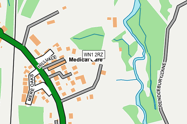
WN1 2RZ lies on Thornhill in Standish, Wigan. WN1 2RZ is located in the Wigan Central electoral ward, within the metropolitan district of Wigan and the English Parliamentary constituency of Wigan. The Sub Integrated Care Board (ICB) Location is NHS Greater Manchester ICB - 02H and the police force is Greater Manchester. This postcode has been in use since March 2008.


GetTheData
Source: OS OpenMap – Local (Ordnance Survey)
Source: OS VectorMap District (Ordnance Survey)
Licence: Open Government Licence (requires attribution)
| Easting | 357981 |
| Northing | 408556 |
| Latitude | 53.571914 |
| Longitude | -2.635991 |
GetTheData
Source: Open Postcode Geo
Licence: Open Government Licence
| Street | Thornhill |
| Locality | Standish |
| Town/City | Wigan |
| Country | England |
| Postcode District | WN1 |
➜ See where WN1 is on a map ➜ Where is Standish? | |
GetTheData
Source: Land Registry Price Paid Data
Licence: Open Government Licence
Elevation or altitude of WN1 2RZ as distance above sea level:
| Metres | Feet | |
|---|---|---|
| Elevation | 60m | 197ft |
Elevation is measured from the approximate centre of the postcode, to the nearest point on an OS contour line from OS Terrain 50, which has contour spacing of ten vertical metres.
➜ How high above sea level am I? Find the elevation of your current position using your device's GPS.
GetTheData
Source: Open Postcode Elevation
Licence: Open Government Licence
| Ward | Wigan Central |
| Constituency | Wigan |
GetTheData
Source: ONS Postcode Database
Licence: Open Government Licence
LARCHES FARM, THORNHILL, STANDISH, WIGAN, WN1 2RZ 2022 30 NOV £670,000 |
2016 19 AUG £545,000 |
2004 18 AUG £499,000 |
SUNNY BANK, THORNHILL, STANDISH, WIGAN, WN1 2RZ 1995 20 OCT £140,000 |
GetTheData
Source: HM Land Registry Price Paid Data
Licence: Contains HM Land Registry data © Crown copyright and database right 2025. This data is licensed under the Open Government Licence v3.0.
| Wigan Rd/Mere Oaks (Wigan Rd) | Standish | 162m |
| Wigan Rd/Mere Oaks (Wigan Rd) | Standish | 168m |
| Wigan Ln/Reservoir (Wigan Ln) | Standish | 266m |
| Wigan Ln/Reservoir (Wigan Ln) | Standish | 269m |
| Chorley Rd/Wigan Rd (Chorley Rd) | Boars Head | 341m |
| Wigan Wallgate Station | 3km |
| Wigan North Western Station | 3.1km |
| Ince (Manchester) Station | 4km |
GetTheData
Source: NaPTAN
Licence: Open Government Licence
| Percentage of properties with Next Generation Access | 100.0% |
| Percentage of properties with Superfast Broadband | 40.0% |
| Percentage of properties with Ultrafast Broadband | 0.0% |
| Percentage of properties with Full Fibre Broadband | 0.0% |
Superfast Broadband is between 30Mbps and 300Mbps
Ultrafast Broadband is > 300Mbps
| Percentage of properties unable to receive 2Mbps | 0.0% |
| Percentage of properties unable to receive 5Mbps | 0.0% |
| Percentage of properties unable to receive 10Mbps | 0.0% |
| Percentage of properties unable to receive 30Mbps | 60.0% |
GetTheData
Source: Ofcom
Licence: Ofcom Terms of Use (requires attribution)
GetTheData
Source: ONS Postcode Database
Licence: Open Government Licence


➜ Get more ratings from the Food Standards Agency
GetTheData
Source: Food Standards Agency
Licence: FSA terms & conditions
| Last Collection | |||
|---|---|---|---|
| Location | Mon-Fri | Sat | Distance |
| Elmfield Road | 18:20 | 11:10 | 366m |
| St Clements Road | 18:20 | 11:10 | 989m |
| Chauner Place | 18:20 | 11:05 | 1,317m |
GetTheData
Source: Dracos
Licence: Creative Commons Attribution-ShareAlike
The below table lists the International Territorial Level (ITL) codes (formerly Nomenclature of Territorial Units for Statistics (NUTS) codes) and Local Administrative Units (LAU) codes for WN1 2RZ:
| ITL 1 Code | Name |
|---|---|
| TLD | North West (England) |
| ITL 2 Code | Name |
| TLD3 | Greater Manchester |
| ITL 3 Code | Name |
| TLD36 | Greater Manchester North West |
| LAU 1 Code | Name |
| E08000010 | Wigan |
GetTheData
Source: ONS Postcode Directory
Licence: Open Government Licence
The below table lists the Census Output Area (OA), Lower Layer Super Output Area (LSOA), and Middle Layer Super Output Area (MSOA) for WN1 2RZ:
| Code | Name | |
|---|---|---|
| OA | E00032315 | |
| LSOA | E01006372 | Wigan 006B |
| MSOA | E02001292 | Wigan 006 |
GetTheData
Source: ONS Postcode Directory
Licence: Open Government Licence
| WN1 2RQ | Thorn Hill Gardens | 95m |
| WN1 2SP | Hillvale | 123m |
| WN1 2RF | Wigan Road | 140m |
| WN1 2NG | Douglas View | 149m |
| WN1 2SL | Mere Oaks | 232m |
| WN1 2RE | Wigan Lane | 267m |
| WN1 2RB | Wigan Lane | 314m |
| WN6 0AA | Chorley Road | 377m |
| WN1 2SD | Woodlands Park Close | 385m |
| WN1 2RG | Elmfield Road | 390m |
GetTheData
Source: Open Postcode Geo; Land Registry Price Paid Data
Licence: Open Government Licence