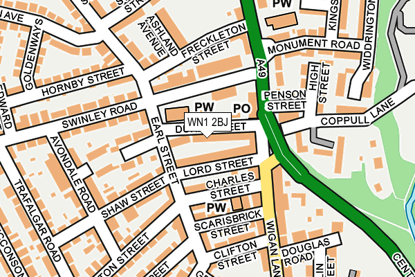
WN1 2BJ lies on Duke Street in Swinley, Wigan. WN1 2BJ is located in the Wigan Central electoral ward, within the metropolitan district of Wigan and the English Parliamentary constituency of Wigan. The Sub Integrated Care Board (ICB) Location is NHS Greater Manchester ICB - 02H and the police force is Greater Manchester. This postcode has been in use since January 1980.


GetTheData
Source: OS OpenMap – Local (Ordnance Survey)
Source: OS VectorMap District (Ordnance Survey)
Licence: Open Government Licence (requires attribution)
| Easting | 358420 |
| Northing | 406524 |
| Latitude | 53.553686 |
| Longitude | -2.629091 |
GetTheData
Source: Open Postcode Geo
Licence: Open Government Licence
| Street | Duke Street |
| Locality | Swinley |
| Town/City | Wigan |
| Country | England |
| Postcode District | WN1 |
➜ See where WN1 is on a map ➜ Where is Wigan? | |
GetTheData
Source: Land Registry Price Paid Data
Licence: Open Government Licence
Elevation or altitude of WN1 2BJ as distance above sea level:
| Metres | Feet | |
|---|---|---|
| Elevation | 50m | 164ft |
Elevation is measured from the approximate centre of the postcode, to the nearest point on an OS contour line from OS Terrain 50, which has contour spacing of ten vertical metres.
➜ How high above sea level am I? Find the elevation of your current position using your device's GPS.
GetTheData
Source: Open Postcode Elevation
Licence: Open Government Licence
| Ward | Wigan Central |
| Constituency | Wigan |
GetTheData
Source: ONS Postcode Database
Licence: Open Government Licence
ST. MICHAELS VICARAGE, DUKE STREET, SWINLEY, WIGAN, WN1 2BJ 2010 3 NOV £240,000 |
GetTheData
Source: HM Land Registry Price Paid Data
Licence: Contains HM Land Registry data © Crown copyright and database right 2025. This data is licensed under the Open Government Licence v3.0.
| Wigan Ln/Scarisbrick St (Wigan Ln) | Wigan | 143m |
| Wigan Ln/Swinley Rd (Wigan Ln) | Wigan Infirmary | 149m |
| Wigan Ln/Swinley Rd (Wigan Ln) | Wigan Infirmary | 181m |
| Wigan Ln/Clifton Cres (Wigan Ln) | Wigan Infirmary | 265m |
| Wigan Ln/Infirmary (Wigan Ln) | Wigan Infirmary | 351m |
| Wigan Wallgate Station | 1km |
| Wigan North Western Station | 1.1km |
| Ince (Manchester) Station | 2km |
GetTheData
Source: NaPTAN
Licence: Open Government Licence
| Percentage of properties with Next Generation Access | 100.0% |
| Percentage of properties with Superfast Broadband | 100.0% |
| Percentage of properties with Ultrafast Broadband | 100.0% |
| Percentage of properties with Full Fibre Broadband | 0.0% |
Superfast Broadband is between 30Mbps and 300Mbps
Ultrafast Broadband is > 300Mbps
| Median download speed | 64.3Mbps |
| Average download speed | 70.2Mbps |
| Maximum download speed | 200.00Mbps |
| Median upload speed | 1.2Mbps |
| Average upload speed | 7.7Mbps |
| Maximum upload speed | 20.00Mbps |
| Percentage of properties unable to receive 2Mbps | 0.0% |
| Percentage of properties unable to receive 5Mbps | 0.0% |
| Percentage of properties unable to receive 10Mbps | 0.0% |
| Percentage of properties unable to receive 30Mbps | 0.0% |
GetTheData
Source: Ofcom
Licence: Ofcom Terms of Use (requires attribution)
Estimated total energy consumption in WN1 2BJ by fuel type, 2015.
| Consumption (kWh) | 210,660 |
|---|---|
| Meter count | 22 |
| Mean (kWh/meter) | 9,575 |
| Median (kWh/meter) | 9,879 |
| Consumption (kWh) | 56,348 |
|---|---|
| Meter count | 20 |
| Mean (kWh/meter) | 2,817 |
| Median (kWh/meter) | 2,356 |
GetTheData
Source: Postcode level gas estimates: 2015 (experimental)
Source: Postcode level electricity estimates: 2015 (experimental)
Licence: Open Government Licence
GetTheData
Source: ONS Postcode Database
Licence: Open Government Licence


➜ Get more ratings from the Food Standards Agency
GetTheData
Source: Food Standards Agency
Licence: FSA terms & conditions
| Last Collection | |||
|---|---|---|---|
| Location | Mon-Fri | Sat | Distance |
| Wrightington Street | 19:05 | 12:10 | 406m |
| Wrightington Street Bus Box | 412m | ||
| Mesnes Road P O | 19:00 | 12:00 | 472m |
GetTheData
Source: Dracos
Licence: Creative Commons Attribution-ShareAlike
The below table lists the International Territorial Level (ITL) codes (formerly Nomenclature of Territorial Units for Statistics (NUTS) codes) and Local Administrative Units (LAU) codes for WN1 2BJ:
| ITL 1 Code | Name |
|---|---|
| TLD | North West (England) |
| ITL 2 Code | Name |
| TLD3 | Greater Manchester |
| ITL 3 Code | Name |
| TLD36 | Greater Manchester North West |
| LAU 1 Code | Name |
| E08000010 | Wigan |
GetTheData
Source: ONS Postcode Directory
Licence: Open Government Licence
The below table lists the Census Output Area (OA), Lower Layer Super Output Area (LSOA), and Middle Layer Super Output Area (MSOA) for WN1 2BJ:
| Code | Name | |
|---|---|---|
| OA | E00032304 | |
| LSOA | E01006375 | Wigan 008E |
| MSOA | E02001294 | Wigan 008 |
GetTheData
Source: ONS Postcode Directory
Licence: Open Government Licence
| WN1 2BN | Lord Street | 29m |
| WN1 2LF | Wigan Lane | 71m |
| WN1 1JP | Wigan Lane | 79m |
| WN1 2BH | Earl Street | 86m |
| WN1 2BP | Charles Street | 91m |
| WN1 2DN | Swinley Road | 93m |
| WN1 2BS | Scarisbrick Street | 109m |
| WN1 2BY | St Michaels Court | 114m |
| WN1 1XS | Wigan Lane | 114m |
| WN1 2DW | Freckleton Street | 119m |
GetTheData
Source: Open Postcode Geo; Land Registry Price Paid Data
Licence: Open Government Licence