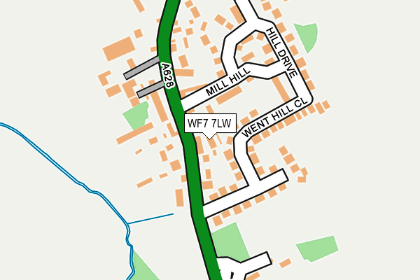
WF7 7LW lies on Halls Court in Ackworth, Pontefract. WF7 7LW is located in the Ackworth, North Elmsall and Upton electoral ward, within the metropolitan district of Wakefield and the English Parliamentary constituency of Hemsworth. The Sub Integrated Care Board (ICB) Location is NHS West Yorkshire ICB - 03R and the police force is West Yorkshire. This postcode has been in use since January 1980.


GetTheData
Source: OS OpenMap – Local (Ordnance Survey)
Source: OS VectorMap District (Ordnance Survey)
Licence: Open Government Licence (requires attribution)
| Easting | 444084 |
| Northing | 417709 |
| Latitude | 53.654027 |
| Longitude | -1.334479 |
GetTheData
Source: Open Postcode Geo
Licence: Open Government Licence
| Street | Halls Court |
| Locality | Ackworth |
| Town/City | Pontefract |
| Country | England |
| Postcode District | WF7 |
➜ See where WF7 is on a map ➜ Where is High Ackworth? | |
GetTheData
Source: Land Registry Price Paid Data
Licence: Open Government Licence
Elevation or altitude of WF7 7LW as distance above sea level:
| Metres | Feet | |
|---|---|---|
| Elevation | 40m | 131ft |
Elevation is measured from the approximate centre of the postcode, to the nearest point on an OS contour line from OS Terrain 50, which has contour spacing of ten vertical metres.
➜ How high above sea level am I? Find the elevation of your current position using your device's GPS.
GetTheData
Source: Open Postcode Elevation
Licence: Open Government Licence
| Ward | Ackworth, North Elmsall And Upton |
| Constituency | Hemsworth |
GetTheData
Source: ONS Postcode Database
Licence: Open Government Licence
| Pontefract Road Mill Hill (Pontefract Road) | High Ackworth | 54m |
| Pontefract Road Mill Hill (Pontefract Road) | High Ackworth | 75m |
| Brown Cow Pub (Pontefract Road) | High Ackworth | 259m |
| Brown Cow Pub (Purston Lane) | High Ackworth | 274m |
| Purston Lane Pontefract Rd (Purston Lane) | High Ackworth | 284m |
| Featherstone Station | 3.2km |
| Fitzwilliam Station | 3.6km |
| Pontefract Tanshelf Station | 4.6km |
GetTheData
Source: NaPTAN
Licence: Open Government Licence
| Percentage of properties with Next Generation Access | 100.0% |
| Percentage of properties with Superfast Broadband | 100.0% |
| Percentage of properties with Ultrafast Broadband | 0.0% |
| Percentage of properties with Full Fibre Broadband | 0.0% |
Superfast Broadband is between 30Mbps and 300Mbps
Ultrafast Broadband is > 300Mbps
| Percentage of properties unable to receive 2Mbps | 0.0% |
| Percentage of properties unable to receive 5Mbps | 0.0% |
| Percentage of properties unable to receive 10Mbps | 0.0% |
| Percentage of properties unable to receive 30Mbps | 0.0% |
GetTheData
Source: Ofcom
Licence: Ofcom Terms of Use (requires attribution)
GetTheData
Source: ONS Postcode Database
Licence: Open Government Licence


➜ Get more ratings from the Food Standards Agency
GetTheData
Source: Food Standards Agency
Licence: FSA terms & conditions
| Last Collection | |||
|---|---|---|---|
| Location | Mon-Fri | Sat | Distance |
| Ackworth P.o. | 17:00 | 11:15 | 281m |
| High Ackworth | 16:00 | 11:00 | 466m |
| Obelisk / Station Road | 16:00 | 11:00 | 515m |
GetTheData
Source: Dracos
Licence: Creative Commons Attribution-ShareAlike
The below table lists the International Territorial Level (ITL) codes (formerly Nomenclature of Territorial Units for Statistics (NUTS) codes) and Local Administrative Units (LAU) codes for WF7 7LW:
| ITL 1 Code | Name |
|---|---|
| TLE | Yorkshire and The Humber |
| ITL 2 Code | Name |
| TLE4 | West Yorkshire |
| ITL 3 Code | Name |
| TLE45 | Wakefield |
| LAU 1 Code | Name |
| E08000036 | Wakefield |
GetTheData
Source: ONS Postcode Directory
Licence: Open Government Licence
The below table lists the Census Output Area (OA), Lower Layer Super Output Area (LSOA), and Middle Layer Super Output Area (MSOA) for WF7 7LW:
| Code | Name | |
|---|---|---|
| OA | E00059343 | |
| LSOA | E01011767 | Wakefield 034A |
| MSOA | E02002471 | Wakefield 034 |
GetTheData
Source: ONS Postcode Directory
Licence: Open Government Licence
| WF7 7LL | Pontefract Road | 19m |
| WF7 7LN | Pontefract Road | 59m |
| WF7 7LP | Wenthill Close | 67m |
| WF7 7LG | Mill Hill | 73m |
| WF7 7QZ | Greystone Mews | 79m |
| WF7 7FD | Lamprey Gardens | 106m |
| WF7 7LH | Jubilee Terrace | 125m |
| WF7 7LJ | Mill Hill | 134m |
| WF7 7LQ | Hill Drive | 165m |
| WF7 7EF | Pontefract Road | 173m |
GetTheData
Source: Open Postcode Geo; Land Registry Price Paid Data
Licence: Open Government Licence