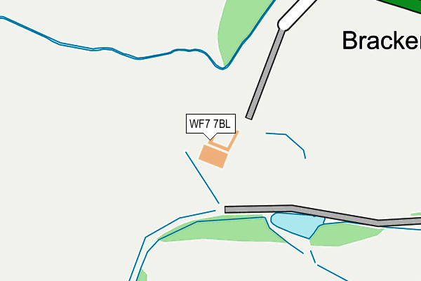
WF7 7BL is located in the Hemsworth electoral ward, within the metropolitan district of Wakefield and the English Parliamentary constituency of Hemsworth. The Sub Integrated Care Board (ICB) Location is NHS West Yorkshire ICB - 03R and the police force is West Yorkshire. This postcode has been in use since January 1980.


GetTheData
Source: OS OpenMap – Local (Ordnance Survey)
Source: OS VectorMap District (Ordnance Survey)
Licence: Open Government Licence (requires attribution)
| Easting | 442362 |
| Northing | 416207 |
| Latitude | 53.640670 |
| Longitude | -1.360736 |
GetTheData
Source: Open Postcode Geo
Licence: Open Government Licence
| Country | England |
| Postcode District | WF7 |
➜ See where WF7 is on a map ➜ Where is Ackworth Moor Top? | |
GetTheData
Source: Land Registry Price Paid Data
Licence: Open Government Licence
Elevation or altitude of WF7 7BL as distance above sea level:
| Metres | Feet | |
|---|---|---|
| Elevation | 40m | 131ft |
Elevation is measured from the approximate centre of the postcode, to the nearest point on an OS contour line from OS Terrain 50, which has contour spacing of ten vertical metres.
➜ How high above sea level am I? Find the elevation of your current position using your device's GPS.
GetTheData
Source: Open Postcode Elevation
Licence: Open Government Licence
| Ward | Hemsworth |
| Constituency | Hemsworth |
GetTheData
Source: ONS Postcode Database
Licence: Open Government Licence
| Wakefield Rd Garden Street (Wakefield Road) | Ackworth Moor Top | 336m |
| Wakefield Rd Garden Street (Wakefield Road) | Ackworth Moor Top | 347m |
| Doncaster Rd King Royd Lane (Doncaster Road) | Ackworth Moor Top | 398m |
| Wakefield Road Dicky Sykes Ln (Wakefield Road) | Ackworth Moor Top | 456m |
| Doncaster Rd King Royd Lane (Doncaster Road) | Ackworth Moor Top | 457m |
| Fitzwilliam Station | 1.3km |
| Featherstone Station | 4.3km |
| Streethouse Station | 4.7km |
GetTheData
Source: NaPTAN
Licence: Open Government Licence
GetTheData
Source: ONS Postcode Database
Licence: Open Government Licence


➜ Get more ratings from the Food Standards Agency
GetTheData
Source: Food Standards Agency
Licence: FSA terms & conditions
| Last Collection | |||
|---|---|---|---|
| Location | Mon-Fri | Sat | Distance |
| Brackenhill Edge | 16:00 | 11:15 | 607m |
| Brackenhill P.o. | 16:30 | 11:15 | 911m |
| Fitzwilliam P.o. | 17:30 | 11:45 | 1,317m |
GetTheData
Source: Dracos
Licence: Creative Commons Attribution-ShareAlike
The below table lists the International Territorial Level (ITL) codes (formerly Nomenclature of Territorial Units for Statistics (NUTS) codes) and Local Administrative Units (LAU) codes for WF7 7BL:
| ITL 1 Code | Name |
|---|---|
| TLE | Yorkshire and The Humber |
| ITL 2 Code | Name |
| TLE4 | West Yorkshire |
| ITL 3 Code | Name |
| TLE45 | Wakefield |
| LAU 1 Code | Name |
| E08000036 | Wakefield |
GetTheData
Source: ONS Postcode Directory
Licence: Open Government Licence
The below table lists the Census Output Area (OA), Lower Layer Super Output Area (LSOA), and Middle Layer Super Output Area (MSOA) for WF7 7BL:
| Code | Name | |
|---|---|---|
| OA | E00059457 | |
| LSOA | E01011785 | Wakefield 039A |
| MSOA | E02002476 | Wakefield 039 |
GetTheData
Source: ONS Postcode Directory
Licence: Open Government Licence
| WF7 7BQ | Wakefield Road | 307m |
| WF7 7BD | Wakefield Road | 369m |
| WF7 7AR | Oddfellows Club Houses | 375m |
| WF7 7DR | Hawthorne Rise | 384m |
| WF7 7AP | Francis Street | 391m |
| WF7 7BG | Bracken Hill | 392m |
| WF7 7AW | Francis Terrace | 399m |
| WF7 7AU | Dicky Sykes Lane | 420m |
| WF7 7AY | Wakefield Road | 422m |
| WF7 7AT | Leigh Street | 424m |
GetTheData
Source: Open Postcode Geo; Land Registry Price Paid Data
Licence: Open Government Licence