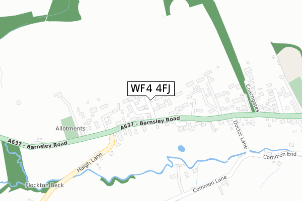
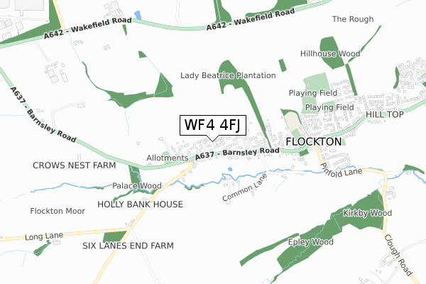
WF4 4FJ is located in the Kirkburton electoral ward, within the metropolitan district of Kirklees and the English Parliamentary constituency of Dewsbury. The Sub Integrated Care Board (ICB) Location is NHS West Yorkshire ICB - X2C4Y and the police force is West Yorkshire. This postcode has been in use since March 2019.


GetTheData
Source: OS Open Zoomstack (Ordnance Survey)
Licence: Open Government Licence (requires attribution)
Attribution: Contains OS data © Crown copyright and database right 2024
Source: Open Postcode Geo
Licence: Open Government Licence (requires attribution)
Attribution: Contains OS data © Crown copyright and database right 2024; Contains Royal Mail data © Royal Mail copyright and database right 2024; Source: Office for National Statistics licensed under the Open Government Licence v.3.0
| Easting | 423513 |
| Northing | 414944 |
| Latitude | 53.630516 |
| Longitude | -1.645923 |
GetTheData
Source: Open Postcode Geo
Licence: Open Government Licence
| Country | England |
| Postcode District | WF4 |
| ➜ WF4 open data dashboard ➜ See where WF4 is on a map ➜ Where is Flockton? | |
GetTheData
Source: Land Registry Price Paid Data
Licence: Open Government Licence
| Ward | Kirkburton |
| Constituency | Dewsbury |
GetTheData
Source: ONS Postcode Database
Licence: Open Government Licence
2021 30 SEP £305,000 |
4, HERDWICK ROAD, FLOCKTON, WAKEFIELD, WF4 4FJ 2021 18 JUN £399,950 |
2, HERDWICK ROAD, FLOCKTON, WAKEFIELD, WF4 4FJ 2021 7 JUN £349,950 |
6, HERDWICK ROAD, FLOCKTON, WAKEFIELD, WF4 4FJ 2021 26 FEB £354,950 |
10, HERDWICK ROAD, FLOCKTON, WAKEFIELD, WF4 4FJ 2021 23 FEB £389,950 |
8, HERDWICK ROAD, FLOCKTON, WAKEFIELD, WF4 4FJ 2020 18 DEC £454,950 |
6A, HERDWICK ROAD, FLOCKTON, WAKEFIELD, WF4 4FJ 2020 27 NOV £344,950 |
3, HERDWICK ROAD, FLOCKTON, WAKEFIELD, WF4 4FJ 2020 25 SEP £339,950 |
11, HERDWICK ROAD, FLOCKTON, WAKEFIELD, WF4 4FJ 2020 25 SEP £339,950 |
17, HERDWICK ROAD, FLOCKTON, WAKEFIELD, WF4 4FJ 2020 25 SEP £339,950 |
GetTheData
Source: HM Land Registry Price Paid Data
Licence: Contains HM Land Registry data © Crown copyright and database right 2024. This data is licensed under the Open Government Licence v3.0.
| June 2022 | Public order | On or near Coachgates | 318m |
| June 2022 | Violence and sexual offences | On or near Haigh Lane | 451m |
| May 2022 | Violence and sexual offences | On or near Providential Street | 403m |
| ➜ Get more crime data in our Crime section | |||
GetTheData
Source: data.police.uk
Licence: Open Government Licence
| Barnsley Road Haigh Ln (Barnsley Road) | Flockton | 161m |
| Barnsley Road Haigh Ln (Barnsley Road) | Flockton | 171m |
| Barnsley Road Doctor Ln (Barnsley Road) | Flockton | 210m |
| Barnsley Road Doctor Ln (Barnsley Road) | Flockton | 214m |
| Barnsley Road Providential St (Barnsley Road) | Flockton | 405m |
| Mirfield Station | 5.5km |
| Shepley Station | 6.1km |
GetTheData
Source: NaPTAN
Licence: Open Government Licence
| Percentage of properties with Next Generation Access | 100.0% |
| Percentage of properties with Superfast Broadband | 100.0% |
| Percentage of properties with Ultrafast Broadband | 0.0% |
| Percentage of properties with Full Fibre Broadband | 0.0% |
Superfast Broadband is between 30Mbps and 300Mbps
Ultrafast Broadband is > 300Mbps
| Percentage of properties unable to receive 2Mbps | 0.0% |
| Percentage of properties unable to receive 5Mbps | 0.0% |
| Percentage of properties unable to receive 10Mbps | 0.0% |
| Percentage of properties unable to receive 30Mbps | 0.0% |
GetTheData
Source: Ofcom
Licence: Ofcom Terms of Use (requires attribution)
GetTheData
Source: ONS Postcode Database
Licence: Open Government Licence


➜ Get more ratings from the Food Standards Agency
GetTheData
Source: Food Standards Agency
Licence: FSA terms & conditions
| Last Collection | |||
|---|---|---|---|
| Location | Mon-Fri | Sat | Distance |
| Main Street | 16:45 | 11:00 | 254m |
| Flockton P.o. | 17:00 | 11:15 | 683m |
| Flockton Green | 16:45 | 11:00 | 1,460m |
GetTheData
Source: Dracos
Licence: Creative Commons Attribution-ShareAlike
| Facility | Distance |
|---|---|
| Hill Top Park Side, Flockton, Wakefield Grass Pitches | 639m |
| Flockton Cricket Club Park Side, Flockton, Wakefield Grass Pitches | 639m |
| Grange Moor Football Ground Liley Lane, Grange Moor, Huddersfield Grass Pitches | 1.7km |
GetTheData
Source: Active Places
Licence: Open Government Licence
| School | Phase of Education | Distance |
|---|---|---|
| Flockton CofE (C) First School Flockton First School, Barnsley Road, Flockton, Wakefield, WF4 4DH | Primary | 535m |
| Grange Moor Primary School Liley Lane, Grange Moor, Wakefield, WF4 4EW | Primary | 1.8km |
| Emley First School School Lane, Emley, Huddersfield, HD8 9RT | Primary | 2km |
GetTheData
Source: Edubase
Licence: Open Government Licence
The below table lists the International Territorial Level (ITL) codes (formerly Nomenclature of Territorial Units for Statistics (NUTS) codes) and Local Administrative Units (LAU) codes for WF4 4FJ:
| ITL 1 Code | Name |
|---|---|
| TLE | Yorkshire and The Humber |
| ITL 2 Code | Name |
| TLE4 | West Yorkshire |
| ITL 3 Code | Name |
| TLE44 | Calderdale and Kirklees |
| LAU 1 Code | Name |
| E08000034 | Kirklees |
GetTheData
Source: ONS Postcode Directory
Licence: Open Government Licence
The below table lists the Census Output Area (OA), Lower Layer Super Output Area (LSOA), and Middle Layer Super Output Area (MSOA) for WF4 4FJ:
| Code | Name | |
|---|---|---|
| OA | E00056397 | |
| LSOA | E01011193 | Kirklees 046C |
| MSOA | E02002316 | Kirklees 046 |
GetTheData
Source: ONS Postcode Directory
Licence: Open Government Licence
| WF4 4DW | Barnsley Road | 68m |
| WF4 4TL | The Russets | 224m |
| WF4 4DP | Barnsley Road | 253m |
| WF4 4DA | Common Side | 267m |
| WF4 4DL | Burnleys Buildings | 271m |
| WF4 4UZ | Doctor Lane | 280m |
| WF4 4TT | Coachgates | 322m |
| WF4 4DJ | Providential Street | 383m |
| WF4 4DB | Common End | 457m |
| WF4 4DH | Barnsley Road | 460m |
GetTheData
Source: Open Postcode Geo; Land Registry Price Paid Data
Licence: Open Government Licence