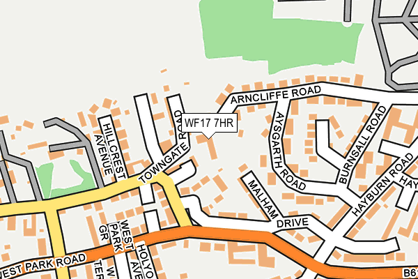
WF17 7HR lies on Healey Lane in Batley. WF17 7HR is located in the Batley West electoral ward, within the metropolitan district of Kirklees and the English Parliamentary constituency of Batley and Spen. The Sub Integrated Care Board (ICB) Location is NHS West Yorkshire ICB - X2C4Y and the police force is West Yorkshire. This postcode has been in use since January 1980.


GetTheData
Source: OS OpenMap – Local (Ordnance Survey)
Source: OS VectorMap District (Ordnance Survey)
Licence: Open Government Licence (requires attribution)
| Easting | 423292 |
| Northing | 424217 |
| Latitude | 53.713871 |
| Longitude | -1.648572 |
GetTheData
Source: Open Postcode Geo
Licence: Open Government Licence
| Street | Healey Lane |
| Town/City | Batley |
| Country | England |
| Postcode District | WF17 |
➜ See where WF17 is on a map ➜ Where is Batley? | |
GetTheData
Source: Land Registry Price Paid Data
Licence: Open Government Licence
Elevation or altitude of WF17 7HR as distance above sea level:
| Metres | Feet | |
|---|---|---|
| Elevation | 130m | 427ft |
Elevation is measured from the approximate centre of the postcode, to the nearest point on an OS contour line from OS Terrain 50, which has contour spacing of ten vertical metres.
➜ How high above sea level am I? Find the elevation of your current position using your device's GPS.
GetTheData
Source: Open Postcode Elevation
Licence: Open Government Licence
| Ward | Batley West |
| Constituency | Batley And Spen |
GetTheData
Source: ONS Postcode Database
Licence: Open Government Licence
137, HEALEY LANE, BATLEY, WF17 7HR 2006 20 JAN £408,000 |
GetTheData
Source: HM Land Registry Price Paid Data
Licence: Contains HM Land Registry data © Crown copyright and database right 2025. This data is licensed under the Open Government Licence v3.0.
| West Park Ave Healey Lane (Healey Lane) | Batley | 142m |
| West Park Ave Healey Lane (West Park Road) | Batley | 197m |
| Hayburn Rd Hayburn Gardens (Hayburn Road) | Batley | 217m |
| Hayburn Rd Hayburn Gardens (Hayburn Road) | Batley | 222m |
| Healey Ln Jessop Park (Healey Lane) | Batley | 264m |
| Batley Station | 1.7km |
| Dewsbury Station | 2.6km |
| Ravensthorpe Station | 4.3km |
GetTheData
Source: NaPTAN
Licence: Open Government Licence
GetTheData
Source: ONS Postcode Database
Licence: Open Government Licence


➜ Get more ratings from the Food Standards Agency
GetTheData
Source: Food Standards Agency
Licence: FSA terms & conditions
| Last Collection | |||
|---|---|---|---|
| Location | Mon-Fri | Sat | Distance |
| Trafalgar St/West Park Road | 17:45 | 11:45 | 242m |
| Healey Lane | 17:45 | 11:45 | 405m |
| 55 Cross Bank Road | 17:45 | 12:00 | 615m |
GetTheData
Source: Dracos
Licence: Creative Commons Attribution-ShareAlike
The below table lists the International Territorial Level (ITL) codes (formerly Nomenclature of Territorial Units for Statistics (NUTS) codes) and Local Administrative Units (LAU) codes for WF17 7HR:
| ITL 1 Code | Name |
|---|---|
| TLE | Yorkshire and The Humber |
| ITL 2 Code | Name |
| TLE4 | West Yorkshire |
| ITL 3 Code | Name |
| TLE44 | Calderdale and Kirklees |
| LAU 1 Code | Name |
| E08000034 | Kirklees |
GetTheData
Source: ONS Postcode Directory
Licence: Open Government Licence
The below table lists the Census Output Area (OA), Lower Layer Super Output Area (LSOA), and Middle Layer Super Output Area (MSOA) for WF17 7HR:
| Code | Name | |
|---|---|---|
| OA | E00055579 | |
| LSOA | E01011032 | Kirklees 010C |
| MSOA | E02002280 | Kirklees 010 |
GetTheData
Source: ONS Postcode Directory
Licence: Open Government Licence
| WF17 7HP | Linton Avenue | 81m |
| WF17 7HY | Aysgarth Road | 86m |
| WF17 7JD | Alder Mews | 94m |
| WF17 7HS | Prospect Terrace | 101m |
| WF17 7HX | Burnsall Avenue | 102m |
| WF17 7SL | Malham Drive | 107m |
| WF17 7HT | Arncliffe Road | 110m |
| WF17 7SF | Chaster Street | 120m |
| WF17 7HD | West Park Road | 169m |
| WF17 7HJ | Healey Lane | 170m |
GetTheData
Source: Open Postcode Geo; Land Registry Price Paid Data
Licence: Open Government Licence