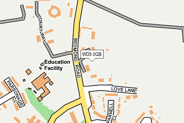
WD5 0QB lies on Bedmond Road in Abbots Langley. WD5 0QB is located in the Abbots Langley & Bedmond electoral ward, within the local authority district of Three Rivers and the English Parliamentary constituency of Watford. The Sub Integrated Care Board (ICB) Location is NHS Hertfordshire and West Essex ICB - 06N and the police force is Hertfordshire. This postcode has been in use since January 1980.


GetTheData
Source: OS OpenMap – Local (Ordnance Survey)
Source: OS VectorMap District (Ordnance Survey)
Licence: Open Government Licence (requires attribution)
| Easting | 509666 |
| Northing | 202492 |
| Latitude | 51.710459 |
| Longitude | -0.414144 |
GetTheData
Source: Open Postcode Geo
Licence: Open Government Licence
| Street | Bedmond Road |
| Town/City | Abbots Langley |
| Country | England |
| Postcode District | WD5 |
➜ See where WD5 is on a map ➜ Where is Abbots Langley? | |
GetTheData
Source: Land Registry Price Paid Data
Licence: Open Government Licence
Elevation or altitude of WD5 0QB as distance above sea level:
| Metres | Feet | |
|---|---|---|
| Elevation | 130m | 427ft |
Elevation is measured from the approximate centre of the postcode, to the nearest point on an OS contour line from OS Terrain 50, which has contour spacing of ten vertical metres.
➜ How high above sea level am I? Find the elevation of your current position using your device's GPS.
GetTheData
Source: Open Postcode Elevation
Licence: Open Government Licence
| Ward | Abbots Langley & Bedmond |
| Constituency | Watford |
GetTheData
Source: ONS Postcode Database
Licence: Open Government Licence
| Love Lane (Tibbs Hill Road) | Abbots Langley | 72m |
| Summerhouse Way (Tibbs Hill Road) | Abbots Langley | 165m |
| Summerhouse Way (Tibbs Hill Road) | Abbots Langley | 196m |
| The Crescent (High Street) | Abbots Langley | 264m |
| The Crescent (High Street) | Abbots Langley | 365m |
| Kings Langley Station | 1.7km |
| Garston (Herts) Station | 3.5km |
| Bricket Wood Station | 3.8km |
GetTheData
Source: NaPTAN
Licence: Open Government Licence
| Percentage of properties with Next Generation Access | 100.0% |
| Percentage of properties with Superfast Broadband | 100.0% |
| Percentage of properties with Ultrafast Broadband | 57.1% |
| Percentage of properties with Full Fibre Broadband | 0.0% |
Superfast Broadband is between 30Mbps and 300Mbps
Ultrafast Broadband is > 300Mbps
| Median download speed | 44.4Mbps |
| Average download speed | 37.3Mbps |
| Maximum download speed | 57.02Mbps |
| Median upload speed | 9.9Mbps |
| Average upload speed | 9.4Mbps |
| Maximum upload speed | 19.53Mbps |
| Percentage of properties unable to receive 2Mbps | 0.0% |
| Percentage of properties unable to receive 5Mbps | 0.0% |
| Percentage of properties unable to receive 10Mbps | 0.0% |
| Percentage of properties unable to receive 30Mbps | 0.0% |
GetTheData
Source: Ofcom
Licence: Ofcom Terms of Use (requires attribution)
Estimated total energy consumption in WD5 0QB by fuel type, 2015.
| Consumption (kWh) | 260,667 |
|---|---|
| Meter count | 11 |
| Mean (kWh/meter) | 23,697 |
| Median (kWh/meter) | 17,762 |
| Consumption (kWh) | 40,670 |
|---|---|
| Meter count | 8 |
| Mean (kWh/meter) | 5,084 |
| Median (kWh/meter) | 4,261 |
GetTheData
Source: Postcode level gas estimates: 2015 (experimental)
Source: Postcode level electricity estimates: 2015 (experimental)
Licence: Open Government Licence
GetTheData
Source: ONS Postcode Database
Licence: Open Government Licence


➜ Get more ratings from the Food Standards Agency
GetTheData
Source: Food Standards Agency
Licence: FSA terms & conditions
| Last Collection | |||
|---|---|---|---|
| Location | Mon-Fri | Sat | Distance |
| Summerhouse Way | 17:00 | 12:00 | 181m |
| Abbotts Langley P O | 17:30 | 11:30 | 575m |
| Tanners Wood Court | 16:00 | 10:30 | 1,078m |
GetTheData
Source: Dracos
Licence: Creative Commons Attribution-ShareAlike
The below table lists the International Territorial Level (ITL) codes (formerly Nomenclature of Territorial Units for Statistics (NUTS) codes) and Local Administrative Units (LAU) codes for WD5 0QB:
| ITL 1 Code | Name |
|---|---|
| TLH | East |
| ITL 2 Code | Name |
| TLH2 | Bedfordshire and Hertfordshire |
| ITL 3 Code | Name |
| TLH23 | Hertfordshire CC |
| LAU 1 Code | Name |
| E07000102 | Three Rivers |
GetTheData
Source: ONS Postcode Directory
Licence: Open Government Licence
The below table lists the Census Output Area (OA), Lower Layer Super Output Area (LSOA), and Middle Layer Super Output Area (MSOA) for WD5 0QB:
| Code | Name | |
|---|---|---|
| OA | E00120878 | |
| LSOA | E01023804 | Three Rivers 001C |
| MSOA | E02004956 | Three Rivers 001 |
GetTheData
Source: ONS Postcode Directory
Licence: Open Government Licence
| WD5 0DU | Tibbs Hill Road | 109m |
| WD5 0DZ | Parnell Close | 124m |
| WD5 0TB | Tithe Barn Court | 170m |
| WD5 0QA | Love Lane | 170m |
| WD5 0AX | Hanover Gardens | 185m |
| WD5 0QL | Antoinette Court | 195m |
| WD5 0QD | Bedmond Road | 196m |
| WD5 0DY | Summerhouse Way | 238m |
| WD5 0QF | Breakspear Place | 254m |
| WD5 0QJ | Dairy Way | 258m |
GetTheData
Source: Open Postcode Geo; Land Registry Price Paid Data
Licence: Open Government Licence