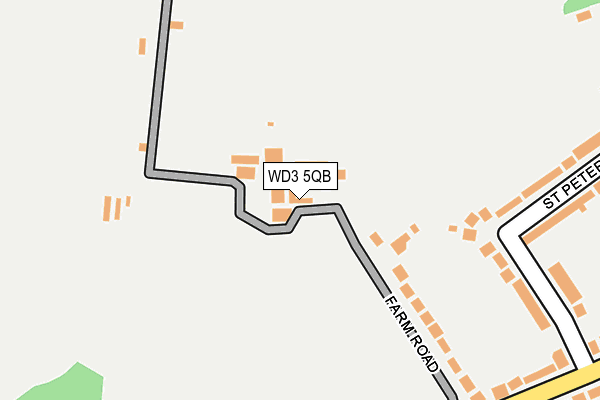
WD3 5QB lies on Farm Road in Chorleywood, Rickmansworth. WD3 5QB is located in the Chess Valley electoral ward, within the unitary authority of Buckinghamshire and the English Parliamentary constituency of Chesham and Amersham. The Sub Integrated Care Board (ICB) Location is NHS Buckinghamshire, Oxfordshire and Berkshire West ICB - 14Y and the police force is Thames Valley. This postcode has been in use since January 1980.


GetTheData
Source: OS OpenMap – Local (Ordnance Survey)
Source: OS VectorMap District (Ordnance Survey)
Licence: Open Government Licence (requires attribution)
| Easting | 501322 |
| Northing | 196134 |
| Latitude | 51.654873 |
| Longitude | -0.536731 |
GetTheData
Source: Open Postcode Geo
Licence: Open Government Licence
| Street | Farm Road |
| Locality | Chorleywood |
| Town/City | Rickmansworth |
| Country | England |
| Postcode District | WD3 |
➜ See where WD3 is on a map ➜ Where is Chorleywood? | |
GetTheData
Source: Land Registry Price Paid Data
Licence: Open Government Licence
Elevation or altitude of WD3 5QB as distance above sea level:
| Metres | Feet | |
|---|---|---|
| Elevation | 110m | 361ft |
Elevation is measured from the approximate centre of the postcode, to the nearest point on an OS contour line from OS Terrain 50, which has contour spacing of ten vertical metres.
➜ How high above sea level am I? Find the elevation of your current position using your device's GPS.
GetTheData
Source: Open Postcode Elevation
Licence: Open Government Licence
| Ward | Chess Valley |
| Constituency | Chesham And Amersham |
GetTheData
Source: ONS Postcode Database
Licence: Open Government Licence
| Chalfont Lane (Shire Lane) | Chorleywood | 724m |
| Chalfont Lane (Shire Lane) | Chorleywood | 740m |
| Shire Lane (Heronsgate Road) | The Swillett | 805m |
| Shire Lane (Heronsgate Road) | The Swillett | 816m |
| Haddon Road (Shire Lane) | Chorleywood | 826m |
| Chorleywood Underground Station | Chorleywood | 1,265m |
| Chorleywood Station | 1.3km |
| Chalfont & Latimer Station | 2.2km |
| Rickmansworth Station | 4.7km |
GetTheData
Source: NaPTAN
Licence: Open Government Licence
| Percentage of properties with Next Generation Access | 100.0% |
| Percentage of properties with Superfast Broadband | 100.0% |
| Percentage of properties with Ultrafast Broadband | 0.0% |
| Percentage of properties with Full Fibre Broadband | 0.0% |
Superfast Broadband is between 30Mbps and 300Mbps
Ultrafast Broadband is > 300Mbps
| Percentage of properties unable to receive 2Mbps | 0.0% |
| Percentage of properties unable to receive 5Mbps | 0.0% |
| Percentage of properties unable to receive 10Mbps | 0.0% |
| Percentage of properties unable to receive 30Mbps | 0.0% |
GetTheData
Source: Ofcom
Licence: Ofcom Terms of Use (requires attribution)
GetTheData
Source: ONS Postcode Database
Licence: Open Government Licence


➜ Get more ratings from the Food Standards Agency
GetTheData
Source: Food Standards Agency
Licence: FSA terms & conditions
| Last Collection | |||
|---|---|---|---|
| Location | Mon-Fri | Sat | Distance |
| Blacketts Wood Drive | 17:00 | 12:00 | 646m |
| Haddon Road | 16:00 | 11:30 | 841m |
| Lodge Lane | 16:15 | 07:15 | 919m |
GetTheData
Source: Dracos
Licence: Creative Commons Attribution-ShareAlike
The below table lists the International Territorial Level (ITL) codes (formerly Nomenclature of Territorial Units for Statistics (NUTS) codes) and Local Administrative Units (LAU) codes for WD3 5QB:
| ITL 1 Code | Name |
|---|---|
| TLJ | South East (England) |
| ITL 2 Code | Name |
| TLJ1 | Berkshire, Buckinghamshire and Oxfordshire |
| ITL 3 Code | Name |
| TLJ13 | Buckinghamshire |
| LAU 1 Code | Name |
| E06000060 | Buckinghamshire |
GetTheData
Source: ONS Postcode Directory
Licence: Open Government Licence
The below table lists the Census Output Area (OA), Lower Layer Super Output Area (LSOA), and Middle Layer Super Output Area (MSOA) for WD3 5QB:
| Code | Name | |
|---|---|---|
| OA | E00089563 | |
| LSOA | E01017750 | Chiltern 001A |
| MSOA | E02003676 | Chiltern 001 |
GetTheData
Source: ONS Postcode Directory
Licence: Open Government Licence
| WD3 5QA | Farm Road | 168m |
| WD3 5QE | St Peters Way | 216m |
| WD3 5QF | St Peters Way | 258m |
| WD3 5QD | Blacketts Wood Drive | 291m |
| WD3 5PJ | Burtons Lane | 313m |
| WD3 5PS | Blacketts Wood Drive | 379m |
| WD3 5QQ | Blacketts Wood Drive | 383m |
| WD3 5RP | Carpenters Wood Drive | 401m |
| WD3 5FE | Badgers Dell | 458m |
| WD3 5RN | Carpenters Wood Drive | 497m |
GetTheData
Source: Open Postcode Geo; Land Registry Price Paid Data
Licence: Open Government Licence