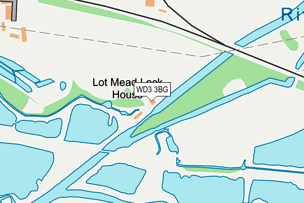
WD3 3BG is in Croxley Green, Rickmansworth. WD3 3BG is located in the Rickmansworth Town electoral ward, within the local authority district of Three Rivers and the English Parliamentary constituency of South West Hertfordshire. The Sub Integrated Care Board (ICB) Location is NHS Hertfordshire and West Essex ICB - 06N and the police force is Hertfordshire. This postcode has been in use since January 1980.


GetTheData
Source: OS OpenMap – Local (Ordnance Survey)
Source: OS VectorMap District (Ordnance Survey)
Licence: Open Government Licence (requires attribution)
| Easting | 507312 |
| Northing | 194414 |
| Latitude | 51.638308 |
| Longitude | -0.450681 |
GetTheData
Source: Open Postcode Geo
Licence: Open Government Licence
| Locality | Croxley Green |
| Town/City | Rickmansworth |
| Country | England |
| Postcode District | WD3 |
➜ See where WD3 is on a map | |
GetTheData
Source: Land Registry Price Paid Data
Licence: Open Government Licence
Elevation or altitude of WD3 3BG as distance above sea level:
| Metres | Feet | |
|---|---|---|
| Elevation | 50m | 164ft |
Elevation is measured from the approximate centre of the postcode, to the nearest point on an OS contour line from OS Terrain 50, which has contour spacing of ten vertical metres.
➜ How high above sea level am I? Find the elevation of your current position using your device's GPS.
GetTheData
Source: Open Postcode Elevation
Licence: Open Government Licence
| Ward | Rickmansworth Town |
| Constituency | South West Hertfordshire |
GetTheData
Source: ONS Postcode Database
Licence: Open Government Licence
| Bateman Road (Watford Road) | Croxley Green | 876m |
| Bateman Road (Watford Road) | Croxley Green | 885m |
| Harvey Road (Watford Road) | Croxley Green | 899m |
| Harvey Road (Watford Road) | Croxley Green | 907m |
| The Sportsman Ph (The Green) | Croxley Green | 978m |
| Croxley Underground Station | Croxley Green | 1,154m |
| Moor Park Underground Station | Moor Park | 1,575m |
| Rickmansworth Station | 1.6km |
| Watford High Street Station | 4.4km |
| Bushey Station | 4.6km |
GetTheData
Source: NaPTAN
Licence: Open Government Licence
| Percentage of properties with Next Generation Access | 100.0% |
| Percentage of properties with Superfast Broadband | 0.0% |
| Percentage of properties with Ultrafast Broadband | 0.0% |
| Percentage of properties with Full Fibre Broadband | 0.0% |
Superfast Broadband is between 30Mbps and 300Mbps
Ultrafast Broadband is > 300Mbps
| Percentage of properties unable to receive 2Mbps | 0.0% |
| Percentage of properties unable to receive 5Mbps | 0.0% |
| Percentage of properties unable to receive 10Mbps | 0.0% |
| Percentage of properties unable to receive 30Mbps | 100.0% |
GetTheData
Source: Ofcom
Licence: Ofcom Terms of Use (requires attribution)
GetTheData
Source: ONS Postcode Database
Licence: Open Government Licence


➜ Get more ratings from the Food Standards Agency
GetTheData
Source: Food Standards Agency
Licence: FSA terms & conditions
| Last Collection | |||
|---|---|---|---|
| Location | Mon-Fri | Sat | Distance |
| Moor Lane | 17:30 | 12:00 | 573m |
| Watford Road Croxley Green | 17:30 | 12:00 | 1,100m |
| Barton Way Croxley Green | 17:00 | 12:00 | 1,216m |
GetTheData
Source: Dracos
Licence: Creative Commons Attribution-ShareAlike
The below table lists the International Territorial Level (ITL) codes (formerly Nomenclature of Territorial Units for Statistics (NUTS) codes) and Local Administrative Units (LAU) codes for WD3 3BG:
| ITL 1 Code | Name |
|---|---|
| TLH | East |
| ITL 2 Code | Name |
| TLH2 | Bedfordshire and Hertfordshire |
| ITL 3 Code | Name |
| TLH23 | Hertfordshire CC |
| LAU 1 Code | Name |
| E07000102 | Three Rivers |
GetTheData
Source: ONS Postcode Directory
Licence: Open Government Licence
The below table lists the Census Output Area (OA), Lower Layer Super Output Area (LSOA), and Middle Layer Super Output Area (MSOA) for WD3 3BG:
| Code | Name | |
|---|---|---|
| OA | E00121112 | |
| LSOA | E01023849 | Three Rivers 011D |
| MSOA | E02004966 | Three Rivers 011 |
GetTheData
Source: ONS Postcode Directory
Licence: Open Government Licence
| WD3 3BE | Croxley Hall Woods | 466m |
| WD3 1LR | Moor Lane Cottages | 523m |
| WD3 3FQ | Wood End | 529m |
| WD18 9SR | Peerglow Industrial Estate | 530m |
| WD3 1LQ | Moor Lane | 565m |
| WD3 3AR | Frankland Close | 567m |
| WD3 3FL | Imperial Way | 603m |
| WD3 3BS | Harvey Road | 624m |
| WD3 3FN | Woodland Chase | 627m |
| WD18 9RU | Olds Close | 644m |
GetTheData
Source: Open Postcode Geo; Land Registry Price Paid Data
Licence: Open Government Licence