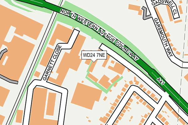
WD24 7NE lies on Colne Way Court in Watford. WD24 7NE is located in the Tudor electoral ward, within the local authority district of Watford and the English Parliamentary constituency of Watford. The Sub Integrated Care Board (ICB) Location is NHS Hertfordshire and West Essex ICB - 06N and the police force is Hertfordshire. This postcode has been in use since October 2000.


GetTheData
Source: OS OpenMap – Local (Ordnance Survey)
Source: OS VectorMap District (Ordnance Survey)
Licence: Open Government Licence (requires attribution)
| Easting | 511761 |
| Northing | 198997 |
| Latitude | 51.678634 |
| Longitude | -0.384953 |
GetTheData
Source: Open Postcode Geo
Licence: Open Government Licence
| Street | Colne Way Court |
| Town/City | Watford |
| Country | England |
| Postcode District | WD24 |
➜ See where WD24 is on a map ➜ Where is Watford? | |
GetTheData
Source: Land Registry Price Paid Data
Licence: Open Government Licence
Elevation or altitude of WD24 7NE as distance above sea level:
| Metres | Feet | |
|---|---|---|
| Elevation | 70m | 230ft |
Elevation is measured from the approximate centre of the postcode, to the nearest point on an OS contour line from OS Terrain 50, which has contour spacing of ten vertical metres.
➜ How high above sea level am I? Find the elevation of your current position using your device's GPS.
GetTheData
Source: Open Postcode Elevation
Licence: Open Government Licence
| Ward | Tudor |
| Constituency | Watford |
GetTheData
Source: ONS Postcode Database
Licence: Open Government Licence
| Garsmouth Way (Meriden Way) | Garston | 335m |
| Garsmouth Way (Meriden Way) | Garston | 346m |
| York Way | Garston | 369m |
| Widgeon Way (Meriden Way) | Garston | 440m |
| Widgeon Way (Meriden Way) | Garston | 461m |
| Watford North Station | 0.5km |
| Garston (Herts) Station | 0.9km |
| Watford Junction Station | 1.9km |
GetTheData
Source: NaPTAN
Licence: Open Government Licence
| Median download speed | 80.0Mbps |
| Average download speed | 74.3Mbps |
| Maximum download speed | 80.00Mbps |
| Median upload speed | 20.0Mbps |
| Average upload speed | 18.6Mbps |
| Maximum upload speed | 20.00Mbps |
GetTheData
Source: Ofcom
Licence: Ofcom Terms of Use (requires attribution)
GetTheData
Source: ONS Postcode Database
Licence: Open Government Licence


➜ Get more ratings from the Food Standards Agency
GetTheData
Source: Food Standards Agency
Licence: FSA terms & conditions
| Last Collection | |||
|---|---|---|---|
| Location | Mon-Fri | Sat | Distance |
| North Watford P.o | 18:30 | 12:00 | 546m |
| Parkgate Road | 18:30 | 12:00 | 687m |
| North Watford Old B.o | 19:00 | 12:00 | 822m |
GetTheData
Source: Dracos
Licence: Creative Commons Attribution-ShareAlike
The below table lists the International Territorial Level (ITL) codes (formerly Nomenclature of Territorial Units for Statistics (NUTS) codes) and Local Administrative Units (LAU) codes for WD24 7NE:
| ITL 1 Code | Name |
|---|---|
| TLH | East |
| ITL 2 Code | Name |
| TLH2 | Bedfordshire and Hertfordshire |
| ITL 3 Code | Name |
| TLH23 | Hertfordshire CC |
| LAU 1 Code | Name |
| E07000103 | Watford |
GetTheData
Source: ONS Postcode Directory
Licence: Open Government Licence
The below table lists the Census Output Area (OA), Lower Layer Super Output Area (LSOA), and Middle Layer Super Output Area (MSOA) for WD24 7NE:
| Code | Name | |
|---|---|---|
| OA | E00121335 | |
| LSOA | E01023897 | Watford 005C |
| MSOA | E02004972 | Watford 005 |
GetTheData
Source: ONS Postcode Directory
Licence: Open Government Licence
| WD24 7QJ | Brookside | 27m |
| WD24 7NZ | Tudor Walk | 134m |
| WD24 7GL | Garnett Close | 155m |
| WD25 9DE | Garsmouth Way | 235m |
| WD25 9DF | Garsmouth Way | 235m |
| WD25 9AH | The Meadows | 256m |
| WD24 7PA | Tudor Walk | 257m |
| WD25 9DR | Garsmouth Way | 261m |
| WD24 7GP | Greycaine Road | 278m |
| WD25 9DS | Gadswell Close | 301m |
GetTheData
Source: Open Postcode Geo; Land Registry Price Paid Data
Licence: Open Government Licence