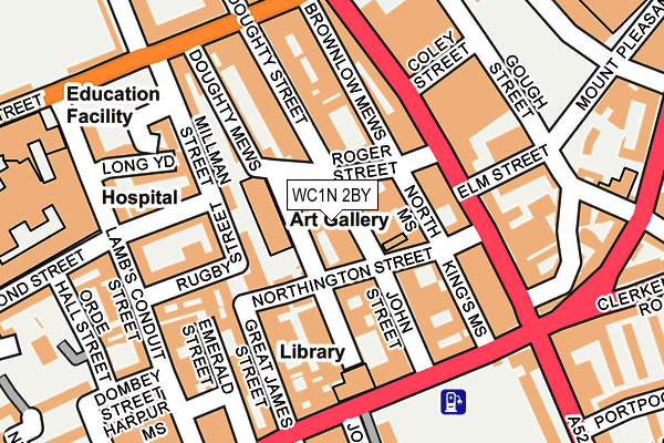
WC1N 2BY lies on John Street in Holborn, London. WC1N 2BY is located in the Holborn & Covent Garden electoral ward, within the London borough of Camden and the English Parliamentary constituency of Holborn and St Pancras. The Sub Integrated Care Board (ICB) Location is NHS North Central London ICB - 93C and the police force is Metropolitan Police. This postcode has been in use since December 2000.


GetTheData
Source: OS OpenMap – Local (Ordnance Survey)
Source: OS VectorMap District (Ordnance Survey)
Licence: Open Government Licence (requires attribution)
| Easting | 530810 |
| Northing | 182073 |
| Latitude | 51.522433 |
| Longitude | -0.115922 |
GetTheData
Source: Open Postcode Geo
Licence: Open Government Licence
| Street | John Street |
| Locality | Holborn |
| Town/City | London |
| Country | England |
| Postcode District | WC1N |
➜ See where WC1N is on a map ➜ Where is London? | |
GetTheData
Source: Land Registry Price Paid Data
Licence: Open Government Licence
Elevation or altitude of WC1N 2BY as distance above sea level:
| Metres | Feet | |
|---|---|---|
| Elevation | 20m | 66ft |
Elevation is measured from the approximate centre of the postcode, to the nearest point on an OS contour line from OS Terrain 50, which has contour spacing of ten vertical metres.
➜ How high above sea level am I? Find the elevation of your current position using your device's GPS.
GetTheData
Source: Open Postcode Elevation
Licence: Open Government Licence
| Ward | Holborn & Covent Garden |
| Constituency | Holborn And St Pancras |
GetTheData
Source: ONS Postcode Database
Licence: Open Government Licence
| Gray's Inn Road Rosebery Ave (Gray's Inn Road) | Holborn | 148m |
| Grays Inn Road Theobalds Road (Theobald's Road) | Holborn | 173m |
| Guilford Street (Gray's Inn Road) | Bloomsbury | 173m |
| Grays Inn Road Theobalds Road (Theobald's Road) | Holborn | 177m |
| Clerkenwell Rd Rosebery Ave (Gray's Inn Road) | Holborn | 180m |
| Chancery Lane Underground Station | Chancery Lane | 555m |
| Russell Square Underground Station | Russell Square | 585m |
| Holborn Underground Station | Holborn | 626m |
| Farringdon Underground Station | Farringdon | 802m |
| King's Cross St. Pancras Underground Station | King's Cross | 1,045m |
| Farringdon (London) Station | 0.8km |
| London Kings Cross Station | 1.1km |
| City Thameslink Station | 1.3km |
GetTheData
Source: NaPTAN
Licence: Open Government Licence
GetTheData
Source: ONS Postcode Database
Licence: Open Government Licence


➜ Get more ratings from the Food Standards Agency
GetTheData
Source: Food Standards Agency
Licence: FSA terms & conditions
| Last Collection | |||
|---|---|---|---|
| Location | Mon-Fri | Sat | Distance |
| John Street (Northington St) | 18:30 | 12:00 | 64m |
| Grays Inn Road (Elm St) | 18:30 | 12:00 | 123m |
| Theobalds Road (Gt James St) | 18:30 | 12:00 | 173m |
GetTheData
Source: Dracos
Licence: Creative Commons Attribution-ShareAlike
The below table lists the International Territorial Level (ITL) codes (formerly Nomenclature of Territorial Units for Statistics (NUTS) codes) and Local Administrative Units (LAU) codes for WC1N 2BY:
| ITL 1 Code | Name |
|---|---|
| TLI | London |
| ITL 2 Code | Name |
| TLI3 | Inner London - West |
| ITL 3 Code | Name |
| TLI31 | Camden and City of London |
| LAU 1 Code | Name |
| E09000007 | Camden |
GetTheData
Source: ONS Postcode Directory
Licence: Open Government Licence
The below table lists the Census Output Area (OA), Lower Layer Super Output Area (LSOA), and Middle Layer Super Output Area (MSOA) for WC1N 2BY:
| Code | Name | |
|---|---|---|
| OA | E00004532 | |
| LSOA | E01000920 | Camden 027D |
| MSOA | E02000192 | Camden 027 |
GetTheData
Source: ONS Postcode Directory
Licence: Open Government Licence
| WC1N 2BG | John Street | 5m |
| WC1N 2BH | John Street | 11m |
| WC1N 2PA | Johns Mews | 24m |
| WC1N 2BL | John Street | 36m |
| WC1N 2DE | John Street | 36m |
| WC1N 2DL | John Street | 37m |
| WC1N 2BF | John Street | 41m |
| WC1N 2EB | John Street | 56m |
| WC1N 2NT | Northington Street | 63m |
| WC1N 2NZ | Johns Mews | 63m |
GetTheData
Source: Open Postcode Geo; Land Registry Price Paid Data
Licence: Open Government Licence