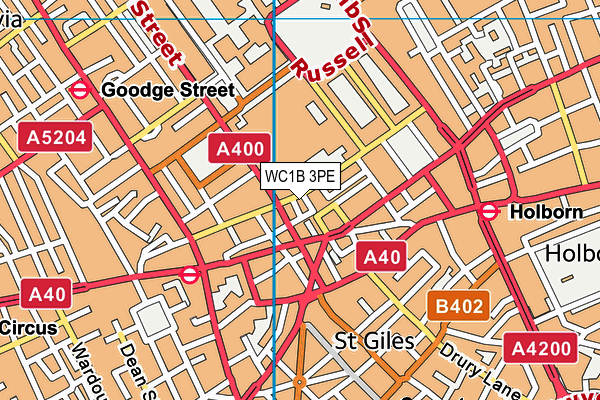
WC1B 3PE is located in the Bloomsbury electoral ward, within the London borough of Camden and the English Parliamentary constituency of Holborn and St Pancras. The Sub Integrated Care Board (ICB) Location is NHS North Central London ICB - 93C and the police force is Metropolitan Police. This postcode has been in use since December 2000.


GetTheData
Source: OS OpenMap – Local (Ordnance Survey)
Source: OS VectorMap District (Ordnance Survey)
Licence: Open Government Licence (requires attribution)
| Easting | 530067 |
| Northing | 181544 |
| Latitude | 51.517851 |
| Longitude | -0.126820 |
GetTheData
Source: Open Postcode Geo
Licence: Open Government Licence
| Country | England |
| Postcode District | WC1B |
➜ See where WC1B is on a map ➜ Where is London? | |
GetTheData
Source: Land Registry Price Paid Data
Licence: Open Government Licence
Elevation or altitude of WC1B 3PE as distance above sea level:
| Metres | Feet | |
|---|---|---|
| Elevation | 20m | 66ft |
Elevation is measured from the approximate centre of the postcode, to the nearest point on an OS contour line from OS Terrain 50, which has contour spacing of ten vertical metres.
➜ How high above sea level am I? Find the elevation of your current position using your device's GPS.
GetTheData
Source: Open Postcode Elevation
Licence: Open Government Licence
| Ward | Bloomsbury |
| Constituency | Holborn And St Pancras |
GetTheData
Source: ONS Postcode Database
Licence: Open Government Licence
| Great Russell Street (Bloomsbury Street) | Tottenham Court Road | 94m |
| British Museum (Great Russell Street) | Holborn | 106m |
| New Oxford Street | Tottenham Court Road | 135m |
| Tottenham Court Road (New Oxford Street) | Tottenham Court Road | 158m |
| Tottenham Court Road Station New Oxford Street (New Oxford Street) | Tottenham Court Road | 160m |
| Tottenham Court Road Underground Station | Tottenham Court Road | 295m |
| Holborn Underground Station | Holborn | 441m |
| Covent Garden Underground Station | Covent Garden | 555m |
| Goodge Street Underground Station | Goodge Street | 606m |
| Russell Square Underground Station | Russell Square | 607m |
| London Charing Cross Station | 1.1km |
| London Euston Station | 1.2km |
| London Kings Cross Station | 1.5km |
GetTheData
Source: NaPTAN
Licence: Open Government Licence
GetTheData
Source: ONS Postcode Database
Licence: Open Government Licence


➜ Get more ratings from the Food Standards Agency
GetTheData
Source: Food Standards Agency
Licence: FSA terms & conditions
| Last Collection | |||
|---|---|---|---|
| Location | Mon-Fri | Sat | Distance |
| Bloomsbury St (New Oxford St) | 18:30 | 12:00 | 100m |
| Gt Russell Street (Adeline Pl) | 18:30 | 12:00 | 207m |
| Shaftesbury Avenue (Neal St) | 18:30 | 12:00 | 271m |
GetTheData
Source: Dracos
Licence: Creative Commons Attribution-ShareAlike
The below table lists the International Territorial Level (ITL) codes (formerly Nomenclature of Territorial Units for Statistics (NUTS) codes) and Local Administrative Units (LAU) codes for WC1B 3PE:
| ITL 1 Code | Name |
|---|---|
| TLI | London |
| ITL 2 Code | Name |
| TLI3 | Inner London - West |
| ITL 3 Code | Name |
| TLI31 | Camden and City of London |
| LAU 1 Code | Name |
| E09000007 | Camden |
GetTheData
Source: ONS Postcode Directory
Licence: Open Government Licence
The below table lists the Census Output Area (OA), Lower Layer Super Output Area (LSOA), and Middle Layer Super Output Area (MSOA) for WC1B 3PE:
| Code | Name | |
|---|---|---|
| OA | E00004561 | |
| LSOA | E01000918 | Camden 028C |
| MSOA | E02000193 | Camden 028 |
GetTheData
Source: ONS Postcode Directory
Licence: Open Government Licence
| WC1B 3PH | Great Russell Street | 7m |
| WC1B 3NZ | Great Russell Street | 13m |
| WC1A 1JD | Willoughby Street | 16m |
| WC1A 1NL | Coptic Street | 29m |
| WC1A 1NP | Coptic Street | 32m |
| WC1B 3PA | Great Russell Street | 38m |
| WC1B 3QA | Bloomsbury Street | 39m |
| WC1A 1NJ | Coptic Street | 45m |
| WC1A 1NS | Coptic Street | 47m |
| WC1A 1LH | Museum Street | 55m |
GetTheData
Source: Open Postcode Geo; Land Registry Price Paid Data
Licence: Open Government Licence