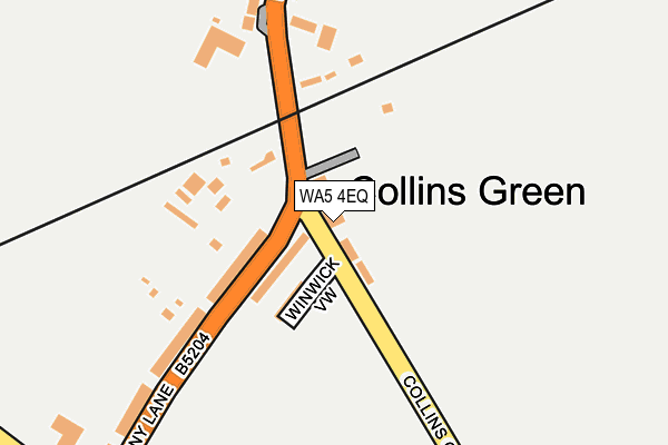
WA5 4EQ lies on Collins Green Lane in Collins Green, Warrington. WA5 4EQ is located in the Burtonwood and Winwick electoral ward, within the unitary authority of Warrington and the English Parliamentary constituency of Warrington North. The Sub Integrated Care Board (ICB) Location is NHS Cheshire and Merseyside ICB - 02E and the police force is Cheshire. This postcode has been in use since January 1980.


GetTheData
Source: OS OpenMap – Local (Ordnance Survey)
Source: OS VectorMap District (Ordnance Survey)
Licence: Open Government Licence (requires attribution)
| Easting | 356011 |
| Northing | 394193 |
| Latitude | 53.442661 |
| Longitude | -2.663717 |
GetTheData
Source: Open Postcode Geo
Licence: Open Government Licence
| Street | Collins Green Lane |
| Locality | Collins Green |
| Town/City | Warrington |
| Country | England |
| Postcode District | WA5 |
➜ See where WA5 is on a map ➜ Where is Collins Green? | |
GetTheData
Source: Land Registry Price Paid Data
Licence: Open Government Licence
Elevation or altitude of WA5 4EQ as distance above sea level:
| Metres | Feet | |
|---|---|---|
| Elevation | 30m | 98ft |
Elevation is measured from the approximate centre of the postcode, to the nearest point on an OS contour line from OS Terrain 50, which has contour spacing of ten vertical metres.
➜ How high above sea level am I? Find the elevation of your current position using your device's GPS.
GetTheData
Source: Open Postcode Elevation
Licence: Open Government Licence
| Ward | Burtonwood And Winwick |
| Constituency | Warrington North |
GetTheData
Source: ONS Postcode Database
Licence: Open Government Licence
| The Pear Tree (Collins Green Lane) | Collins Green | 25m |
| The Pear Tree (Collins Green Lane) | Collins Green | 65m |
| Collins Green Lane (Penny Lane) | Collins Green | 104m |
| Collins Green Farm (Penkford Lane) | Collins Green | 224m |
| Collins Green Farm (Penkford Lane) | Collins Green | 267m |
| Earlestown Station | 2km |
| St Helens Junction Station | 2.6km |
| Newton-le-Willows Station | 3.5km |
GetTheData
Source: NaPTAN
Licence: Open Government Licence
| Percentage of properties with Next Generation Access | 100.0% |
| Percentage of properties with Superfast Broadband | 100.0% |
| Percentage of properties with Ultrafast Broadband | 0.0% |
| Percentage of properties with Full Fibre Broadband | 0.0% |
Superfast Broadband is between 30Mbps and 300Mbps
Ultrafast Broadband is > 300Mbps
| Median download speed | 39.8Mbps |
| Average download speed | 46.8Mbps |
| Maximum download speed | 80.00Mbps |
| Median upload speed | 10.0Mbps |
| Average upload speed | 11.6Mbps |
| Maximum upload speed | 20.00Mbps |
| Percentage of properties unable to receive 2Mbps | 0.0% |
| Percentage of properties unable to receive 5Mbps | 0.0% |
| Percentage of properties unable to receive 10Mbps | 0.0% |
| Percentage of properties unable to receive 30Mbps | 0.0% |
GetTheData
Source: Ofcom
Licence: Ofcom Terms of Use (requires attribution)
Estimated total energy consumption in WA5 4EQ by fuel type, 2015.
| Consumption (kWh) | 142,148 |
|---|---|
| Meter count | 11 |
| Mean (kWh/meter) | 12,923 |
| Median (kWh/meter) | 11,809 |
| Consumption (kWh) | 37,487 |
|---|---|
| Meter count | 10 |
| Mean (kWh/meter) | 3,749 |
| Median (kWh/meter) | 2,873 |
GetTheData
Source: Postcode level gas estimates: 2015 (experimental)
Source: Postcode level electricity estimates: 2015 (experimental)
Licence: Open Government Licence
GetTheData
Source: ONS Postcode Database
Licence: Open Government Licence


➜ Get more ratings from the Food Standards Agency
GetTheData
Source: Food Standards Agency
Licence: FSA terms & conditions
| Last Collection | |||
|---|---|---|---|
| Location | Mon-Fri | Sat | Distance |
| 128 Common Road | 16:15 | 11:00 | 1,252m |
| Bank Street | 16:00 | 11:00 | 1,280m |
| Sephton Street | 16:15 | 11:00 | 1,447m |
GetTheData
Source: Dracos
Licence: Creative Commons Attribution-ShareAlike
The below table lists the International Territorial Level (ITL) codes (formerly Nomenclature of Territorial Units for Statistics (NUTS) codes) and Local Administrative Units (LAU) codes for WA5 4EQ:
| ITL 1 Code | Name |
|---|---|
| TLD | North West (England) |
| ITL 2 Code | Name |
| TLD6 | Cheshire |
| ITL 3 Code | Name |
| TLD61 | Warrington |
| LAU 1 Code | Name |
| E06000007 | Warrington |
GetTheData
Source: ONS Postcode Directory
Licence: Open Government Licence
The below table lists the Census Output Area (OA), Lower Layer Super Output Area (LSOA), and Middle Layer Super Output Area (MSOA) for WA5 4EQ:
| Code | Name | |
|---|---|---|
| OA | E00062877 | |
| LSOA | E01012469 | Warrington 003C |
| MSOA | E02002592 | Warrington 003 |
GetTheData
Source: ONS Postcode Directory
Licence: Open Government Licence
| WA5 4DT | Penny Lane | 68m |
| WA5 4ED | Penny Lane | 83m |
| WA5 4ER | Winwick View | 84m |
| WA5 4DS | Penny Lane | 169m |
| WA5 4EH | Thatchers Mount | 206m |
| WA5 4EE | Penkford Lane | 243m |
| WA5 4EG | Penkford Lane | 250m |
| WA5 4AS | Lumber Lane | 455m |
| WA5 4PH | Bold Lane | 461m |
| WA5 4ES | Forshaws Lane | 471m |
GetTheData
Source: Open Postcode Geo; Land Registry Price Paid Data
Licence: Open Government Licence