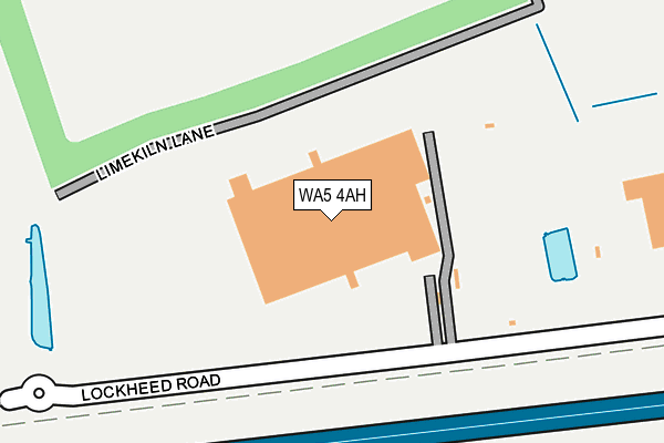
WA5 4AH is located in the Burtonwood and Winwick electoral ward, within the unitary authority of Warrington and the English Parliamentary constituency of Warrington North. The Sub Integrated Care Board (ICB) Location is NHS Cheshire and Merseyside ICB - 02E and the police force is Cheshire. This postcode has been in use since September 2013.


GetTheData
Source: OS OpenMap – Local (Ordnance Survey)
Source: OS VectorMap District (Ordnance Survey)
Licence: Open Government Licence (requires attribution)
| Easting | 356146 |
| Northing | 391153 |
| Latitude | 53.415365 |
| Longitude | -2.661260 |
GetTheData
Source: Open Postcode Geo
Licence: Open Government Licence
| Country | England |
| Postcode District | WA5 |
➜ See where WA5 is on a map | |
GetTheData
Source: Land Registry Price Paid Data
Licence: Open Government Licence
Elevation or altitude of WA5 4AH as distance above sea level:
| Metres | Feet | |
|---|---|---|
| Elevation | 20m | 66ft |
Elevation is measured from the approximate centre of the postcode, to the nearest point on an OS contour line from OS Terrain 50, which has contour spacing of ten vertical metres.
➜ How high above sea level am I? Find the elevation of your current position using your device's GPS.
GetTheData
Source: Open Postcode Elevation
Licence: Open Government Licence
| Ward | Burtonwood And Winwick |
| Constituency | Warrington North |
GetTheData
Source: ONS Postcode Database
Licence: Open Government Licence
| County Boundary | Bold Heath | 735m |
| County Boundary | Bold Heath | 736m |
| Wright's Lane (Burtonwood Road) | Burtonwood | 931m |
| Wright's Lane (Burtonwood Road) | Burtonwood | 951m |
| Burtonwood Road | Old Hall | 1,125m |
| Sankey for Penketh Station | 2.6km |
| St Helens Junction Station | 3.3km |
| Earlestown Station | 4.3km |
GetTheData
Source: NaPTAN
Licence: Open Government Licence
GetTheData
Source: ONS Postcode Database
Licence: Open Government Licence


➜ Get more ratings from the Food Standards Agency
GetTheData
Source: Food Standards Agency
Licence: FSA terms & conditions
| Last Collection | |||
|---|---|---|---|
| Location | Mon-Fri | Sat | Distance |
| Clay Lane | 16:00 | 11:00 | 1,433m |
| Castle Green | 17:30 | 10:30 | 1,635m |
| Malvern Chase | 17:00 | 11:00 | 1,653m |
GetTheData
Source: Dracos
Licence: Creative Commons Attribution-ShareAlike
The below table lists the International Territorial Level (ITL) codes (formerly Nomenclature of Territorial Units for Statistics (NUTS) codes) and Local Administrative Units (LAU) codes for WA5 4AH:
| ITL 1 Code | Name |
|---|---|
| TLD | North West (England) |
| ITL 2 Code | Name |
| TLD6 | Cheshire |
| ITL 3 Code | Name |
| TLD61 | Warrington |
| LAU 1 Code | Name |
| E06000007 | Warrington |
GetTheData
Source: ONS Postcode Directory
Licence: Open Government Licence
The below table lists the Census Output Area (OA), Lower Layer Super Output Area (LSOA), and Middle Layer Super Output Area (MSOA) for WA5 4AH:
| Code | Name | |
|---|---|---|
| OA | E00062877 | |
| LSOA | E01012469 | Warrington 003C |
| MSOA | E02002592 | Warrington 003 |
GetTheData
Source: ONS Postcode Directory
Licence: Open Government Licence
| WA5 3TP | Skyline Drive | 397m |
| WA5 4DE | Joy Lane | 486m |
| WA5 3XA | Orion Boulevard | 970m |
| WA5 7AA | Partisan Green | 1180m |
| WA5 7XN | Tourney Green | 1188m |
| WA5 7AD | Butts Green | 1250m |
| WA5 7XQ | Kingswood Road | 1272m |
| WA5 7XL | Tourney Green | 1289m |
| WA5 4JE | Haley Road South | 1293m |
| WA5 7XT | Butts Green | 1307m |
GetTheData
Source: Open Postcode Geo; Land Registry Price Paid Data
Licence: Open Government Licence