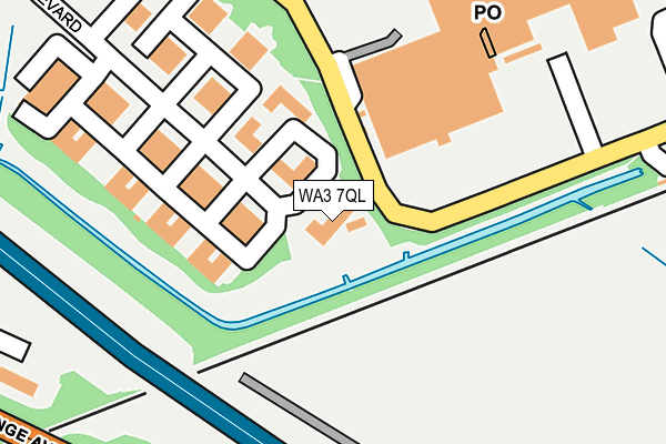
WA3 7QL is located in the Birchwood electoral ward, within the unitary authority of Warrington and the English Parliamentary constituency of Warrington North. The Sub Integrated Care Board (ICB) Location is NHS Cheshire and Merseyside ICB - 02E and the police force is Cheshire. This postcode has been in use since January 1991.


GetTheData
Source: OS OpenMap – Local (Ordnance Survey)
Source: OS VectorMap District (Ordnance Survey)
Licence: Open Government Licence (requires attribution)
| Easting | 364843 |
| Northing | 390741 |
| Latitude | 53.412299 |
| Longitude | -2.530373 |
GetTheData
Source: Open Postcode Geo
Licence: Open Government Licence
| Country | England |
| Postcode District | WA3 |
➜ See where WA3 is on a map ➜ Where is Warrington? | |
GetTheData
Source: Land Registry Price Paid Data
Licence: Open Government Licence
Elevation or altitude of WA3 7QL as distance above sea level:
| Metres | Feet | |
|---|---|---|
| Elevation | 10m | 33ft |
Elevation is measured from the approximate centre of the postcode, to the nearest point on an OS contour line from OS Terrain 50, which has contour spacing of ten vertical metres.
➜ How high above sea level am I? Find the elevation of your current position using your device's GPS.
GetTheData
Source: Open Postcode Elevation
Licence: Open Government Licence
| Ward | Birchwood |
| Constituency | Warrington North |
GetTheData
Source: ONS Postcode Database
Licence: Open Government Licence
| Birchwood Centre (Dewhurst Road) | Birchwood | 118m |
| Birchwood Centre (Dewhurst Road) | Birchwood | 133m |
| Birchwood Centre (Benson Road) | Birchwood | 284m |
| Birchwood Station (Station Forecourt) | Birchwood | 302m |
| Olympic Park (Olympic Way) | Warrington | 390m |
| Birchwood Station | 0.3km |
| Padgate Station | 1.9km |
| Warrington Central Station | 4.8km |
GetTheData
Source: NaPTAN
Licence: Open Government Licence
GetTheData
Source: ONS Postcode Database
Licence: Open Government Licence


➜ Get more ratings from the Food Standards Agency
GetTheData
Source: Food Standards Agency
Licence: FSA terms & conditions
| Last Collection | |||
|---|---|---|---|
| Location | Mon-Fri | Sat | Distance |
| Birchwood Boulevard | 18:30 | 310m | |
| Birchwood Centre | 17:30 | 11:00 | 314m |
| Kingland Grange | 18:30 | 598m | |
GetTheData
Source: Dracos
Licence: Creative Commons Attribution-ShareAlike
The below table lists the International Territorial Level (ITL) codes (formerly Nomenclature of Territorial Units for Statistics (NUTS) codes) and Local Administrative Units (LAU) codes for WA3 7QL:
| ITL 1 Code | Name |
|---|---|
| TLD | North West (England) |
| ITL 2 Code | Name |
| TLD6 | Cheshire |
| ITL 3 Code | Name |
| TLD61 | Warrington |
| LAU 1 Code | Name |
| E06000007 | Warrington |
GetTheData
Source: ONS Postcode Directory
Licence: Open Government Licence
The below table lists the Census Output Area (OA), Lower Layer Super Output Area (LSOA), and Middle Layer Super Output Area (MSOA) for WA3 7QL:
| Code | Name | |
|---|---|---|
| OA | E00173151 | |
| LSOA | E01012459 | Warrington 005A |
| MSOA | E02002594 | Warrington 005 |
GetTheData
Source: ONS Postcode Directory
Licence: Open Government Licence
| WA3 7QN | Birchwood Boulevard | 108m |
| WA3 7QU | Birchwood Boulevard | 252m |
| WA3 7WD | Birchwood Boulevard | 383m |
| WA2 0YL | Olympic Way | 461m |
| WA1 4RW | Kingsland Grange | 475m |
| WA3 7AG | Hamnett Court | 485m |
| WA3 6PX | Leatham Close | 508m |
| WA3 7GB | Dewhurst Road | 539m |
| WA2 0UH | Burnet Close | 562m |
| WA3 6PU | Harcourt Close | 590m |
GetTheData
Source: Open Postcode Geo; Land Registry Price Paid Data
Licence: Open Government Licence