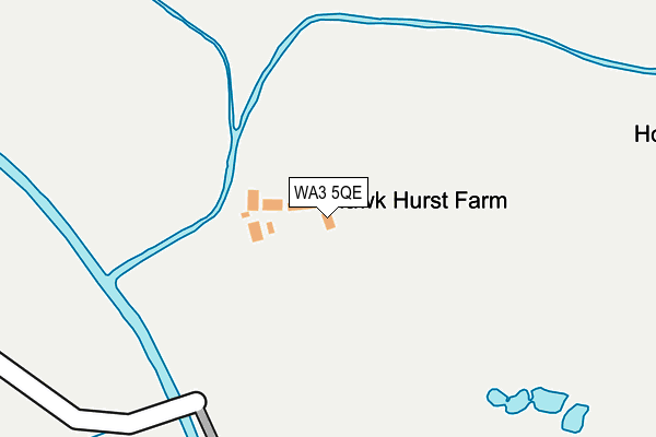
WA3 5QE is located in the Astley electoral ward, within the metropolitan district of Wigan and the English Parliamentary constituency of Leigh. The Sub Integrated Care Board (ICB) Location is NHS Greater Manchester ICB - 02H and the police force is Greater Manchester. This postcode has been in use since January 1980.


GetTheData
Source: OS OpenMap – Local (Ordnance Survey)
Source: OS VectorMap District (Ordnance Survey)
Licence: Open Government Licence (requires attribution)
| Easting | 367650 |
| Northing | 398176 |
| Latitude | 53.479306 |
| Longitude | -2.488913 |
GetTheData
Source: Open Postcode Geo
Licence: Open Government Licence
| Country | England |
| Postcode District | WA3 |
➜ See where WA3 is on a map | |
GetTheData
Source: Land Registry Price Paid Data
Licence: Open Government Licence
Elevation or altitude of WA3 5QE as distance above sea level:
| Metres | Feet | |
|---|---|---|
| Elevation | 20m | 66ft |
Elevation is measured from the approximate centre of the postcode, to the nearest point on an OS contour line from OS Terrain 50, which has contour spacing of ten vertical metres.
➜ How high above sea level am I? Find the elevation of your current position using your device's GPS.
GetTheData
Source: Open Postcode Elevation
Licence: Open Government Licence
| Ward | Astley |
| Constituency | Leigh |
GetTheData
Source: ONS Postcode Database
Licence: Open Government Licence
| Bents Garden Centre (Off Warrington Road) | Glazebury | 595m |
| Foresters Arms (Warrington Road) | Glazebury | 621m |
| Foresters Arms (Warrington Road) | Glazebury | 646m |
| Bents Garden Centre (Warrington Road) | Glazebury | 651m |
| Bents Garden Centre (Warrington Road) | Glazebury | 667m |
GetTheData
Source: NaPTAN
Licence: Open Government Licence
GetTheData
Source: ONS Postcode Database
Licence: Open Government Licence


➜ Get more ratings from the Food Standards Agency
GetTheData
Source: Food Standards Agency
Licence: FSA terms & conditions
| Last Collection | |||
|---|---|---|---|
| Location | Mon-Fri | Sat | Distance |
| Hurst Mill Avenue | 17:30 | 09:00 | 720m |
| Glazebury S.o. | 17:30 | 12:00 | 1,078m |
| Wensleydale | 18:25 | 11:45 | 1,956m |
GetTheData
Source: Dracos
Licence: Creative Commons Attribution-ShareAlike
The below table lists the International Territorial Level (ITL) codes (formerly Nomenclature of Territorial Units for Statistics (NUTS) codes) and Local Administrative Units (LAU) codes for WA3 5QE:
| ITL 1 Code | Name |
|---|---|
| TLD | North West (England) |
| ITL 2 Code | Name |
| TLD3 | Greater Manchester |
| ITL 3 Code | Name |
| TLD36 | Greater Manchester North West |
| LAU 1 Code | Name |
| E08000010 | Wigan |
GetTheData
Source: ONS Postcode Directory
Licence: Open Government Licence
The below table lists the Census Output Area (OA), Lower Layer Super Output Area (LSOA), and Middle Layer Super Output Area (MSOA) for WA3 5QE:
| Code | Name | |
|---|---|---|
| OA | E00031668 | |
| LSOA | E01006251 | Wigan 029B |
| MSOA | E02001315 | Wigan 029 |
GetTheData
Source: ONS Postcode Directory
Licence: Open Government Licence
| WA3 5QJ | East Lancashire Road | 343m |
| WA3 5QL | East Lancashire Road | 464m |
| WA3 5NY | Warrington Road | 629m |
| WA3 5NX | Warrington Road | 660m |
| WA3 5QQ | Warrington Road | 662m |
| WA3 5PB | Hesnall Close | 670m |
| WA3 5NS | Warrington Road | 702m |
| WA3 5NR | Hurst Mill Lane | 702m |
| WA3 5NP | Warrington Road | 730m |
| WA3 5NN | Warrington Road | 773m |
GetTheData
Source: Open Postcode Geo; Land Registry Price Paid Data
Licence: Open Government Licence